
-
Products ⌄
 Premium parcels
.png) AI and ML tools
AI and ML tools
 Roadway ROW
 Spatial add-ons
 Delivery methods
- Industries ⌄
- Data store
- Property App
- Esri users
- Resources ⌄
- Contact us


.svg)


-
Products ⌄
AI and ML tools
Roadway ROW
-
Industries ⌄
-
Resources ⌄
INDUSTRIES
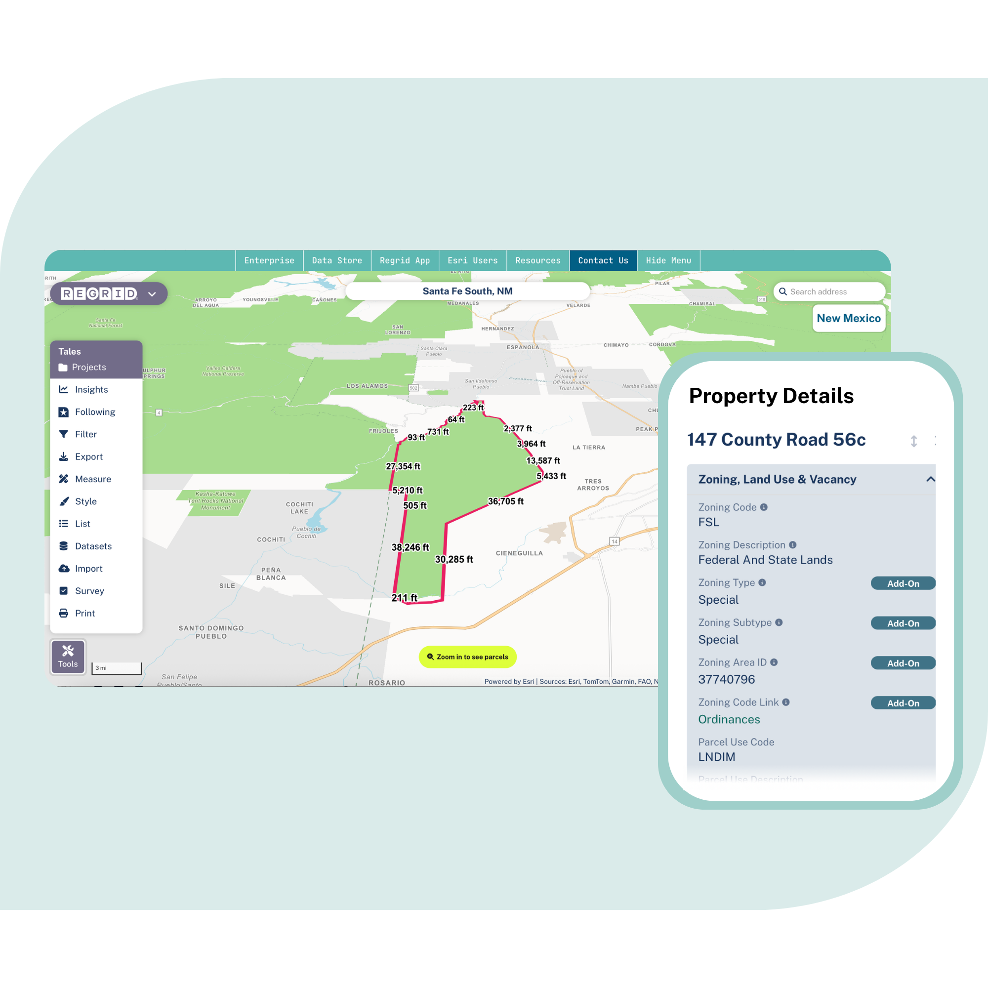
Nationwide parcel data for Architecture, Engineering and Construction (AEC)
Standardized parcels are just the start. Regrid supports AEC workflows like ROW, stakeholder outreach, and field planning with a parcel layer that plugs straight into your GIS stack.

Why standardized parcel data matters in AEC
When parcels vary by project or team, delivery slows down. A standardized parcel layer keeps kickoff and handoffs clean.

100%
U.S. Parcel
data coverage


Right of way outreach
You need reliable owner and occupant data to build defensible contact lists, fast.

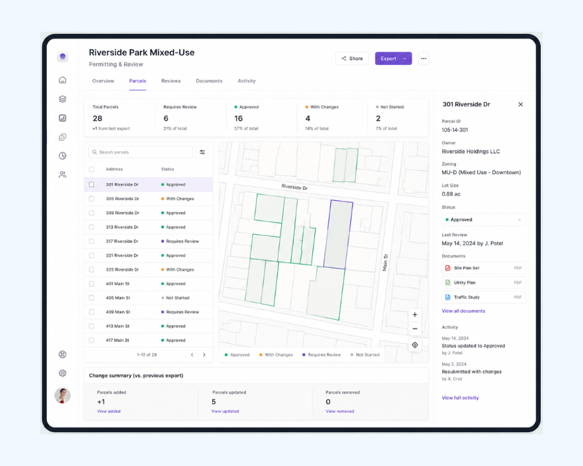
Permitting and review
Consistent layers make it easier to package work, track what changed, and back your results.

Hybrid delivery stacks
Parcels must move cleanly between GIS, design tools, field apps and automation.
Built for core AEC workflows
See how a standardized parcel layer supports work across the project lifecycle.
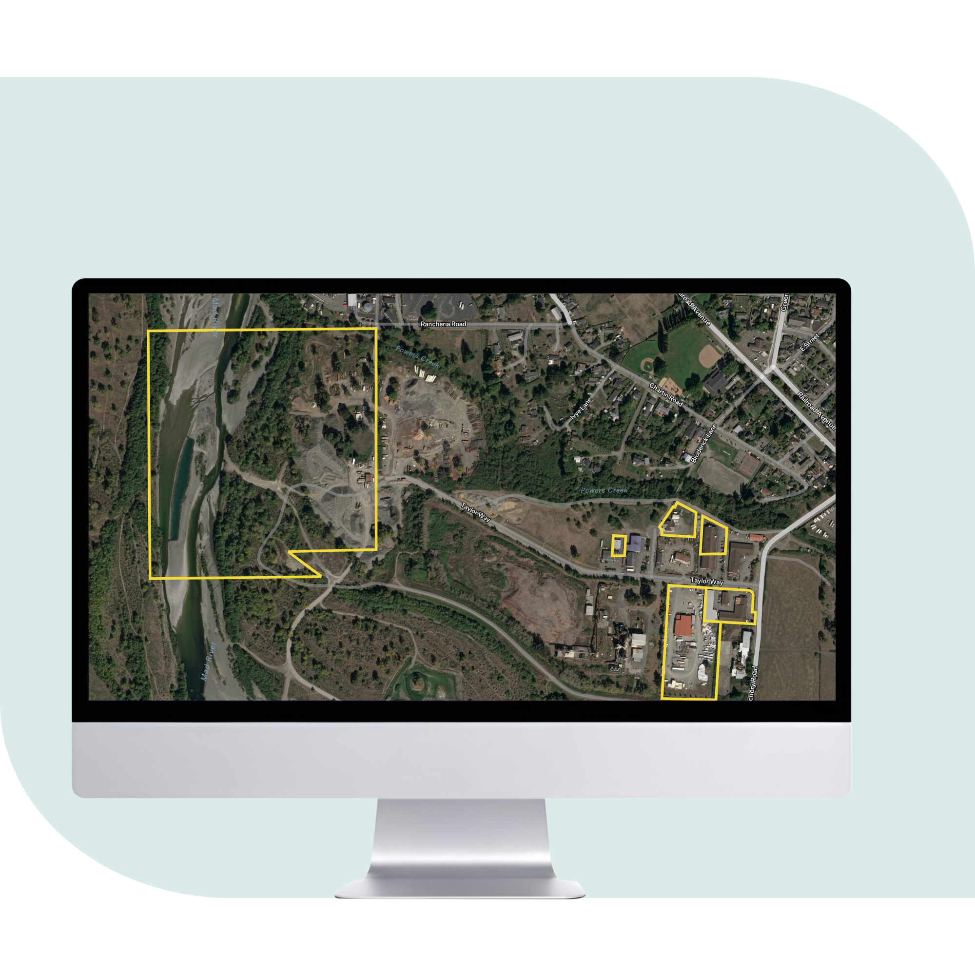
Planning and Site Selection
Move faster in early screening with clarity around parcel size, land use, zoning, and neighborhood context.
ROW and Land Acquisition
Build outreach lists with owner and occupant context. Keep acquisition work organized as the corridor evolves.
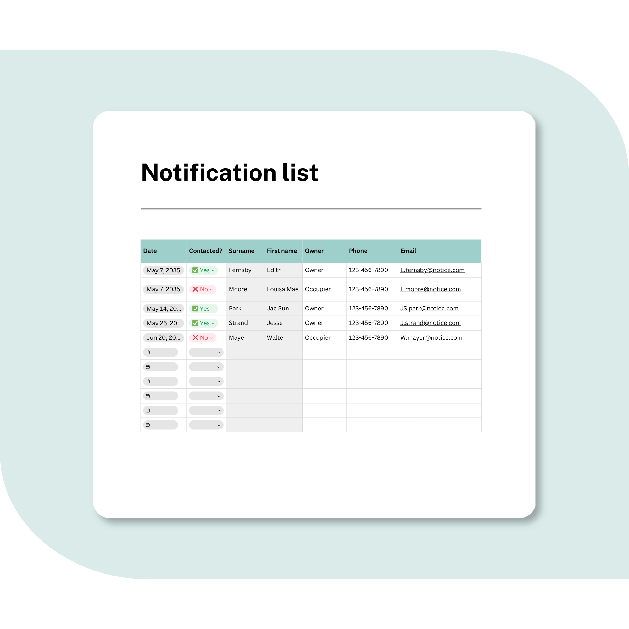
Public Engagement
Create notification lists from parcels, and keep stakeholder records consistent from one phase to the next.
Environmental and Permitting
Use parcels to see constraints and impact areas, so review packages stay consistent between milestones.
Design and Delivery Toolchain
Keep parcel context clean & consistent as it moves downstream.Whether work starts in GIS, CAD, or an ETL pipeline.

Field Operations
Take parcels offline for remote work, then sync updates later while keeping notes and photos tied to parcel IDs.
You're in great company


Trusted by AEC industry leaders
“With the Regrid parcel dataset, we don’t treat data as just a project cost anymore. Instead of selling parcel data, we’re selling location intelligence, and that’s a professional service. Clients can buy data anywhere, but we add context, insight, and support to help them make better decisions.”
- Michael Allen, GIS Product Manager, Burns & McDonnell

“We’re definitely getting to the starting point a lot faster. All that pre-work of gathering the data has been eliminated”

"The inclusion of Regrid's parcel data emerged as a critical driver for user adoption.

"We now have more confidence, which enhances our clients' experience with Langan. It's a win-win for all parties."
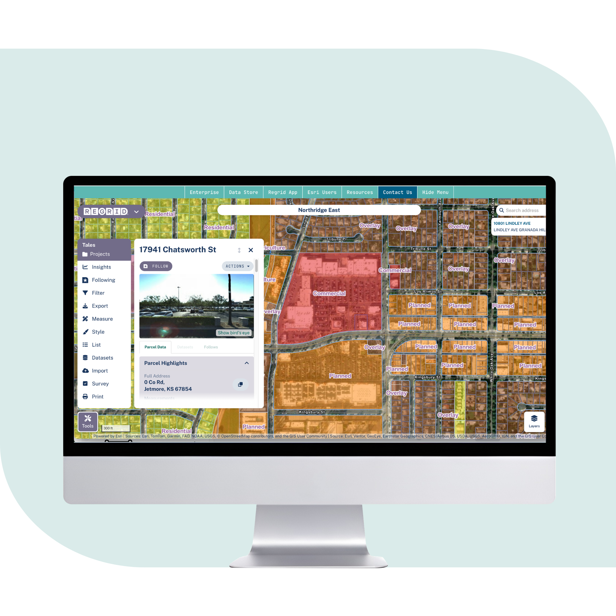
Explore the coverage map
See live coverage, refresh dates, and attribute completeness. Click any county to see parcel counts and field-by-field coverage, then continue to purchase or explore data in the Regrid web app.

What you get
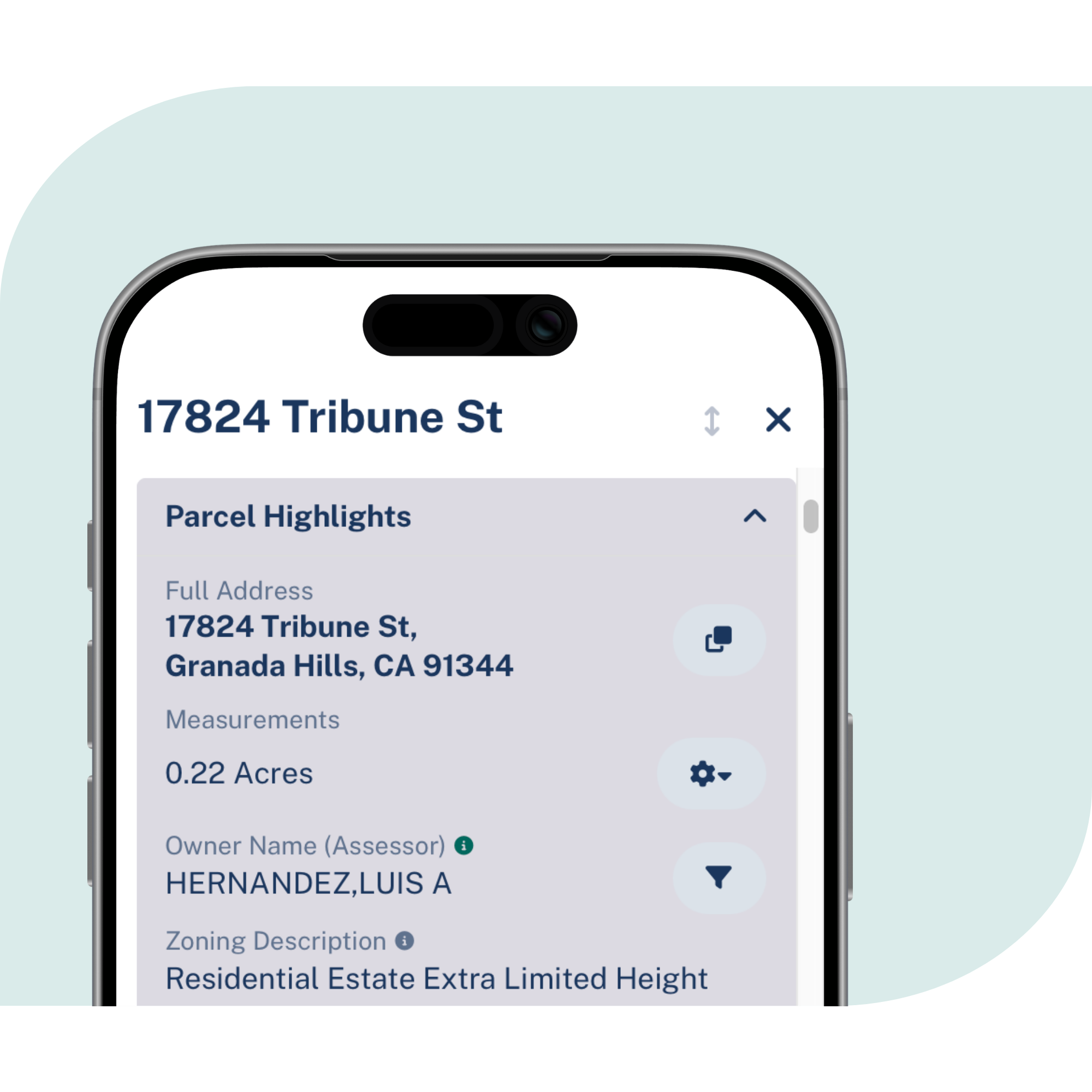
Critical attributes, standardized
Property boundaries and sizes, owner names and mailing addresses, plus land use and zoning.
Nationwide coverage, kept current
All U.S. counties with a reliable refresh cadence, including monthly Premium schema updates, built for urban and rural site work.
Easy to match, map, and share
Connect your internal records to current boundaries using parcel IDs, addresses, or spatial joins, then deliver via SFTP or cloud formats and share in your GIS.
Frequently asked questions
-
It means 100% U.S. county coverage, delivered as an enterprise-ready dataset that can support projects across regions without county-by-county sourcing.
-
Many teams use live layers for internal work, then pull a defined record set for client deliverables. Regrid also publishes update cadence and targets so you can plan around change.
-
Yes. Regrid supports Feature Service, API, and bulk delivery, which makes it easier to feed GIS, applications, and automation pipelines.
-
Regrid provides standardized zoning coverage in many municipalities and standardized land use codes as part of the broader parcel ecosystem.
-
Yes. Regrid offers parcel-matched add-ons such as building footprints, secondary addresses, and owner update products.
-
Most teams start with one delivery method, connect it to existing workflows, then expand to additional access methods as needs grow across phases and business units.

(888) 4RE-GRID
Subscribe for email updates