-
Products ⌄
 Premium parcels
.png) AI and ML tools
AI and ML tools
 Roadway ROW
 Spatial add-ons
 Delivery methods
- Industries ⌄
- Data store
- Property App
- Esri users
- Resources ⌄
- Contact us


.svg)


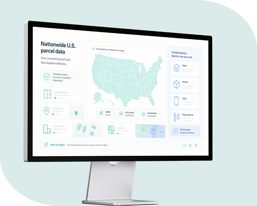
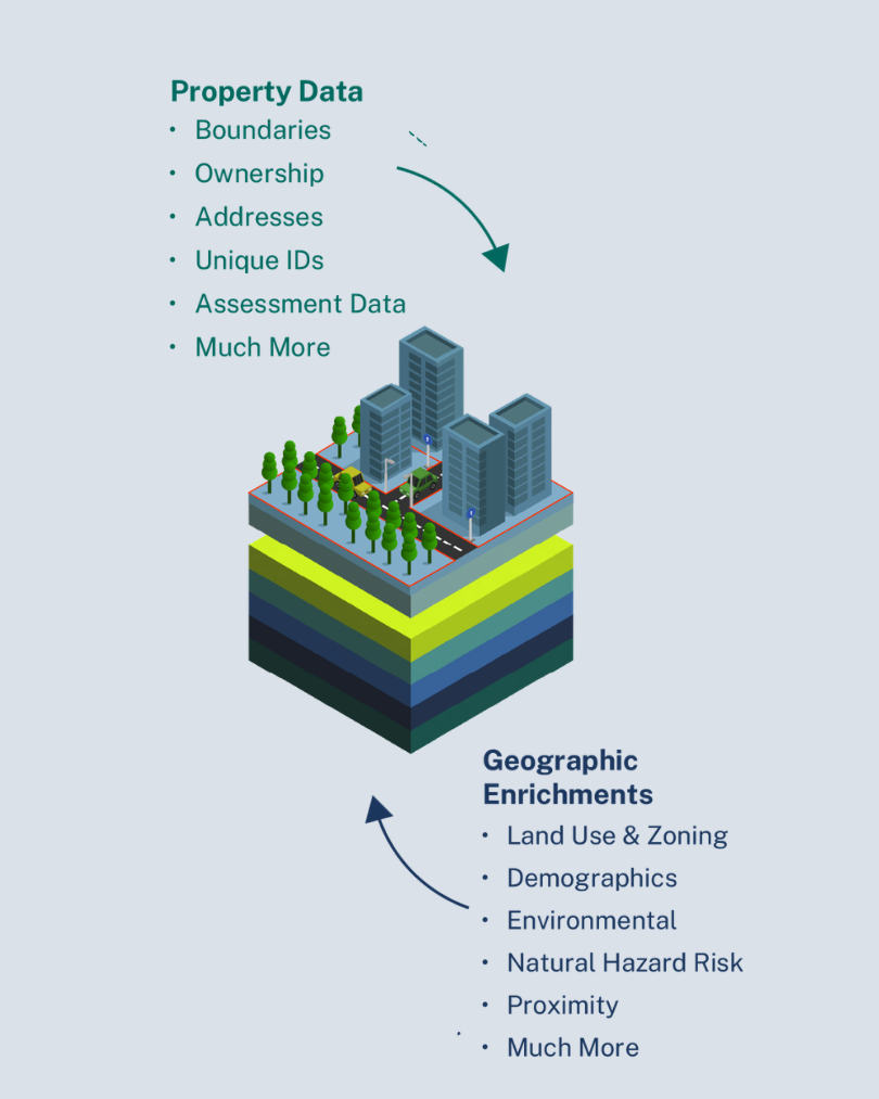
What’s included in our U.S. parcel data
Regrid brings standardized U.S. parcel boundaries and property context into one national parcel dataset, which includes:
100%
US Coverage

Parcel boundaries
Nationwide parcel geometry standardized into one consistent structure for mapping, analysis, and integration.

Property attributes
Core parcel information organized in a documented schema, so teams can query, filter, and join data with confidence.

Ownership and mailing information
Owner and mailing data to help connect properties to stakeholders, portfolios, customers, and decision-making workflows.

Addresses and location context
Address and site information that helps connect parcels to the places, buildings, and systems that depend on them.

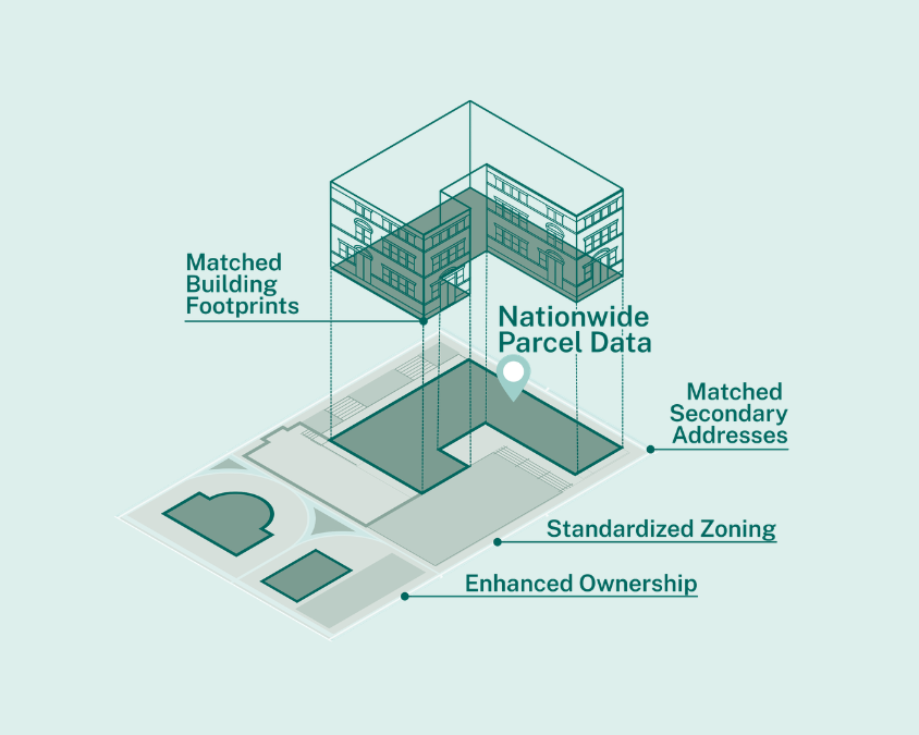
Matched building footprints
Optional building footprint data matched to parcels for teams that need a clearer view of structures on the land.

Secondary addresses
Additional address context for parcels with multiple units, buildings, suites, or serviceable locations.

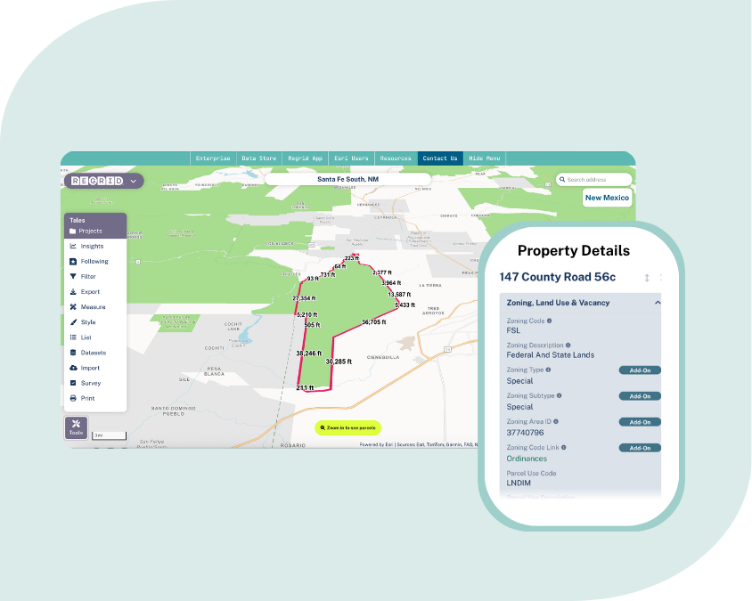
Standardized zoning
Zoning data brought into a more usable structure, helping teams evaluate land use, development potential, constraints, and opportunities.

Daily ownership updates
Optional owner update workflows for teams that need to monitor ownership changes more frequently.