
-
Products ⌄
 Premium parcels
.png) AI and ML tools
AI and ML tools
 Roadway ROW
 Spatial add-ons
 Delivery methods
- Industries ⌄
- Data store
- Property App
- Esri users
- Resources ⌄
- Contact us


.svg)


-
Products ⌄
AI and ML tools
Roadway ROW
-
Industries ⌄
-
Resources ⌄
INDUSTRIES
Nationwide parcel data for agriculture and forestry
Regrid gives agriculture and forestry teams the parcel boundaries, ownership, addresses, land use, zoning, and cropland context they need to evaluate properties and manage land data with confidence.

Better parcel context for rural land decisions
Use one standardized parcel layer to evaluate properties, support operations, monitor change, and connect land records to your existing tools.

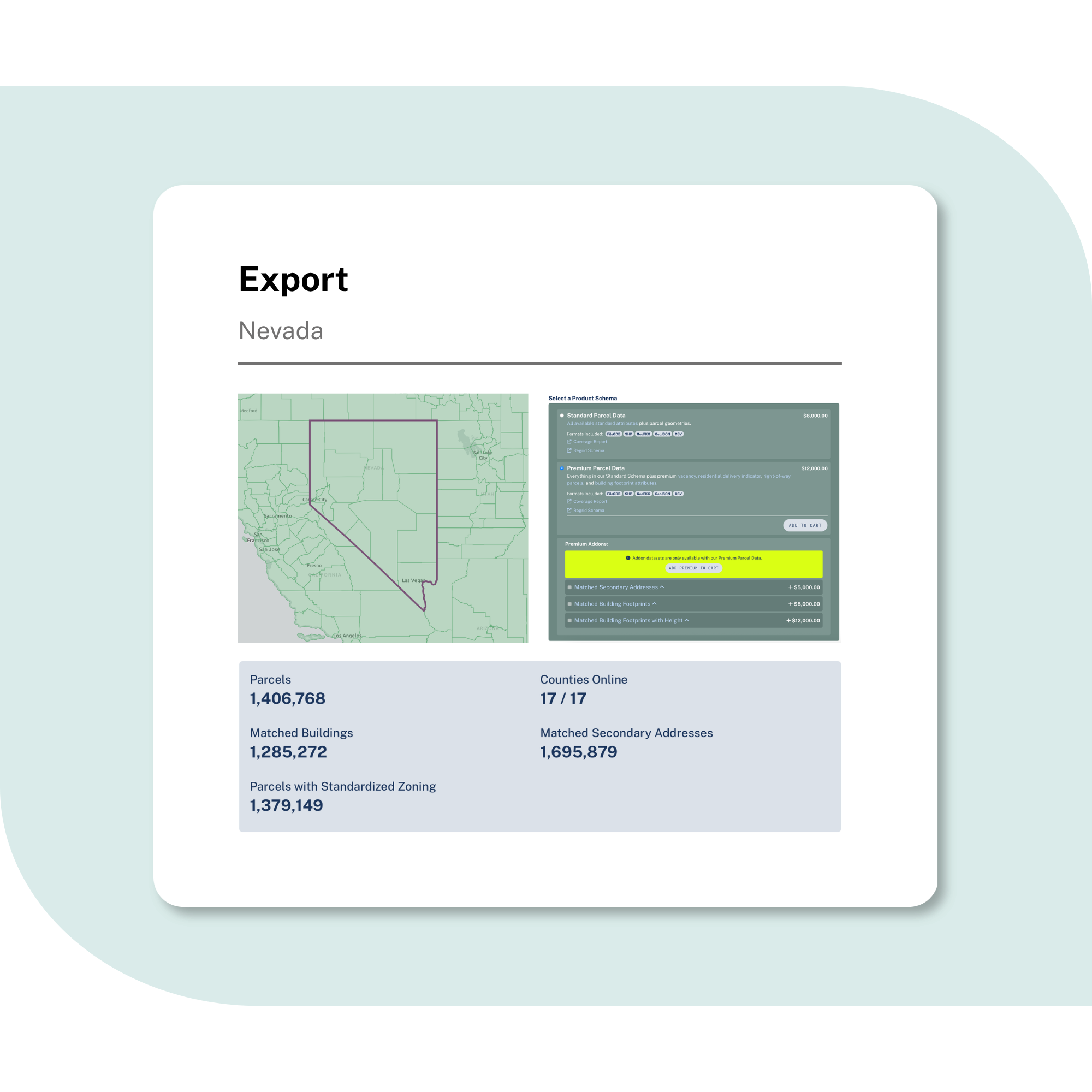
100%
U.S. Parcel
data coverage


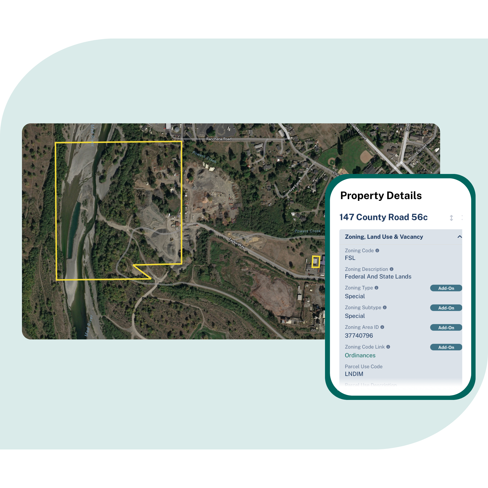
Understand ownership and boundaries
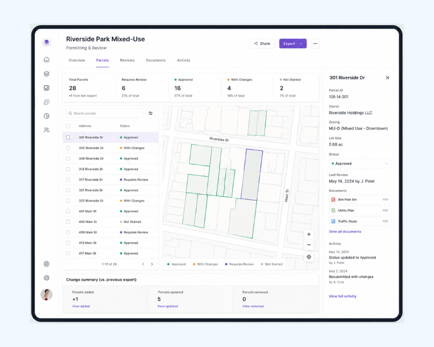
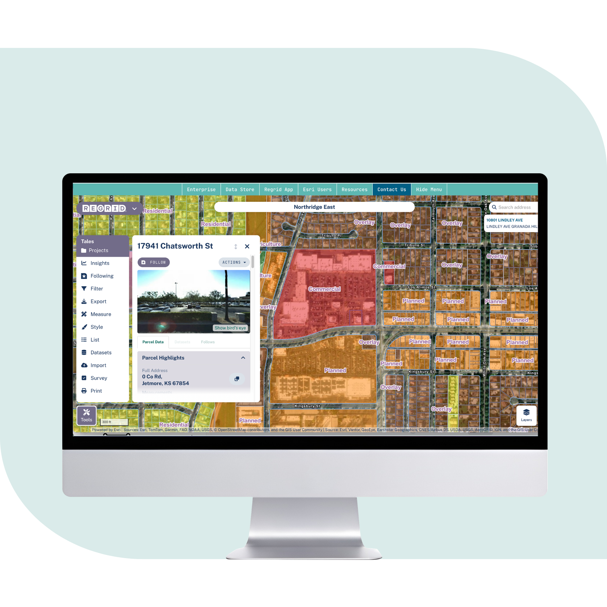
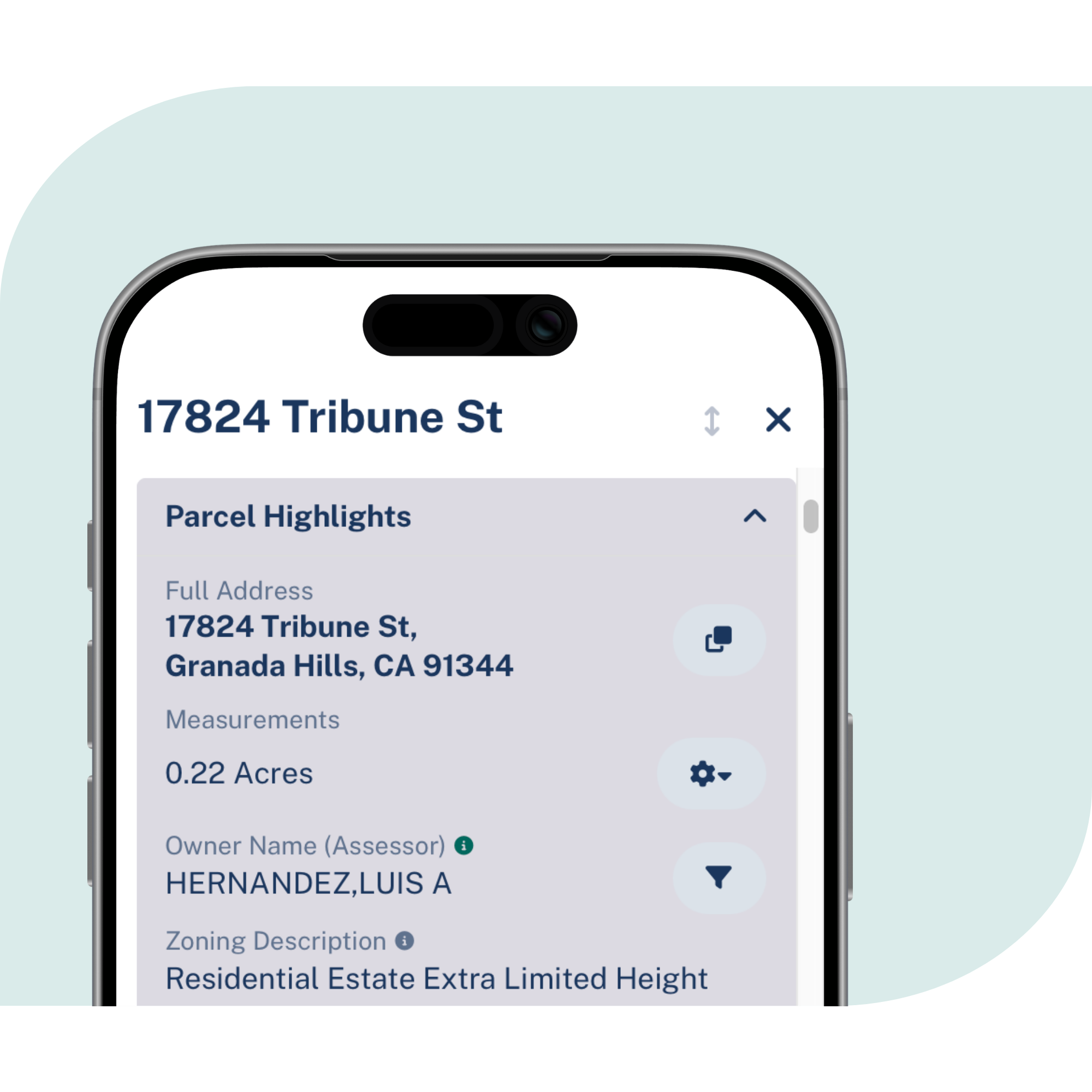
Identify parcel boundaries, parcel sizes, APNs, owner names, and mailing addresses in one standardized structure.

Connect your data to parcels
Match your existing records to parcel boundaries, run spatial analysis, and visualize property context on a map.

Add property context to land analysis
Bring land use, zoning, USDA cropland, and neighboring parcel context into property evaluation and planning workflows.
What can agriculture and forestry teams
do with standardized parcel data?
See how Regrid supports land-focused workflows across agriculture,
timber, agtech, conservation acquisition, and rural property intelligence.
Evaluate agricultural properties with clearer context
Review parcel size, ownership, land use, zoning, and nearby property context early, so teams can understand land assets faster.
Power agtech products and property intelligence
Add parcel boundaries, ownership, land use, valuation context, and property attributes to tools built for land management, sales intelligence, and rural asset analysis.
Build research, analytics, and mapping workflows
Use parcels as the spatial reference for land analysis, data science, app development, and map-based reporting.
Support forestry operations
Use parcel data in GIS workflows for acquisitions, divestitures, tax responsibilities, regulatory context, and environmental review.
Monitor ownership and subdivisions
Track changes to ownership and parcel structure so teams can stay current as land changes hands or is subdivided.
Strengthen land acquisition research
Use parcel boundaries and ownership data to compare records, review legal descriptions, and resolve property questions before acquisition.
You're in great company


Trusted by agriculture and forestry teams
Regrid supports agriculture, forestry, agtech, and land acquisition teams that need reliable parcel data to evaluate properties, support operations, and understand land ownership at scale.


Explore the coverage map
See live coverage, refresh dates, and attribute completeness. Click any county to see parcel counts and field-by-field coverage, then continue to purchase or explore data in the Regrid web app.

What you get
Critical attributes, standardized
Parcel boundaries and sizes, APNs, owner names and mailing addresses, land use, zoning, USDA cropland, valuation context, and other property attributes delivered in a consistent structure.
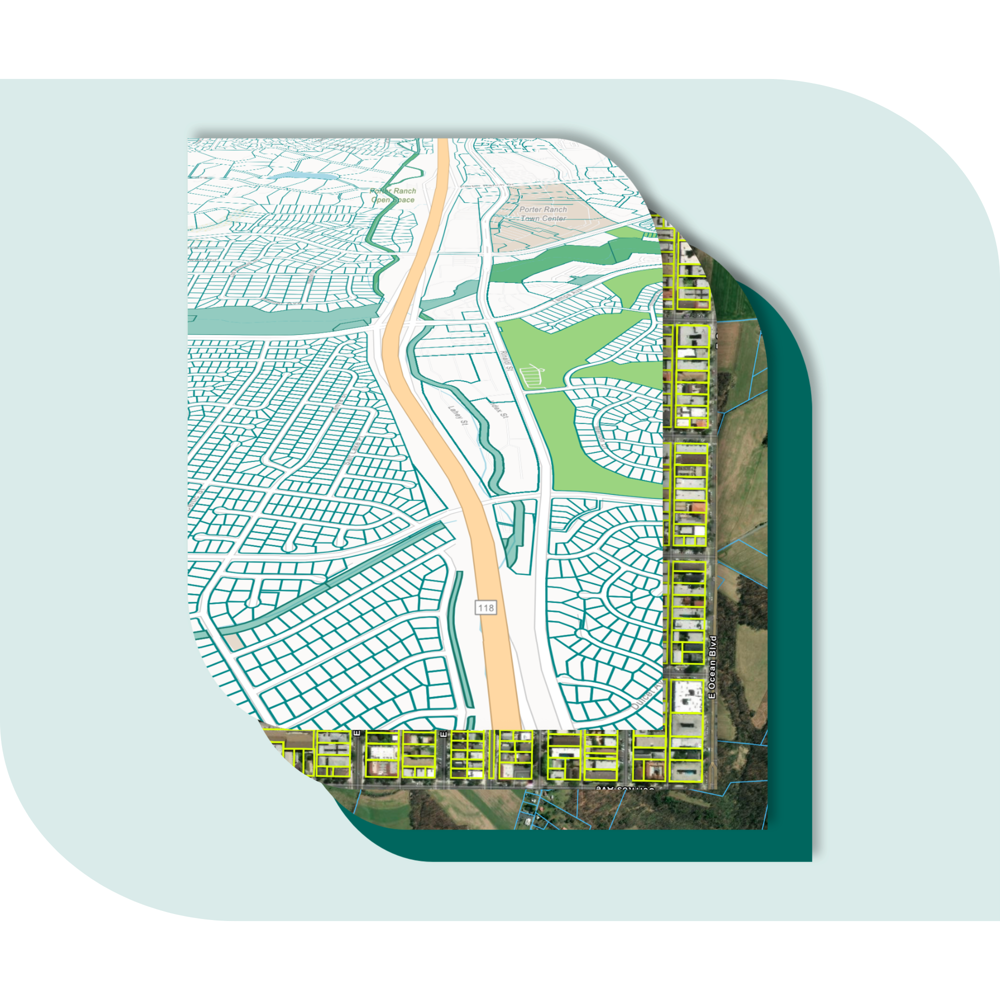
Nationwide coverage, built for large-area work
Coverage across the United States, including agricultural, timber, and rural geographies, with ongoing refreshes that help teams monitor ownership, subdivision, and property change.
Easy to match, map, and use
Connect your existing records to parcels, perform spatial analysis, visualize results on a map, and deliver data into the tools your team already uses.
Frequently asked questions
-
Regrid provides standardized parcel data across the United States, including parcel boundaries, parcel sizes, APNs, owner names, mailing addresses, land use, zoning, USDA cropland, and other property context.
-
Yes. Regrid’s parcel coverage is designed for nationwide use, including agricultural and rural geographies where ownership, boundaries, and local land records are central to the work.
-
Yes. Teams can match existing records to parcel boundaries, run spatial analysis, and visualize results on a map.
-
Forestry teams can use parcel data in GIS workflows to support operations, acquisitions, divestitures, tax responsibilities, regulatory context, and environmental obligations
-
Agtech teams can use Regrid parcel data to add property-level context to tools for valuation, sales intelligence, land management, mapping, and analytics.
-
Yes. Parcel data can provide a clear starting point for understanding boundaries, ownership, legal descriptions, neighboring context, and property structure during acquisition research.

(888) 4RE-GRID
Subscribe for email updates