
-
Products ⌄
 Premium parcels
.png) AI and ML tools
AI and ML tools
 Roadway ROW
 Spatial add-ons
 Delivery methods
- Industries ⌄
- Data store
- Property App
- Esri users
- Resources ⌄
- Contact us


.svg)


-
Products ⌄
AI and ML tools
Roadway ROW
-
Industries ⌄
-
Resources ⌄

INDUSTRIES
Nationwide parcel data for broadband and telecommunications
Regrid helps broadband and telecommunications teams plan expansion, validate serviceable locations, and connect network decisions to standardized parcel boundaries, ownership, addresses, and building context.
One parcel layer for network planning, buildout and serviceability
Broadband and telecommunications work depends on knowing where people, businesses, buildings, parcels, and infrastructure meet. A standardized parcel layer helps teams move from broad coverage questions to specific places, properties, and projects.

100%
U.S. Parcel
data coverage


Validate serviceable locations
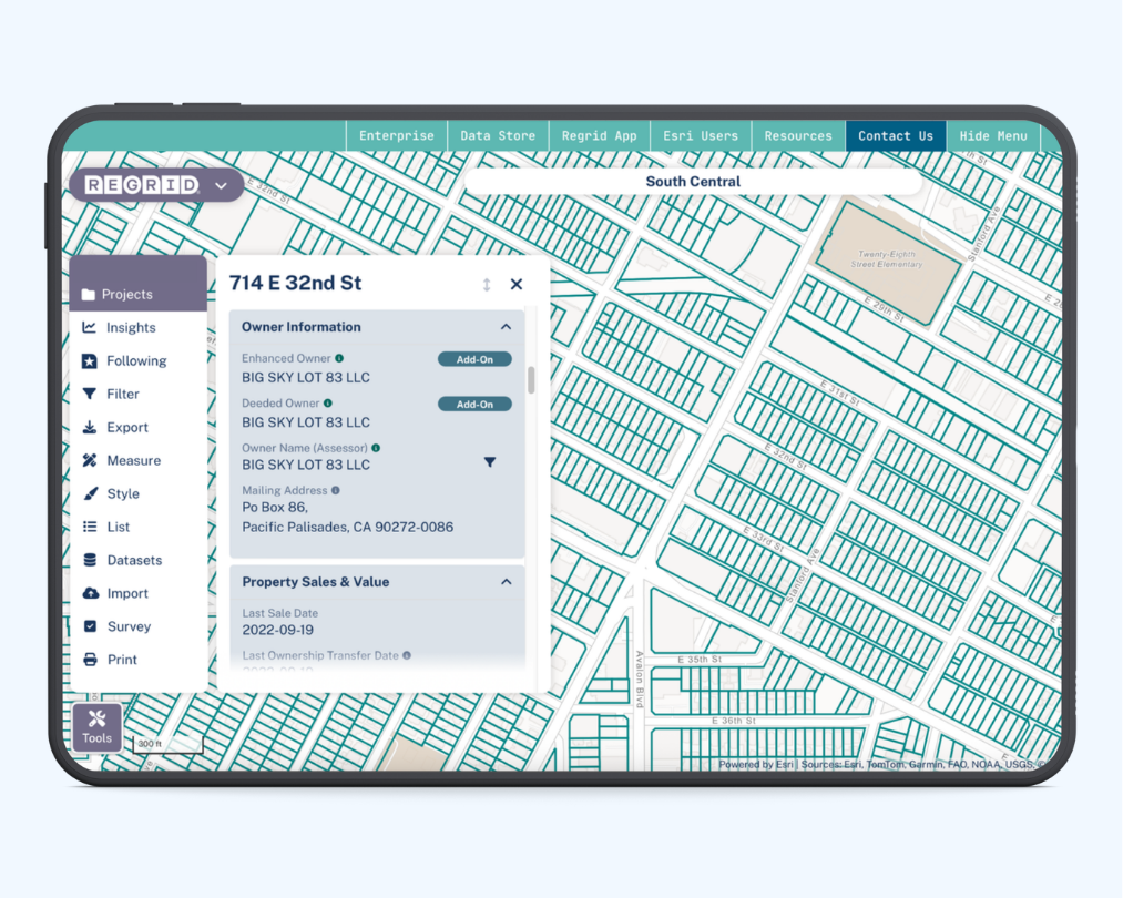
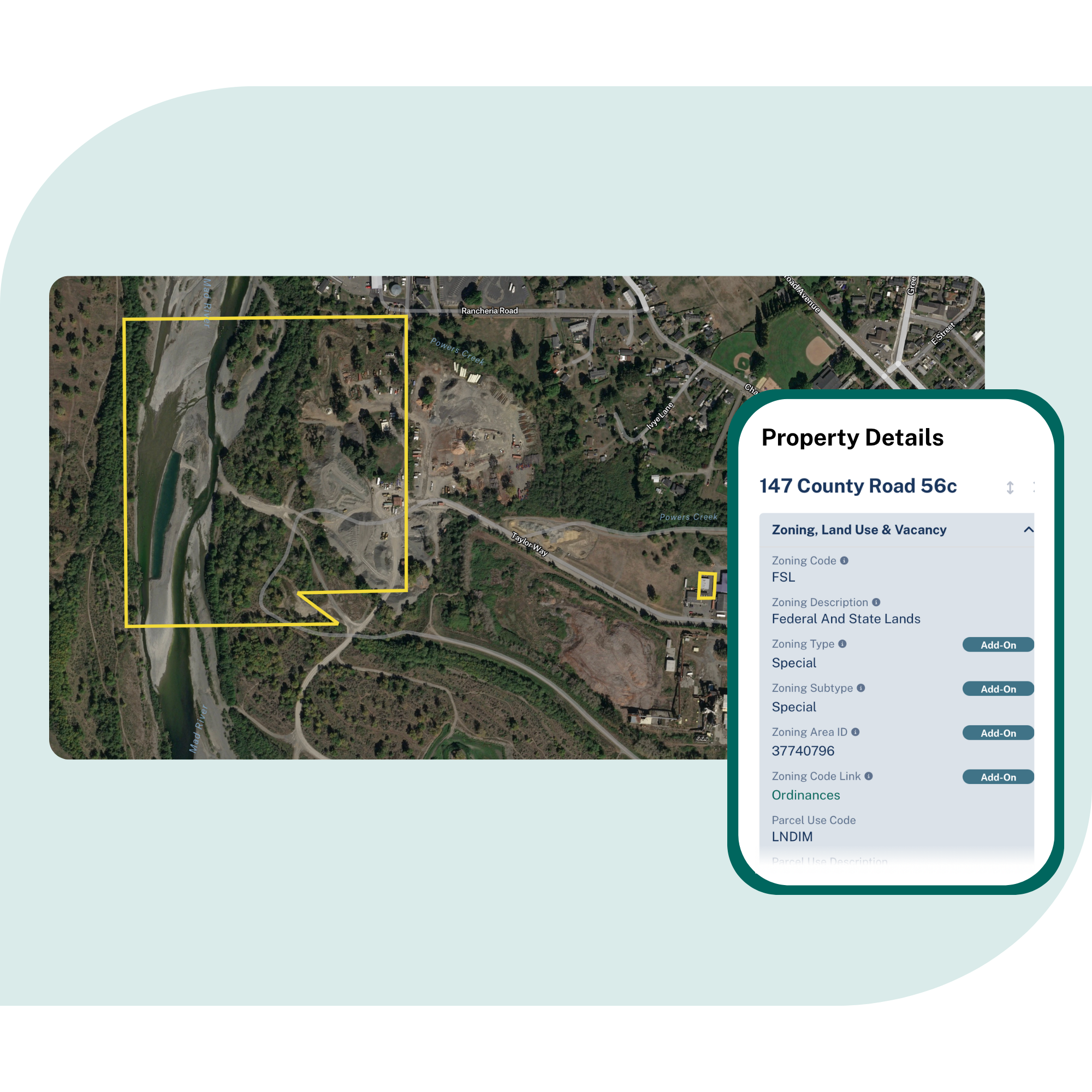
Use parcels, addresses, and building context to understand the property behind each location.

Find and prioritize service gaps
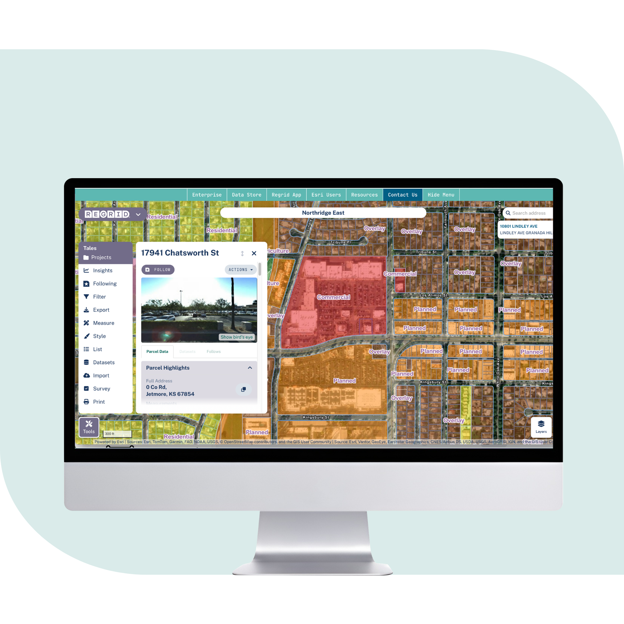
Compare coverage, infrastructure, addresses, and buildings against a consistent parcel layer.

Move from planning to deployment
Deliver parcel data into GIS, analytics, network planning tools, and applications.
Built for broadband and telecommunications workflows
See how parcel data can support network planning, expansion, and serviceability workflows.
Enhance broadband serviceability mapping
Use parcel boundaries, addresses, and building context to support more accurate identification of residential and business service locations.
Identify underserved areas and expansion opportunities
Find where addresses and buildings may need service, then scope projects around the parcels, ownership patterns, and service areas involved.
Plan 5G and wireless network density
Use buildings, addresses, and parcel context to validate customer locations, assess density, and refine coverage areas.
Support grants and funding proposals
Build clearer evidence for broadband expansion proposals by connecting underserved locations, project areas, and parcel-level context in one consistent dataset.
Power network management tools and customer-facing maps
Serve parcel overlays through API, tiles, or feature service so users can see property boundaries and location context inside the tools they already use.

Standardize analysis across rural and urban markets
Work from one nationwide schema instead of rebuilding logic county by county. Parcel IDs help keep joins stable as data refreshes.
You're in great company


Trusted by broadband and telecommunications teams
Regrid supports telecommunications providers, broadband infrastructure developers, network engineers, investors, planners, analysts, and software teams that need reliable parcel data for planning, serviceability, and network workflows.
Supporting
serviceability
Regrid parcel data has supported CostQuest’s work on the FCC Broadband Serviceable Location Fabric, helping connect broadband serviceability questions to property and location context.
Uncovering service gaps
One broadband operator used Regrid parcel data to identify underserved areas, scope engineering projects, define service areas, and support stronger grant funding proposals.
Optimizing 5G expansion
One telecommunications company used Regrid parcel, building, and address context to validate customer locations, refine coverage areas, and improve network deployment planning.
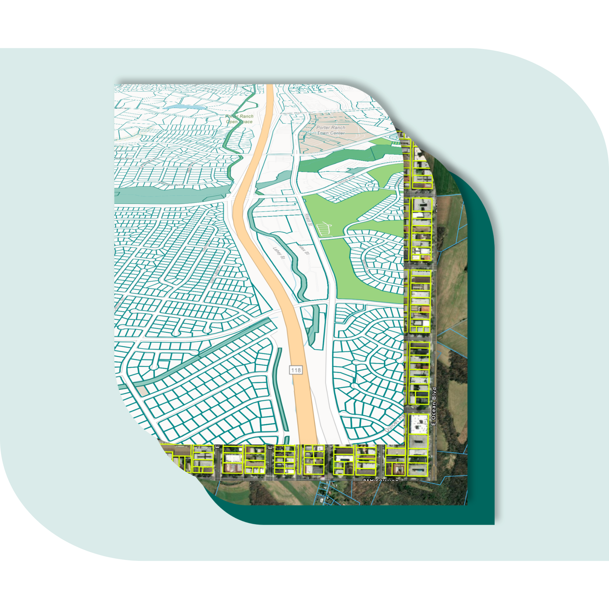
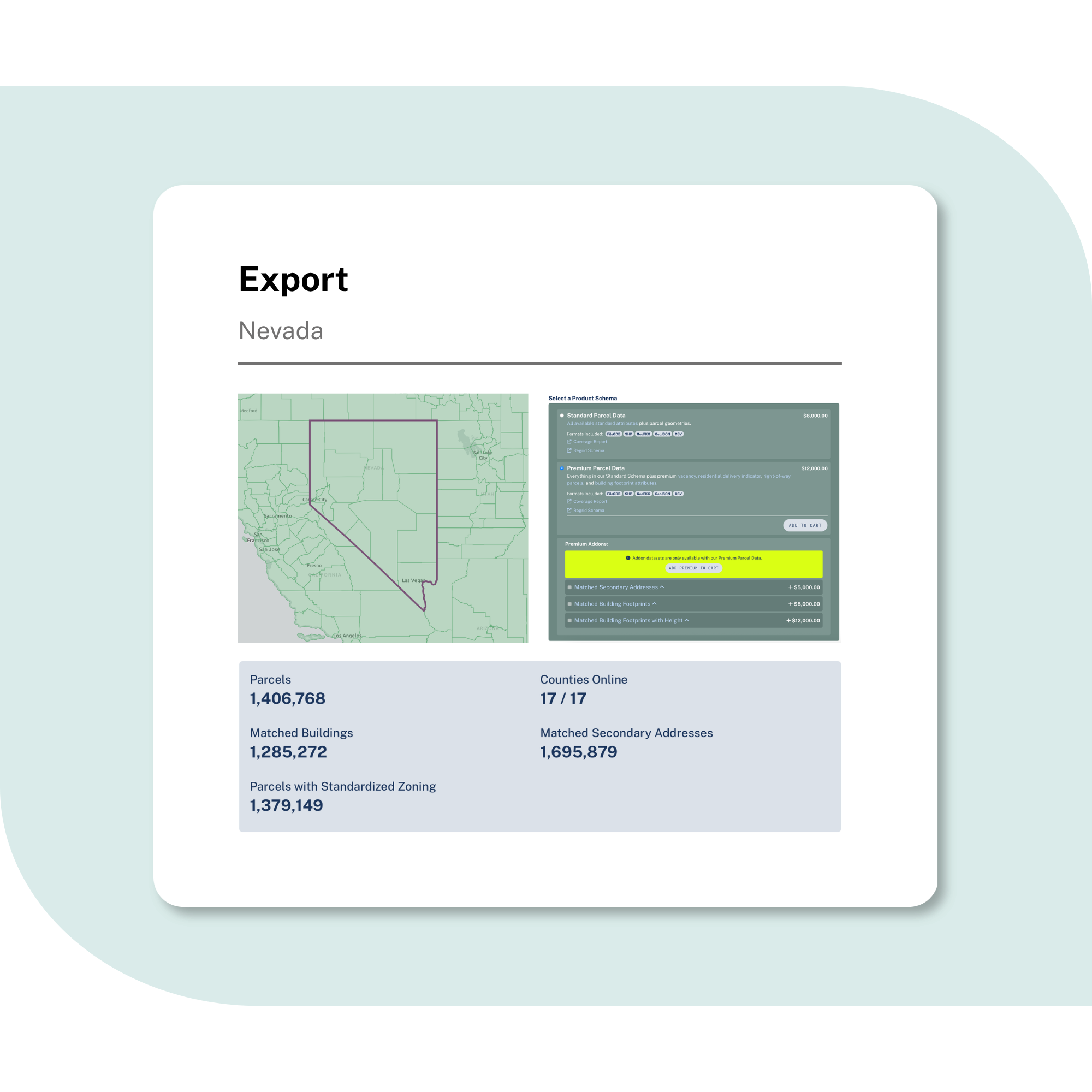
Explore the coverage map
See live coverage, refresh dates, and attribute completeness. Click any county to see parcel counts and field-by-field coverage, then continue to purchase or explore data in the Regrid web app.

What you get

-
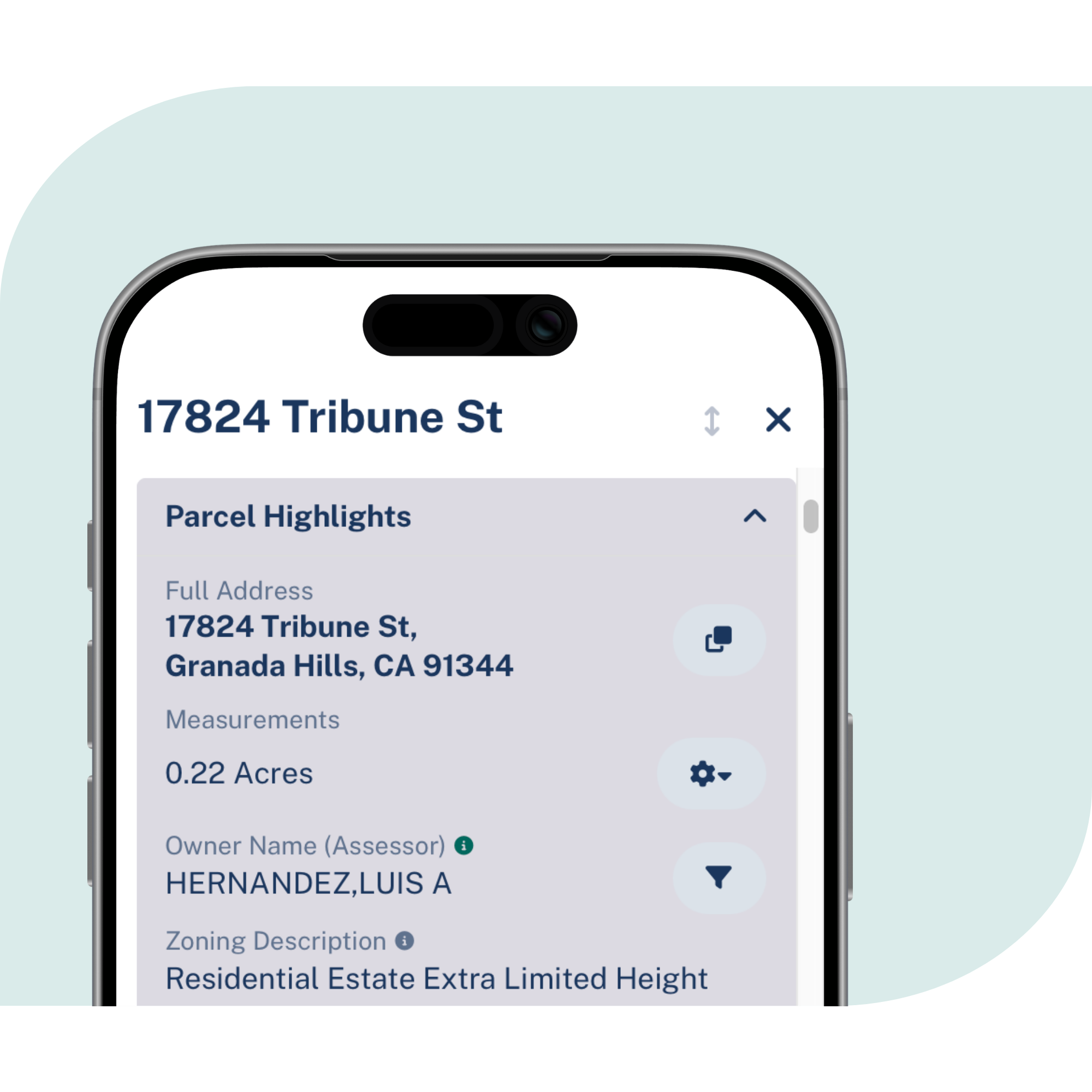
Parcel boundaries and sizes, owner names and mailing addresses, situs addresses, building footprints, land use, zoning, and valuation context, delivered in one consistent structure.
-
Coverage across every U.S. county, including rural and urban markets, with ongoing refreshes to support serviceability, expansion, and network analysis.
-
Use API, tiles, feature service, or bulk files to power GIS, planning tools, analytics, field workflows, and customer-facing maps.
Frequently asked questions
-
Addresses tell you where a location is. Parcels help you understand the property, boundary, ownership, and building context around that location. This makes it easier to connect serviceability decisions to real places.
-
Teams can combine Regrid parcels, addresses, and building context with their own coverage and infrastructure data to identify where service gaps may exist and where expansion projects should be evaluated.
-
Building footprints, addresses, and parcel context can help teams validate customer locations, assess density, and refine coverage areas before site identification and deployment decisions move forward.
-
Regrid supports API, tiles, feature service, and bulk delivery, so teams can work in GIS, analytics tools, applications, or internal network planning systems.
-
Many broadband and telecommunications decisions need more than a point on a map. Parcels show the property boundary and provide a stable reference key for ownership, addresses, buildings, land use, and internal records.
-
Most teams start with one delivery method, connect it to existing workflows, then expand to additional access methods as needs grow across phases and business units.

(888) 4RE-GRID
Subscribe for email updates