-
Enterprise
Premium Parcels
 Roadway ROW
- Data Store
- Regrid App
- Esri Users
-
Resources
Support
Content
Programs
.png) Shop
Shop
- Contact Us
Case Studies
Take a look at Regrid customer projects & live parcel data use cases. See why we are the go-to source for land parcels & location context data.
land parcel augmented Reality application
Regrid partnered with the team at Gravity Jack to create a futuristic mobile application that displays land parcel data in augmented reality.
Using Regrid’s existing Parcel API filled with property information, they could create a mobile app capable of displaying boundaries in Augmented Reality and producing additional property data points.
To learn more about the project, visit Gravity Jack's digital portfolio.
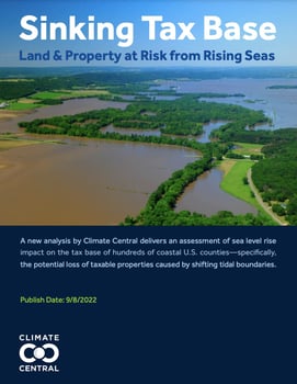
Land & property at risk from rising seas
Our customer Climate Central has released a deep data analysis report on the sinking tax base & implications of rising temperatures across the country. To calculate the taxable value of affected parcels and buildings, Climate Central used standardized land parcel data from Regrid. 
This analysis delivers an assessment of sea level rise impact on the tax base of hundreds of coastal U.S. counties—specifically, the potential loss of taxable properties caused by shifting tidal boundaries. Findings by the county are detailed in more than 250 reports and a national summary including data on the acreage, buildings, number of properties, and assessed value projected to be at risk this century, by decade.
OHIO 3CS MAPPING PROJECT
With support from the JPMorgan Chase Foundation, Regrid partnered with the Western Reserve Land Conservancy to update our platform, gather data, provide our technology to government, nonprofit, and community groups, and organize property surveys across Cleveland, Cincinnati, and Columbus, Ohio.
The projects conducted took various forms, with various groups and individuals in each city continuing to use the tools for projects big and small.
MOTOR CITY MAPPING Citywide property survey
In 2014, Detroit knew it had a blight problem - but nobody knew exactly how many structures were vacant. Because good data is crucial to good decision-making, Regrid teamed up with Data Driven Detroit and the Blight Elimination Task Force led by Dan Gilbert to conduct an ambitious survey: photograph and evaluate every single property within Detroit's 139 square miles. 200 Detroiters used Regrid's mapping technology and the Regrid Property App to get the job done. Data from this unprecedented effort led to hundreds of millions of dollars in federal funding allocated to blight removal and demolitions. It also provided valuable information to City Hall, developers, and neighborhood groups about the state of their city.
TAX FORECLOSURE PREVENTION
History will marvel that Detroit’s most intense period of displacement and property damage happened in the 21st century through misguided tax foreclosure and auction systems. Local governments and organizations use data from Regrid and The Regrid Property App to visit people facing foreclosure, understand their situation, connect them to resources, and advocate for change.
People Are Making Big Money Kicking Detroit Residents Out Of Their Homes (HBO) (featuring a brief appearance by Regrid CEO, Jerry Paffendorf).
FLINT PROPERTY PORTAL
The Genesee County Land Bank and the City of Flint needed a custom platform and worked with Regrid to build a site to meet their needs. The Flint Property Portal hosts continuously-updated property data and provides residents with a platform to easily make maps, look up properties and showcase property surveys in real-time.
Industries using Regrid parcel data
REAL ESTATE
Professionals of all types turn to Regrid for our nationwide land parcel data and enhanced location context products. Gain market insight and make data-driven decisions with our comprehensive dataset. Use the Regrid Property App to explore our data in a visual environment.
To learn more about using parcel data in your real estate project, please visit our Real Estate use case page.
Denovo Real Estate, a Detroit-based real estate company, uses Regrid to research and plan investments, target parcels for acquisition, and track the properties they own. Their clients include Recovery Park Farms, a group that transforms vacant land into a source of local food production and walkable neighborhoods.
The Lansing Medical Cannabis Guild used Regrid to find properties that could become medicinal marijuana dispensaries within the restraints set by recent legislation. They imported information and created maps that spatially visualized these locations within the city of Lansing, MI.
NEIGHBORHOOD GROUPS
Pittsburgh Community Reinvestment Group used Regrid mapping software to survey the Bloomfield neighborhood in Pittsburgh. The data collected will help local nonprofits and residents connect with resources that will improve and repair homes and lead to a more sustainable neighborhood for everyone.
Grandmont Rosedale Development Corporation annually surveys properties in their service area and use this data to identify, track, and map vacant properties. They also use the Regrid Property App to record the property intervention performed by the Vacant Property Task Force in their neighborhood.
Focus:HOPE used Regrid's mapping tools to create maps, work plans, and strategize for a three-day event where thousands of volunteers worked on a beautifying initiative. They also utilized the Regrid App to document progress during the event.
"Regrid has helped not just Rise, but so many other organizations in St. Louis to be able to understand the context of our neighborhoods as we work on a path towards more equitable, sustainable, and inclusive development.
Regrid has been a tremendous help in being able to challenge our views of our own communities and create dialog around the facts, not simply anecdotal evidence."

John Cruz
Rise St. Louis
ENVIRONMENTAL Conservation
The Detroit Riverfront Conservancy uses the Regrid Property App & SaaS Mapping Platform to collect, visualize, and analyze parcel-based information. This information is shared with collaborators in an interactive map in order to operate, maintain, and develop the Detroit Riverfront and nearby green spaces.
The Delray Community Benefits Coalition uses the structure and ownership data that is pre-loaded into The Regrid Property Web App to identify where publicly-owned land might be easily assembled. This information is then used to determine target areas for green buffers.


“Regrid parcel data was the essential starting place for The Nature Conservancy’s recent 32,000 acre land acquisition in Michigan. We were able to compare the parcel data to the tax and legal descriptions, even within the tricky Assessor Plats and Government Lots. The data helped us identify areas of difference and work towards resolution with the title company and previous landowner.”

Emily Clegg
Director of Land & Water Management at The Nature Conservancy
GOVERNMENT & LAND BANKS
Macon-Bibb County commissioned Regrid to survey property conditions in their Urban Redevelopment Zone, and generate data about occupancy and lot maintenance. The data has been used internally as well as made open to the public.
The Wayne County Treasurer used the Regrid Property App's survey function to analyze foreclosed homes. The data produced can inform future policies and local programs. The Treasurer also uses Regrid to help plan and implement initiatives designed to stabilize neighborhoods.
The Greater Syracuse Land Bank and the Lucas County Land Bank use Regrid to visualize property data and track inventory & sales.
"Working with the Regrid team has provided us a platform that helps us understand the property data we need to efficiently run an operation like the Land Bank."
DISASTER RECOVERY & MANAGEMENT
Friends of Rockaway used Regrid to assess the repair needs of hurricane-damaged homes in Rockaway Beach, NY. Their surveyors went door-to-door with the Regrid Property App to interview homeowners and collect data on the remaining damage inflicted by Hurricane Sandy.
Detroit Fire Survey: Regrid surveyors visited, photographed, and assessed every structure-damaging fire in the city of Detroit in 2015 using the Regrid platform. This data was used to identify characteristics that increased the likelihood of residential structures catching fire and then find properties in the city that fit these criteria.
Regrid sent a crew to Portland, MI to survey parcels in and around the path of damage left by a tornado. Surveyors assessed the level of damage for each property and the resulting map showed where the parcels most damaged by the tornado were located.
POLITICAL & ADVOCACY OUTREACH
When advocates for Michigan’s 2018 Proposal 2 needed to reach Michiganders all across the state in an effort to change the political gerrymandering laws, they contacted Regrid for a canvassing solution. Approximately 1,000 canvassers used the Regrid Property App's survey function. They knocked on more than 84,000 doors in a statewide campaign to inform and understand voters.
The proposal passed.


