
-
Products ⌄
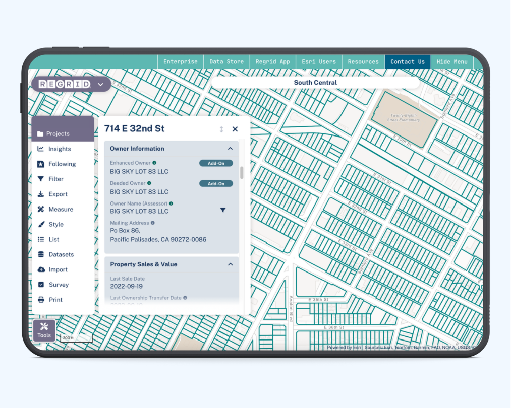
 Premium parcels
.png) AI and ML tools
AI and ML tools
 Roadway ROW
 Spatial add-ons
 Delivery methods
- Industries ⌄
- Data store
- Property App
- Esri users
- Resources ⌄
- Contact us


.svg)


-
Products ⌄
AI and ML tools
Roadway ROW
-
Industries ⌄
-
Resources ⌄
INDUSTRIES
Nationwide parcel data for state and federal government agencies
Complete U.S. parcel coverage, built for government teams that need reliable property data for planning, analysis, response, and public sector decision-making.

You're in great company


One parcel layer. Clearer public sector decisions.
Government teams work across jurisdictions, programs, and partners. When land data is inconsistent, it gets harder to compare places, coordinate response, and explain decisions.
With Regrid’s standardized nationwide parcel layer, you can:

-
Use parcels as a common base for land, ownership, address, building, zoning, and valuation context.
-
Analyze counties, regions, and programs with one schema instead of piecing together county data.
-
Keep analysts, GIS teams, field staff, and external partners aligned on the same parcel context.
What can government teams do with a standardized parcel layer?
See how parcel data can support planning, response, acquisition, and public-facing workflows
Modernize address and residential location analysis
Use parcel boundaries and address context to support location intelligence, modeling, and population-related workflows.

Support disaster response and environmental coordination
Identify properties near incidents, response areas, or impact zones, then share clearer parcel-level context with partners.
Plan land acquisition and conservation programs
Filter and prioritize parcels by size, ownership, location, and surrounding context to support planning, outreach, and acquisition workflows.
Improve land use, zoning, and development review
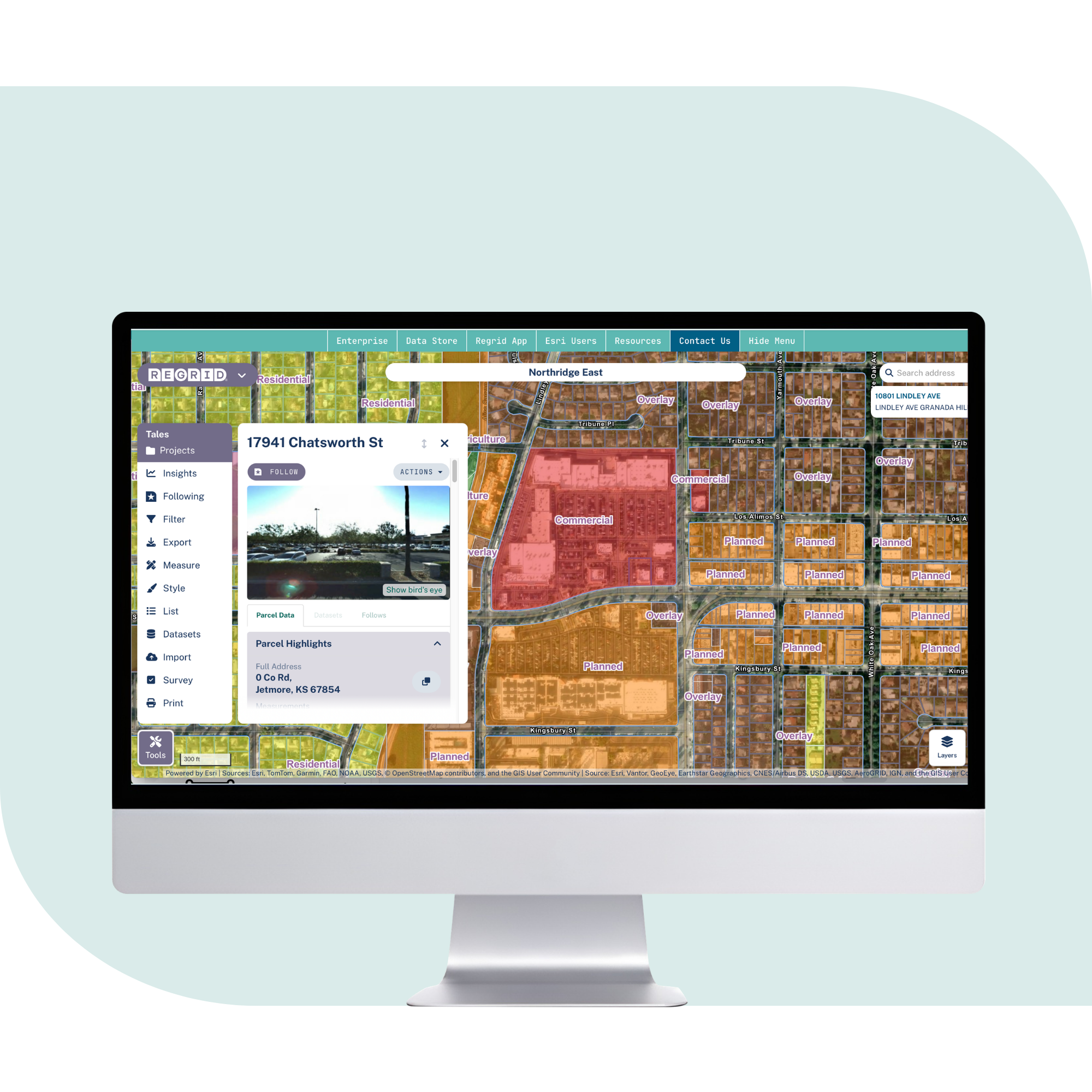
Bring parcel boundaries, zoning, buildings, valuation, and land use context into one consistent map for cross-jurisdiction analysis.
Build public-facing maps, portals, and reports
Use tiles and APIs to bring parcel context into public maps, internal portals, and partner-facing tools without managing raw parcel files.

Standardize analytics across programs and geographies
Connect internal records, risk layers, program data, and spatial analyses to one parcel schema that works across counties and regions.
Trusted by government teams
Regrid supports agencies that need parcel data in the tools and systems they already use.
census mapping
The Census Bureau used Regrid as a key data source to support location intelligence modeling and help identify residential locations more accurately as part of census modernization work.
Disaster response
The Environmental Protection Agency incorporated Regrid data and Feature Service into disaster response workflows to understand properties impacted by disasters and support coordination with government entities, first responders, and NGOs
Land Acquisition
The Georgia Department of Natural Resources Wildlife Resources Division used Regrid parcel data in ArcGIS to filter parcels by size and owner, helping build a planning database of properties to pursue for acquisition.
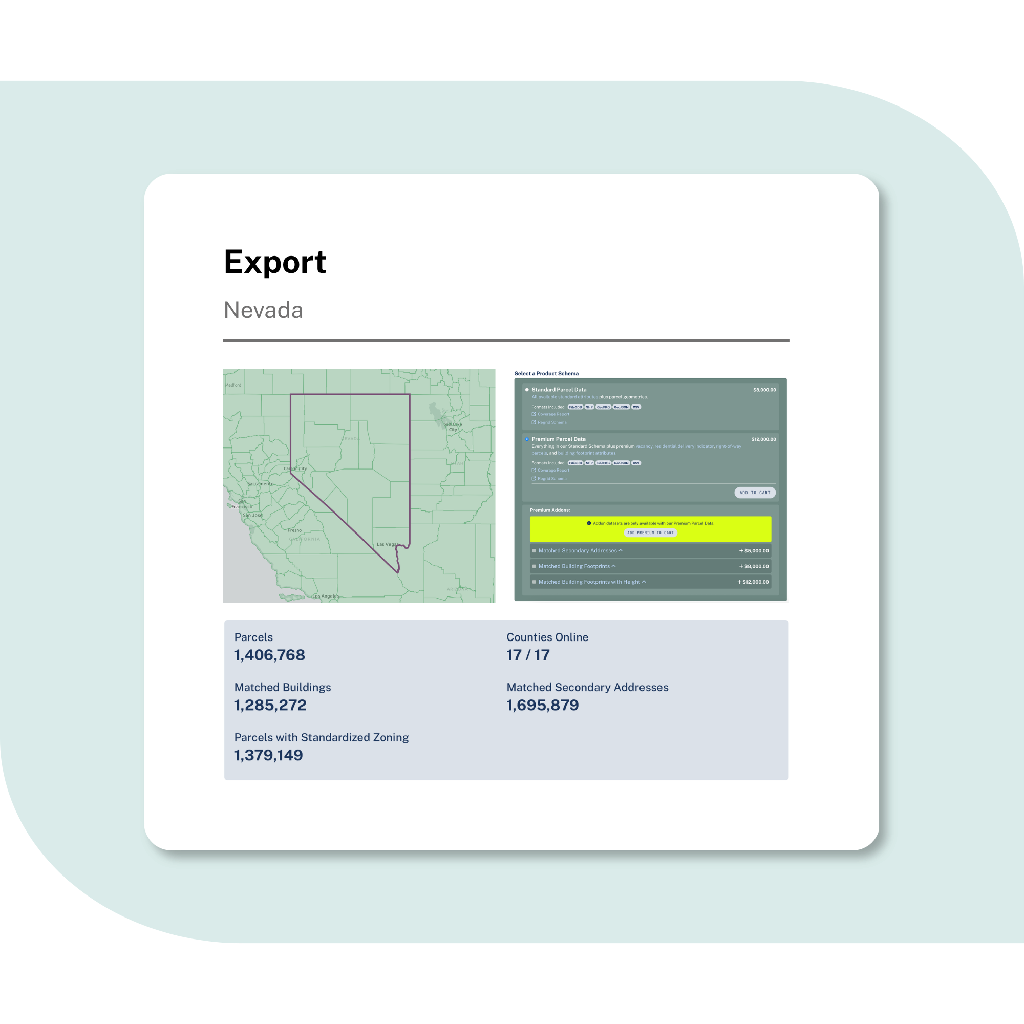
Explore the coverage map
See live coverage, refresh dates, and attribute completeness. Click any county to see parcel counts and field-by-field coverage, then continue to purchase or explore data in the Regrid web app.

What you get
Explore what makes Regrid data a great option for government teams:

100%
U.S. Parcel
data coverage


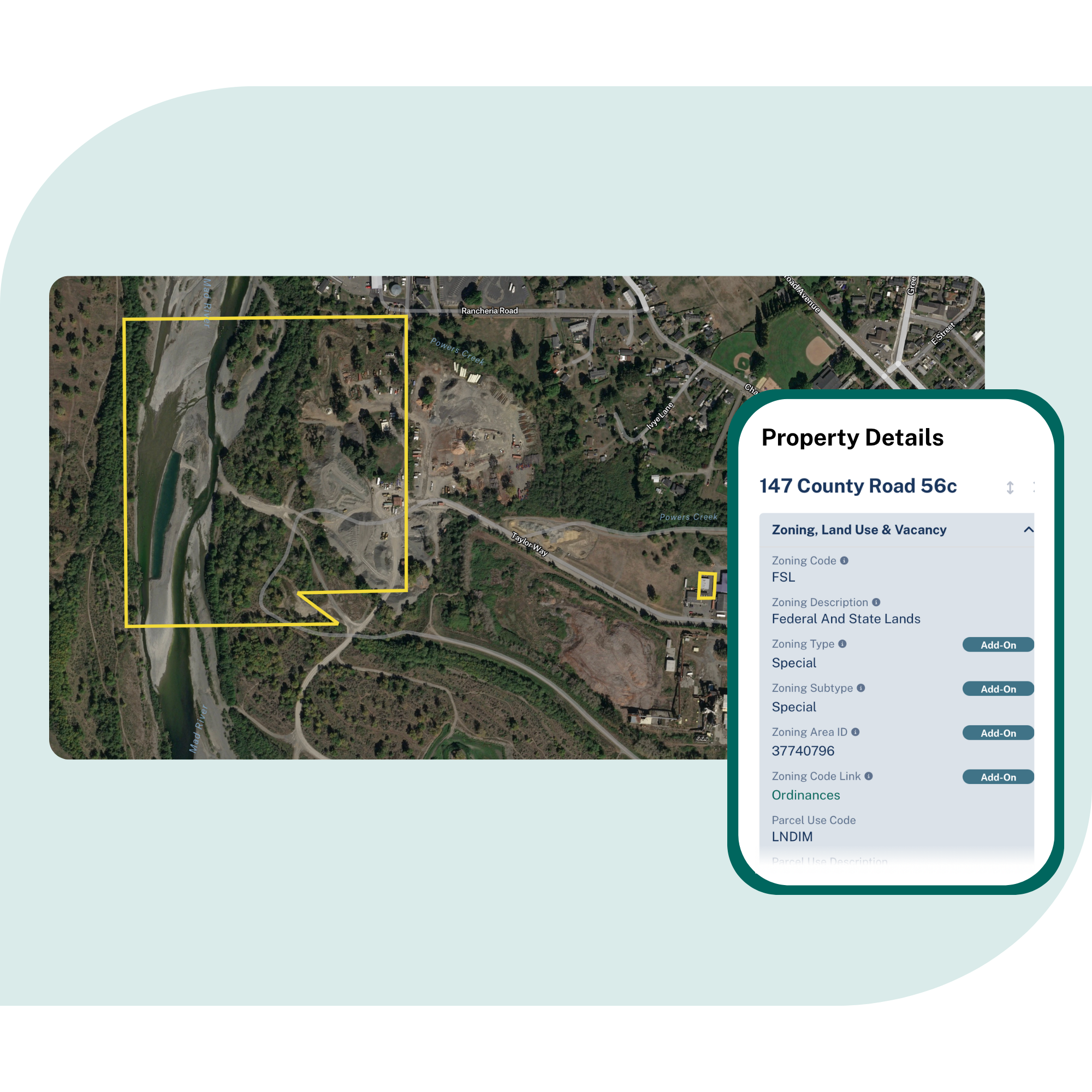
Critical attributes, standardized
Parcel boundaries and sizes, owner names and mailing addresses, zoning, property valuation, building footprints, and address context delivered in one consistent structure.

Nationwide coverage, kept current
Coverage across all U.S. counties, with ongoing refreshes and monthly Premium schema updates to help teams work from current parcel context.

Delivery that fits government GIS and data teams
Use Feature Service for GIS workflows, APIs and tiles for apps and portals, or bulk delivery for modeling, analysis, and internal systems.

Easy to match, map, and share
Connect internal records to current parcel boundaries using parcel IDs, addresses, or spatial joins, then use that same parcel context across maps, exports, and downstream workflows.
Frequently asked questions
-
It means Regrid provides parcel coverage across all U.S. counties in a standardized structure, so teams can work across jurisdictions without sourcing and cleaning data county by county.
-
Yes. Regrid’s parcel schema is designed to make cross-county and cross-state work more consistent, which helps when programs, models, or reporting workflows need to compare places.
-
Yes. Regrid supports Feature Service, API, tiles, and bulk delivery, so parcel data can feed GIS workflows, internal systems, public portals, and analysis pipelines.
-
Regrid refreshes parcel data on an ongoing schedule and publishes coverage, refresh dates, and attribute completeness so teams can understand what is available in each county.
-
Yes. Teams can connect existing records to parcels using parcel IDs, addresses, or spatial joins, then reuse that connection across maps, exports, analysis, and reporting.

(888) 4RE-GRID
Subscribe for email updates