-
Products ⌄
 Premium parcels
.png) AI and ML tools
AI and ML tools
 Roadway ROW
 Spatial add-ons
 Delivery methods
- Industries ⌄
- Data store
- Property App
- Esri users
- Resources ⌄
- Contact us


.svg)


"Our mission is to strengthen neighborhoods and preserve property values." |
Tell us a little about you and the work you do.
The Lucas County Land Bank is a non-profit organization located in Toledo, Ohio. We were established in 2010 and were the 2nd land bank to exist in Ohio.
Our mission is to strengthen neighborhoods and preserve property values by strategically returning vacant, abandoned, and tax-delinquent properties to productive use. We accomplish that mission with a small staff of dedicated, passionate individuals and strong partnerships with local governments and community groups. Everything we do is geared towards strengthening the economic future of our region and improving quality of life for our residents. As a land bank, we have a unique set of tools that enables us to step in and solve lingering problems for our community.
“We are committed to creating fair access to opportunity and data for every member of our community."
What got you into your field? Tell us more about your journey so far.
Anne - I graduated from Michigan State University in 2009 with a Bachelor of Science in Urban and Regional Planning and after a short while I realized that my passion for urban planning was truly rooted in finding ways to impact people’s quality of life. From there I started working towards a Masters of Public Administration which allowed me to understand how to implement positive change within our communities. After earning my degrees, I started to work with some local municipalities on land use planning and study its long-term effects. As a part of these efforts, I started to work for the Lucas County Land Bank. I was able to use my passion for urban planning, the environment, and shaping policy all in one place.
Stephanie - I was born and raised in Toledo. I have a Master's in Public Administration from Bowling Green State University with a focus on local government and non-profit management. After graduating, I worked in a few different public sector positions that led me to move to Southwest Ohio for a period before returning home to Lucas County. Once I was back in Toledo, I had the opportunity to join the staff of the Lucas County Land Bank. This organization is the perfect union between my public sector education and immense love and pride for my hometown. I feel so lucky to come to work every day and know that I have the chance to make my community better.
|
|
We're sure you are able to help a lot of people through your work at the land bank. We want to learn more about it.
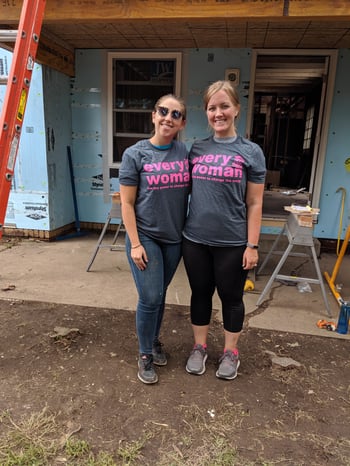
We always say that our work is directed towards problem properties, but the purpose of what we do is to serve the neighbor around that problem. To date, we have helped to repurpose over 4,000 homes, businesses, and vacant lots. By taking control of abandoned, nuisance properties, we can remove the blight that is causing safety concerns, increased crime, and lowered property values.
In turn, this helps all adjacent residents and property owners that continue to do their best to maintain their properties and protect their property values. We also want to be a source of information for our citizens because knowledge is power. We are committed to creating fair access to opportunity and data for every member of our community.
 |
How has Regrid been useful to your efforts?
First, we use them in the more traditional sense, where we use the survey tool to create a survey and use the Regrid app as a land survey information system in the field to complete that in person survey. We have so far completed a neighborhood survey that focused on vacant land attributes. In addition, we are currently in the beginning stages of building a city-wide survey for the City of Toledo. We hope to begin this survey after wrapping up six years of demolition work later this year. We are very excited!
Second, we use the data Regrid provides during our day to day operations. Not only do we use the map to conduct spatial analysis and create focus areas we also use the property records data to run reports. These reports provide real time data that allows us to have a true sense of what is happening at a property at any given time. For an organization like ours, reliable data is crucial. We have a small staff that works to assist all neighborhoods throughout Lucas County but with limited resources, we depend on tools such as Regrid to help guide our decision making. Being able to combine survey results, the mapping tool, and property record information all in one place is a true asset to our organization.
The Regrid team has been tremendously helpful over the years. We have worked with the team for a while now and every encounter we have is not only productive but pleasant. We enjoy the energy the team brings and their true understanding of our mission and what we are trying to accomplish to reach our goals. It is apparent that the team’s values match ours when it comes to serving the community and being transparent while doing so.
The team is also open to ongoing dialogue regarding our needs and providing us tips for the best ways to use the data and app. The team is easy to get a hold of and quick to respond. Overall, the Regrid team has been a welcomed asset to us at the Land Bank.