
-
Products ⌄
 Premium parcels
.png) AI and ML tools
AI and ML tools
 Roadway ROW
 Spatial add-ons
 Delivery methods
- Industries ⌄
- Data store
- Property App
- Esri users
- Resources ⌄
- Contact us


.svg)


-
Products ⌄
AI and ML tools
Roadway ROW
-
Industries ⌄
-
Resources ⌄
INDUSTRIES
Nationwide parcel data for transportation and logistics teams
Plan routes, corridors, service areas, and infrastructure with standardized parcel data built for transportation workflows.

One parcel layer for transportation planning and operations
Connect routes, corridors, facilities, and service areas to reliable property, address, building, and ownership context.

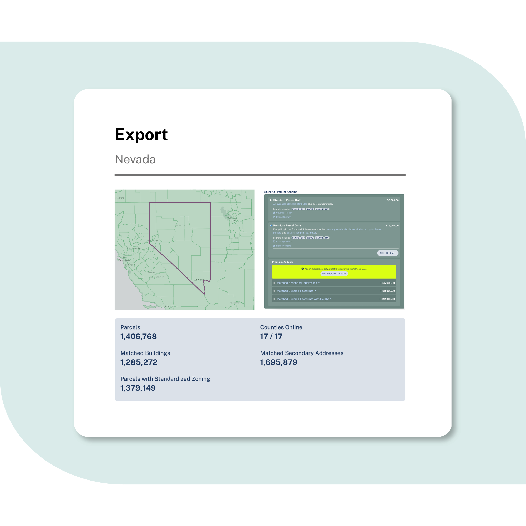
100%
U.S. Parcel
data coverage


Validate addresses and destinations
Match addresses, buildings, and parcel boundaries so delivery, service point, and routing workflows start from a cleaner location reference.

Understand corridors and nearby parcels
Connect transportation projects to surrounding parcels, ownership, land use, zoning, and building context before planning moves downstream.

Keep teams working from the same map
Move parcel context between GIS, analytics, field tools, applications, and partner workflows without rebuilding county by county.
Built for core transportation workflows
See how standardized parcel data supports planning, operations, and transportation technology.
Plan network and infrastructure projects
Use parcel boundaries, ownership, zoning, and building context to understand affected properties, nearby land uses, and corridor constraints early.
Support right of way and corridor planning
Use parcels as a starting point for owner context, outreach lists, impact areas, and project handoffs as routes and corridors evolve.
Define service points
and geofences
Anchor service points to parcels, addresses, and buildings so fleet, delivery, and geofencing workflows use a clearer property reference.
Optimize logistics and facility decisions
Compare warehouse, hub, and route-adjacent sites with parcel size, building context, zoning, ownership, and surrounding property data.
Improve drone and advanced mobility planning
Use parcel boundaries to understand private property context, support safer flight planning, and reduce the risk of conflicts with landowners.
Build transportation mapping products
Serve parcel overlays through API, tiles, Feature Service, or bulk delivery so users can explore property context inside apps, portals, and GIS.
Need Roadway Right of Way polygons?
For DOTs, public agencies, and infrastructure teams, Regrid also offers a dedicated Roadway Right of Way polygon dataset for identifying road and rail corridor areas.
Use it alongside parcel data to add corridor context to transportation planning, infrastructure projects, utilities work, and right of way analysis.

You're in great company


Trusted by transport and logistics teams
Regrid supports transportation, logistics, drone safety, software, and public-sector teams
that use parcel data to plan routes, evaluate sites, and understand infrastructure impacts.
Logistics operations
A distribution company used Regrid parcel data to analyze potential warehouse sites and support delivery route decisions.
Service point definition
A logistics company used parcel data to identify property locations, support geofencing, and improve delivery accuracy.
Drone flight planning
A drone logistics company used parcel boundaries to plan flight paths and reduce the risk of encroaching on private property.
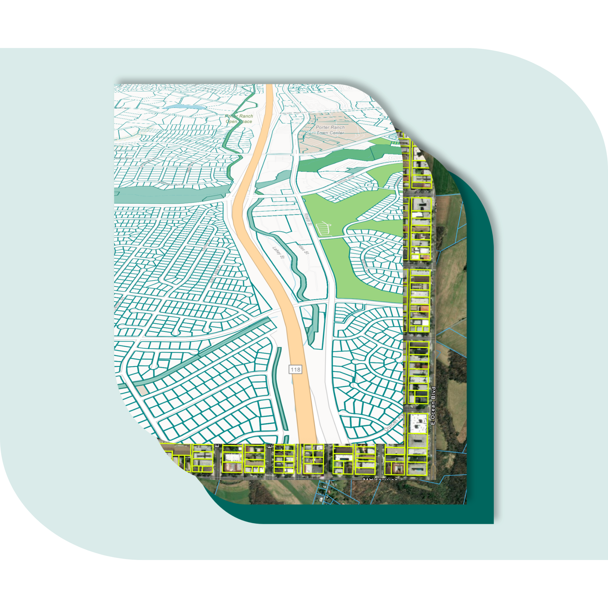
Explore the coverage map
See live coverage, refresh dates, and attribute completeness. Click any county to see parcel counts and field-by-field coverage, then continue to purchase or explore data in the Regrid web app.

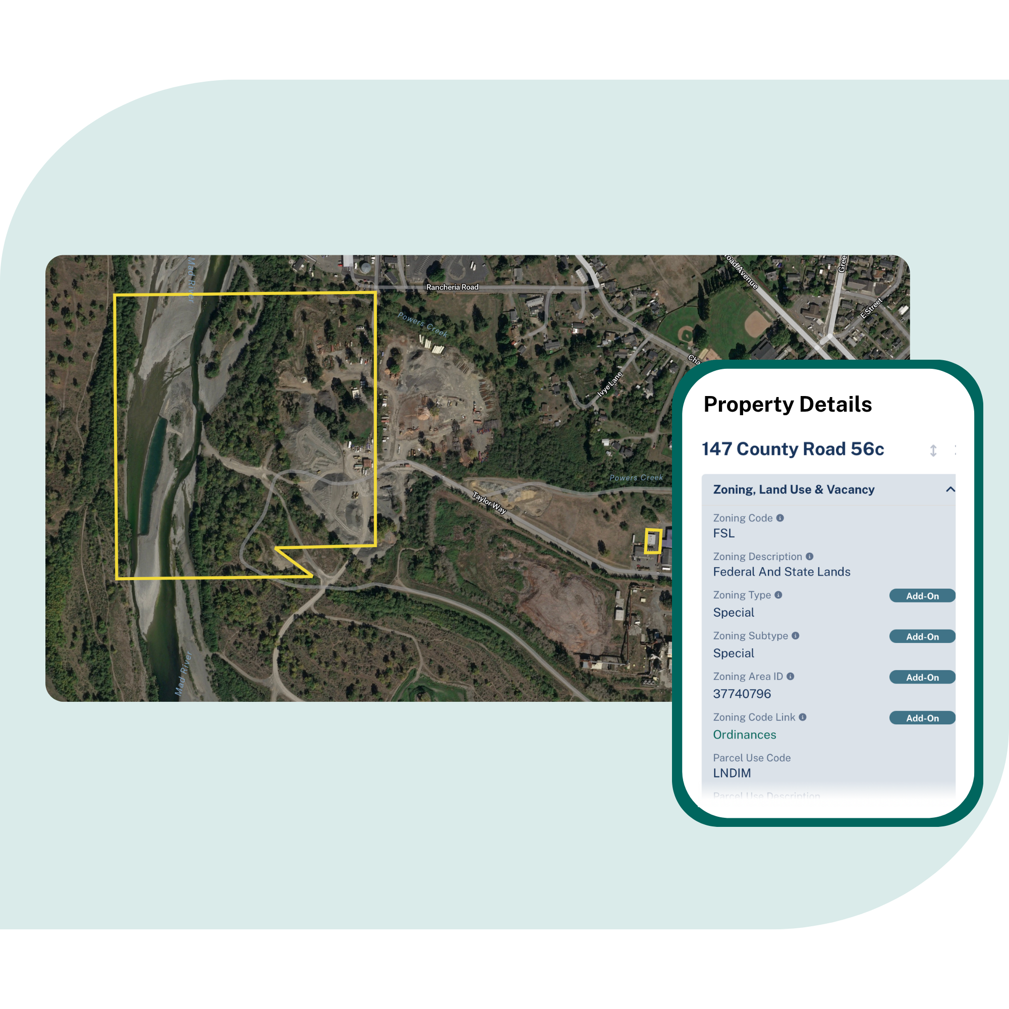
What you get

-
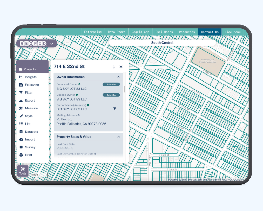
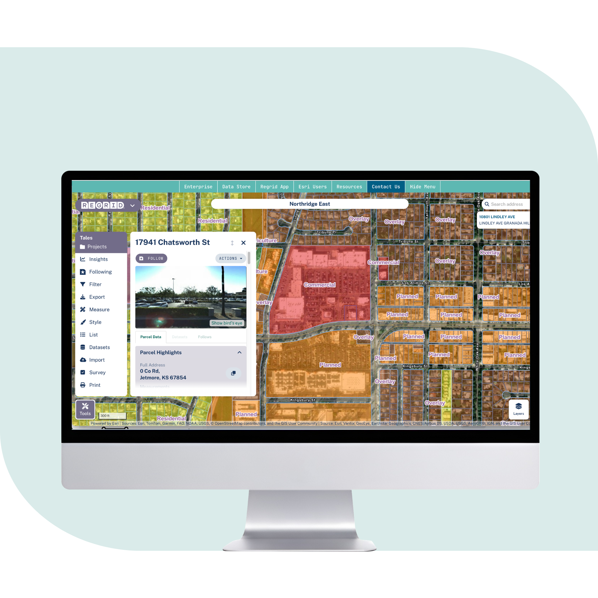
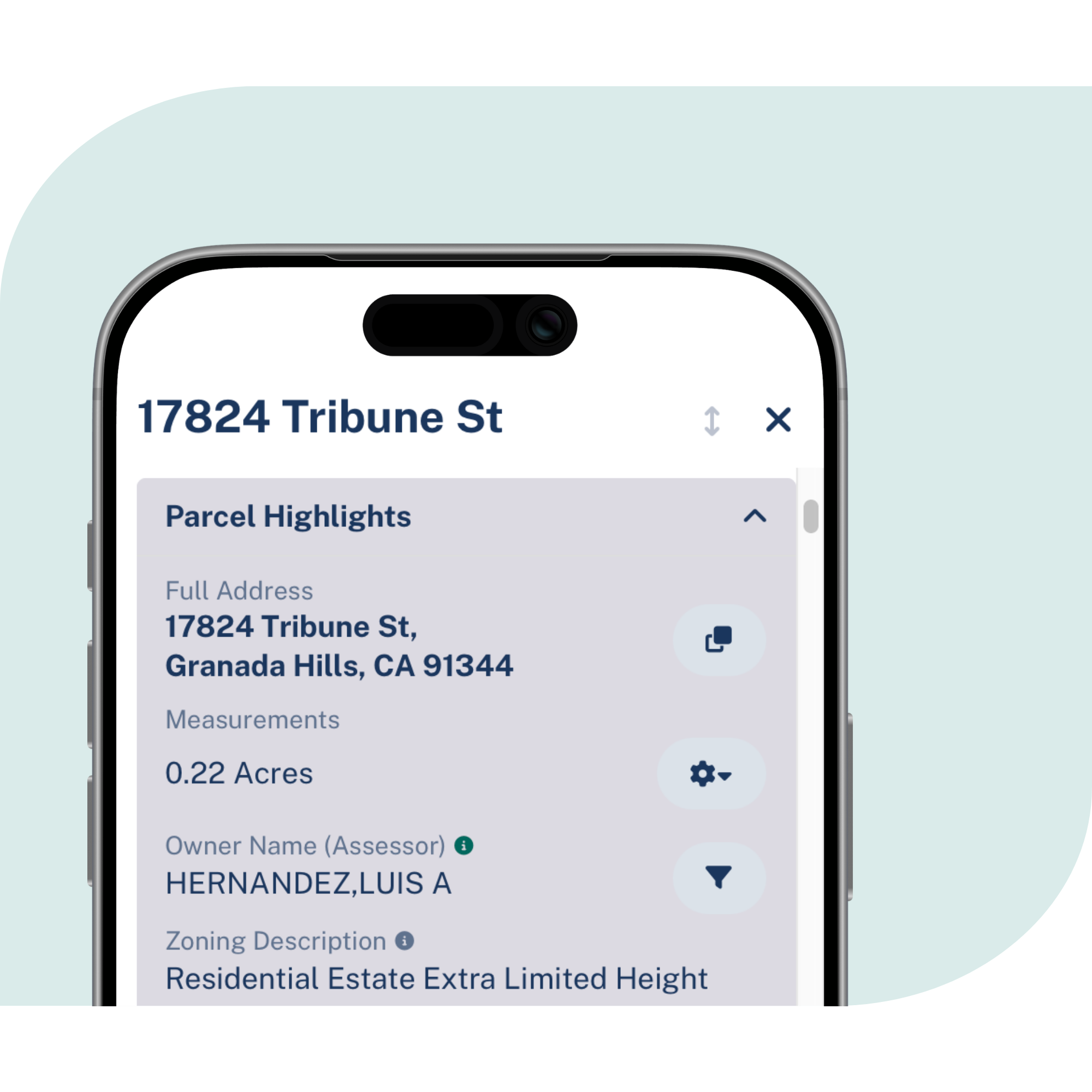
Parcel boundaries and sizes, owner names and mailing addresses, situs and unit addresses, zoning, valuation, and available building and address context in one consistent structure.
-
Coverage across the United States, with ongoing refreshes so transportation teams can work from current parcel, address, ownership, and property context.
-
Use Feature Service and GIS layers for planning, APIs and tiles for applications, or bulk delivery for analytics, routing, and internal systems.
Frequently asked questions
-
Parcel data gives transportation teams a property-level reference for addresses, buildings, facilities, service points, land ownership, and nearby context. That helps teams plan routes, define service areas, evaluate sites, support field work, and connect transportation decisions to the land.
-
An address helps identify a location. A road centerline shows the path of a road. A parcel shows the property boundary and related property context, which can help teams understand ownership, land use, buildings, access, and surrounding properties.
-
Yes. Regrid parcel data can support owner research, outreach lists, corridor planning, and project handoffs. For teams that need dedicated road and rail corridor polygons, Regrid’s Roadway right of way dataset is available as a separate product.
-
Yes. Regrid supports API, tiles, Feature Service, and bulk delivery, making it easier to bring parcel context into GIS tools, routing systems, internal analytics, and customer-facing applications.

(888) 4RE-GRID
Subscribe for email updates