Regrid logo, registered trademark
  • Enterprise

    Regrid premium parcel data menu icon Premium Parcels

    • US Parcel Data U.S. Parcels
    • Canada Parcel Data Canadian Parcels
    • global-icon Global Parcels

    Spatial add-ons menu icon Spatial Add-Ons

    • Matched building footprints menu icon Matched Building Footprints
    • Matched secondary addresses menu icon Matched Secondary Addresses
    • Standardized zoning menu icon Standardized Zoning
    • Enhanced property ownership menu icon Daily Ownership Updates

    road icon Roadway ROW

    • Roadway polygons icon U.S. Roadway Polygons

    Data access icon Data Access

    • data-store-2 Coverage Map
    • blog_resources_icon-1 Parcel Schema
    • Bulk files icon Bulk Files
    • Feature Service Feature Service
    • api-icon_2025 Parcel API & Tiles
    • API Sandbox icon Interactive API Sandbox
  • Data Store
  • Regrid App
  • Esri Users
  • Resources

    Support menu icon Support

    • Support site menu icon Support Site
    • Tutorial videos menu icon Tutorial Videos

    Content menu icon Content

    • Blog menu icon Blog
    • Customer stories menu icon Customer Stories
    • Reports menu icon Reports

    Programs menu icon Programs

    • academia_menu-icon Nonprofit & Academia
    • Regrid giving menu icon Regrid Giving
  • Contact Us
Contact Us
  • Enterprise

    Premium Parcels

    • U.S. Parcels
    • Canadian Parcels
    • Global Parcels

    Roadway ROW

    • U.S. Roadway Polygons

    Spatial Add-Ons

    • Matched Building Footprints
    • Matched Secondary Addresses
    • Standardized Zoning
    • Daily Ownership Updates

    Data Access

    • Coverage Map
    • Parcel Schema
    • Bulk Files
    • Feature Service
    • Parcel API & Tiles
    • Interactive API Sandbox
  • Data Store
  • Regrid App
  • Esri Users
  • Resources

    Support

    • Support Site
    • Tutorial Videos

    Programs

    • Nonprofit & Academia
    • Regrid Giving

    Content

    • Blog
    • Customer Stories
    • Reports
  • Contact Us

The Regrid Blog

Discover the Latest in Land Parcels & Spatial Data with the Regrid Team!
Regrid Blog

Living In The Map

Categories

  • Announcements
  • Parcel Data Updates
  • Democratizing Data
  • Regrid Updates
  • Product How-To
  • Use Cases
  • Customer & Guest Blogs
  • All About Parcel Data
  • Working at Regrid
  • Regrid 100
  • Reports

Parcel API Program, Buildings Data, Opportunity Zones & Much More…

Sahana Murthy November 5, 2019

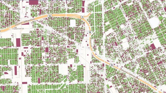
A map of parcels on Regrid Pro

Happy November!


As the year comes to a close and thoughts turn to 2020, let’s jump right in to what’s new for you.

1. New Parcel Data API Program:

We’ve launched a new way to access  our nationwide dataset of 146 million+ parcels via API for those who want the data in their own apps, but don’t need to host or download it.

There is a 30 day free trial, no payment info required, and after that if you want to continue using the API it’s only $500 - $2,000/month depending on the fields you want access to and the number of API calls.
Full details are at https://regrid.com/api


Get trial API access
For a license to download and host the data yourself, email us at parcels@landgrid.com.

2. Product & Data Updates:

  • Landgrid Pro - For those of you with Pro and Enterprise accounts, we have a lot of great updates on the software side. If you don’t have a Landgrid Pro account yet and you use the site, then come on, it's time to upgrade. They’re only $75/year through the end of December and offer a much better experience: https://regrid.com/saas. And if you’re trying to push a team project through a Pro account, just drop us a line and we’ll work with you to get you exactly what you need: enterprise@landgrid.com.
  • Opportunity Zones - You asked and we delivered! We added opportunity zones as columns to our dataset and as a layer to the mapping platform. 
  • Buildings Footprints - Mid November, we are going to launch buildings footprints as a layer on our platform (Pro & above) and we will also append buildings count per parcel to our dataset as a column.
  • Acreage & SQFT columns - We recently added acreage & SQFT of each parcel as columns to our nationwide dataset. You should be able to download this as part of our next parcel update.
  • Landgrid App - We have made so many improvements to our mobile surveying app that listing them would go against our current goal to keep this email short. ;) Check it out. Its free to download - https://regrid.com/apps
  • Site Control- In December, we will be closing down Sitecontrol.us entirely. Those of you who still use Sitecontrol, we highly recommend that you login into regrid.com using your Sitecontrol credentials and continue using your account as is. Landgrid.com has all the features that Sitecontrol does, but is augmented with an intuitive & user friendly UI. 


3. People of Landgrid Series :
We launched our first ever customer story with Giancarlo Di Lonardo from New Jersey Community Capital.
Read all about the amazing work Giancarlo & NJCC are doing for NJ communities - https://regrid.com/customers

Help us tell your story by emailing sahana@regrid.com

We're sure you are all planning for a solid start to the new year.
Holler & let us know how we or our solutions can help you with your projects & goals. We are just an email away.


Happy Mapping!


Previous Next
logo

(888) 4RE-GRID

  • Contact Us
  • Customer Support
  • Privacy Policy
  • Terms of Use

Subscribe for email updates

Company

  • About Regrid
  • Careers
  • Press

Resources

  • Coverage Map
  • Support Center
  • Reports
  • Regrid Status Page

Enterprise Solutions

  • U.S. Parcels
  • Canada Parcels
  • Parcel & Tiles API

Self-Serve Solutions

  • Regrid Property App
  • Shop the Data Store
  • API Monthly Plans