Regrid logo, registered trademark
  • Enterprise

    Regrid premium parcel data menu icon Premium Parcels

    • US Parcel Data U.S. Parcels
    • Canada Parcel Data Canadian Parcels
    • global-icon Global Parcels

    Spatial add-ons menu icon Spatial Add-Ons

    • Matched building footprints menu icon Matched Building Footprints
    • Matched secondary addresses menu icon Matched Secondary Addresses
    • Standardized zoning menu icon Standardized Zoning
    • Enhanced property ownership menu icon Daily Ownership Updates

    road icon Roadway ROW

    • Roadway polygons icon U.S. Roadway Polygons

    Data access icon Data Access

    • data-store-2 Coverage Map
    • blog_resources_icon-1 Parcel Schema
    • Bulk files icon Bulk Files
    • Feature Service Feature Service
    • api-icon_2025 Parcel API & Tiles
    • API Sandbox icon Interactive API Sandbox
  • Data Store
  • Regrid App
  • Esri Users
  • Resources

    Support menu icon Support

    • Support site menu icon Support Site
    • Tutorial videos menu icon Tutorial Videos

    Content menu icon Content

    • Blog menu icon Blog
    • Customer stories menu icon Customer Stories
    • Reports menu icon Reports

    Programs menu icon Programs

    • academia_menu-icon Nonprofit & Academia
    • Regrid giving menu icon Regrid Giving
  • Contact Us
Contact Us
  • Enterprise

    Premium Parcels

    • U.S. Parcels
    • Canadian Parcels
    • Global Parcels

    Roadway ROW

    • U.S. Roadway Polygons

    Spatial Add-Ons

    • Matched Building Footprints
    • Matched Secondary Addresses
    • Standardized Zoning
    • Daily Ownership Updates

    Data Access

    • Coverage Map
    • Parcel Schema
    • Bulk Files
    • Feature Service
    • Parcel API & Tiles
    • Interactive API Sandbox
  • Data Store
  • Regrid App
  • Esri Users
  • Resources

    Support

    • Support Site
    • Tutorial Videos

    Programs

    • Nonprofit & Academia
    • Regrid Giving

    Content

    • Blog
    • Customer Stories
    • Reports
  • Contact Us

Regrid Reports

Check out the official reports on customer property survey and data analyses projects using the Regrid Parcel Data

Regrid Blog

Living In The Map

Categories

  • Reports
  • Use Cases

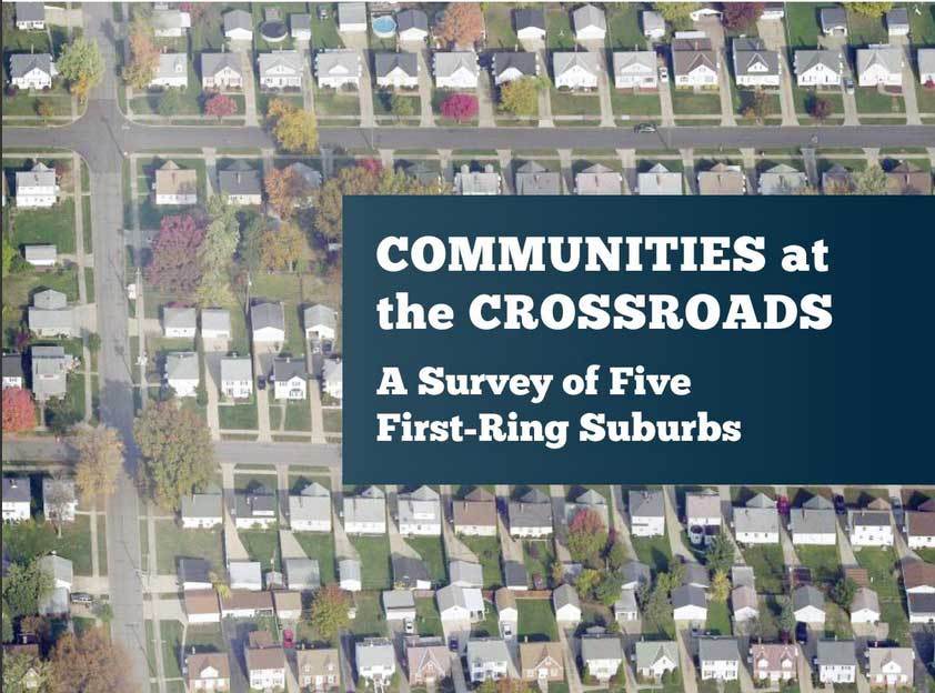
Communities at the Crossroads

Matt Hampel January 12, 2018

Headed by Western Reserve Land Conservancy in partnership with Dynamo Metrics and Loveland Technologies, analysis of five of Cleveland’s first-ring suburbs – Euclid, Garfield Heights, Maple Heights, South Euclid, and Warrensville Heights – in the wake of the foreclosure crisis. The report examines housing market challenges and opportunities facing these communities, with property survey information analyzed alongside an array of other available property data.

Communities at the Crossroads; A survey of five first-ring suburbs
Communities at the Crossroads: A Survey of Five First-Ring Suburbs


About the Survey


Western Reserve Land Conservancy's urban arm - Thriving Communities - has conducted property surveys of communities in Northeast Ohio since 2013.  The most significant survey was the 2015 Cleveland property inventory which provided a detailed look at the property conditions throughout the City of Cleveland, block by block and building by building - almost 160,000 properties in total.


The foreclosure crisis that devasted Cleveland for over a decade and the resulting "Great Recession" created thousands of vacant and abandoned buildings and exacerbated the already serious conditions in distressed Cleveland neighborhoods. While less publicized, the foreclosure crisis also had a detrimental impact in Cleveland's first-ring suburbs - communities that had suffered a decline from decades of out-migration and disinvestment. These suburbs also suffered vacancies, increase foreclosures, and declining property values. The 2015 Cleveland survey aided policymakers on the ground, assessing which properties were most distressed and candidates for demolitions, and which could be salvaged. This report provides the same opportunity for suburban policymakers. 


Over the past several years, significant economic resources were made available to the City of Cleveland and the Cuyahoga County Land Reutilization Corporation (CCLRC), commonly known as the Cuyahoga Land bank. 


Those behind the destructive real estate practices in Cleveland learned that the suburbs, in particular the first-ring suburbs, were fertile ground for speculation and faulty mortgages that came with that speculation. 

Previous Next
logo

(888) 4RE-GRID

  • Contact Us
  • Customer Support
  • Privacy Policy
  • Terms of Use

Subscribe for email updates

Company

  • About Regrid
  • Careers
  • Press

Resources

  • Coverage Map
  • Support Center
  • Reports
  • Regrid Status Page

Enterprise Solutions

  • U.S. Parcels
  • Canada Parcels
  • Parcel & Tiles API

Self-Serve Solutions

  • Regrid Property App
  • Shop the Data Store
  • API Monthly Plans