×
See Regrid's NEW Roadway ROW Data in Action!
Regrid logo, registered trademark
  • Enterprise

    Regrid premium parcel data menu icon Premium Parcels

    • US Parcel Data U.S. Parcels
    • Canada Parcel Data Canadian Parcels
    • global-icon Global Parcels

    Spatial add-ons menu icon Spatial Add-Ons

    • Matched building footprints menu icon Matched Building Footprints
    • Matched secondary addresses menu icon Matched Secondary Addresses
    • Standardized zoning menu icon Standardized Zoning
    • Enhanced property ownership menu icon Daily Ownership Updates

    road icon Roadway ROW

    • Roadway polygons icon U.S. Roadway Polygons

    Data access icon Data Access

    • data-store-2 Coverage Map
    • blog_resources_icon-1 Parcel Schema
    • Bulk files icon Bulk Files
    • Feature Service Feature Service
    • api-icon_2025 Parcel API & Tiles
    • API Sandbox icon Interactive API Sandbox
  • Data Store
  • Regrid App
  • Esri Users
  • Resources

    Support menu icon Support

    • Support site menu icon Support Site
    • Tutorial videos menu icon Tutorial Videos

    Content menu icon Content

    • Blog menu icon Blog
    • Customer stories menu icon Customer Stories
    • Reports menu icon Reports

    Programs menu icon Programs

    • academia_menu-icon Nonprofit & Academia
    • Regrid giving menu icon Regrid Giving
  • Contact Us
Contact Us
  • Enterprise

    Premium Parcels

    • U.S. Parcels
    • Canadian Parcels
    • Global Parcels

    Roadway ROW

    • U.S. Roadway Polygons

    Spatial Add-Ons

    • Matched Building Footprints
    • Matched Secondary Addresses
    • Standardized Zoning
    • Daily Ownership Updates

    Data Access

    • Coverage Map
    • Parcel Schema
    • Bulk Files
    • Feature Service
    • Parcel API & Tiles
    • Interactive API Sandbox
  • Data Store
  • Regrid App
  • Esri Users
  • Resources

    Support

    • Support Site
    • Tutorial Videos

    Programs

    • Nonprofit & Academia
    • Regrid Giving

    Content

    • Blog
    • Customer Stories
    • Reports
  • Contact Us

The Regrid Blog

Discover the Latest in Land Parcels & Spatial Data with the Regrid Team!

Regrid Blog

Living In The Map

Categories

  • Announcements
  • Parcel Data Updates
  • Democratizing Data
  • Regrid Updates
  • Product How-To
  • Use Cases
  • Customer & Guest Blogs
  • All About Parcel Data
  • Working at Regrid
  • Regrid 100
  • Reports

Loveland CEO Letter: 8 Years in 70 Seconds + UP Winter Pics

Sahana Murthy January 21, 2021


Happy New Year, all.

Sharing a short video that visualizes 8 years of land data growth in 75 seconds; a reminder that it’s easy to reach out to the Loveland team any time, and, just because it’s the season, some winter pics from the snowy north.

Our co-founder and CTO, Larry Sheradon, recently blew my mind when he made this short time-lapse of our nationwide dataset growing by the day from 2013 through the present: https://youtu.be/rfgh7aqRx7I


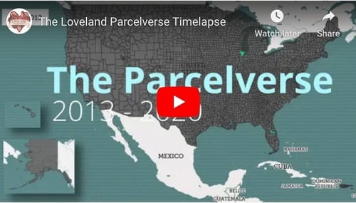
Our whole job at Loveland is to make it easy for you to access and work with this land and property information. As a refresher, we can do that for you in a variety of complimentary ways:

  • A free online viewer 
  • A free mobile app
  • Subscription software
  • Nationwide bulk data licenses 
  • A data API
  • Vector & rastor tiles
  • A county Data Store


We try to lay it all out neatly at landgrid.com, but with so many options and so much data, you can always reach us at team@landgrid.com to tell us what you’re looking for or trying to accomplish and we’ll get back to you within a day to help you find the right solution.

And while I’m here, since we’re smack dab in the middle of winter, I can’t not share some views of what it looks like in Michigan’s Upper Peninsula right now.

The Loveland team is spread out across the country, but this is the current view through the window of our home office in Calumet, where Mary and I have relocated full-time from Detroit since March, trading skyscrapers for frozen stalactites — a different, but equally inspiring view:


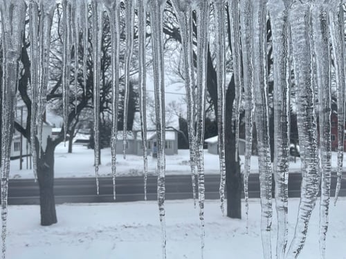
This is “pancake ice” on Lake Superior, the largest freshwater lake on earth (well, largest by surface area — there’s a deeper one in Russia that’s smaller on the surface, but has more volume… I’ll still give it to Superior, though):


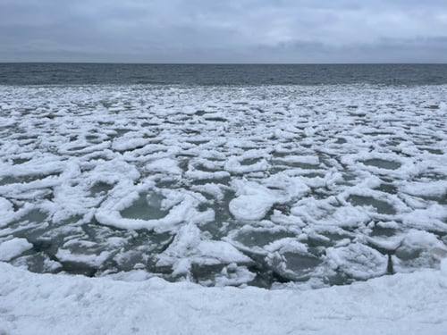
This is the glow of lights in town bouncing off low-flying lake effect clouds in a light snow on a cross-country ski trail:


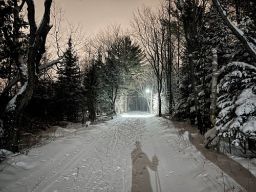
This is new-fallen snow on a freshly groomed trail — getting outdoors and skiing has become my go-to way to unplug and recharge outdoors in winter:


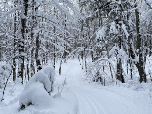
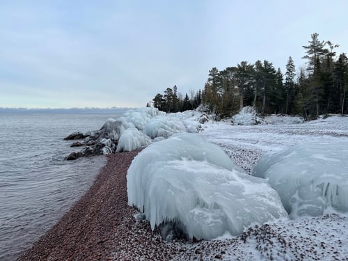
This is an ice formation on a frozen, rocky beachscape — my rock picking is basically on pause until spring at this point, though I’ve got a couple of rock tumblers going around the clock in the garage: 


I’ve got too many of these pictures, so I’ll stop there, but the landscape is amazing, and land is more than data about land, so I wanted to share. Depending on where you are in the world, I hope you’re still finding joy in the seasons and the outdoors if you’re experiencing short, cold, gray days. Hang in there.

Watch out for more exciting product updates coming from the Loveland team this year. The products are already outstanding, but we’re not resting on our laurels. 

Stay safe, stay healthy, and stay connected to the land,


Happy Mapping!

Jerry Paffendorf

team@landgrid.com

313-649-LAND

Previous Next
logo

(888) 4RE-GRID

  • Contact Us
  • Customer Support
  • Privacy Policy
  • Terms of Use

Subscribe for email updates

Company

  • About Regrid
  • Careers
  • Press

Resources

  • Coverage Map
  • Support Center
  • Reports
  • Regrid Status Page

Enterprise Solutions

  • U.S. Parcels
  • Canada Parcels
  • Parcel & Tiles API

Self-Serve Solutions

  • Regrid Property App
  • Shop the Data Store
  • API Monthly Plans