Regrid logo, registered trademark
  • Enterprise

    Regrid premium parcel data menu icon Premium Parcels

    • US Parcel Data U.S. Parcels
    • Canada Parcel Data Canadian Parcels
    • global-icon Global Parcels

    Spatial add-ons menu icon Spatial Add-Ons

    • Matched building footprints menu icon Matched Building Footprints
    • Matched secondary addresses menu icon Matched Secondary Addresses
    • Standardized zoning menu icon Standardized Zoning
    • Enhanced property ownership menu icon Daily Ownership Updates

    road icon Roadway ROW

    • Roadway polygons icon U.S. Roadway Polygons

    Data access icon Data Access

    • data-store-2 Coverage Map
    • blog_resources_icon-1 Parcel Schema
    • Bulk files icon Bulk Files
    • Feature Service Feature Service
    • api-icon_2025 Parcel API & Tiles
    • API Sandbox icon Interactive API Sandbox
  • Data Store
  • Regrid App
  • Esri Users
  • Resources

    Support menu icon Support

    • Support site menu icon Support Site
    • Tutorial videos menu icon Tutorial Videos

    Content menu icon Content

    • Blog menu icon Blog
    • Customer stories menu icon Customer Stories
    • Reports menu icon Reports

    Programs menu icon Programs

    • academia_menu-icon Nonprofit & Academia
    • Regrid giving menu icon Regrid Giving
  • Contact Us
Contact Us
  • Enterprise

    Premium Parcels

    • U.S. Parcels
    • Canadian Parcels
    • Global Parcels

    Roadway ROW

    • U.S. Roadway Polygons

    Spatial Add-Ons

    • Matched Building Footprints
    • Matched Secondary Addresses
    • Standardized Zoning
    • Daily Ownership Updates

    Data Access

    • Coverage Map
    • Parcel Schema
    • Bulk Files
    • Feature Service
    • Parcel API & Tiles
    • Interactive API Sandbox
  • Data Store
  • Regrid App
  • Esri Users
  • Resources

    Support

    • Support Site
    • Tutorial Videos

    Programs

    • Nonprofit & Academia
    • Regrid Giving

    Content

    • Blog
    • Customer Stories
    • Reports
  • Contact Us

The Regrid Blog

Discover the Latest in Land Parcels & Spatial Data with the Regrid Team!

Regrid Blog

Living In The Map

Categories

  • Announcements
  • Parcel Data Updates
  • Democratizing Data
  • Regrid Updates
  • Product How-To
  • Use Cases
  • Customer & Guest Blogs
  • All About Parcel Data
  • Working at Regrid
  • Regrid 100
  • Reports

Launching - New Basemap on the Landgrid Platform!

Matthew Klovski February 7, 2020

We’ve recently updated our basemap here at LandGrid and it’s a pretty big change from what we had online before!

A map of the United States


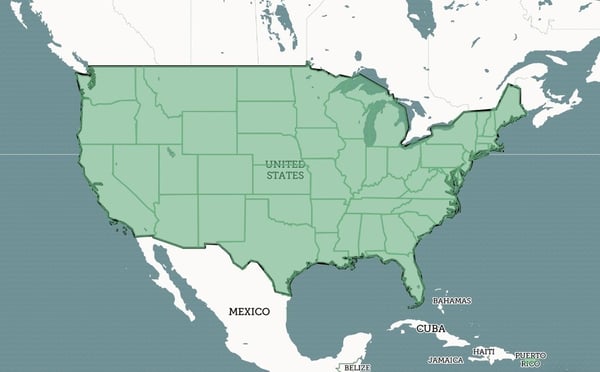
Let’s take a dig through some of the different changes we’ve made to help improve your LandGrid experience.

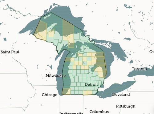
The most noticeable change is that we now have a lighter base color, to improve parcel legibility, as well as making it easier to see at the state level what places are online or not online. This was one of the main bits of feedback we received on our previous basemap, and we’re happy to report we think this really improves the visibility in general. We’ve also improved the city hierarchy on the map to provide a bit more legibility in terms of population size, and also by which cities are shown at different zoom levels.


A map of the counties in Michigan


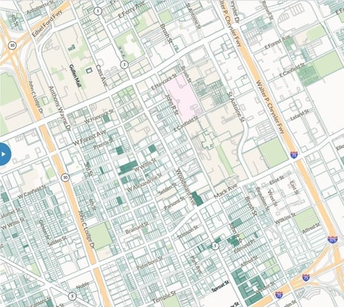
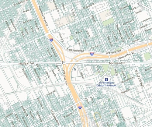
We’ve also changed the color coding of underlying land uses to subtler hues, especially in areas where there’s public lands or forests underneath the parcels. Here’s a side by side example of the same area within Midtown Detroit, using the old and new basemaps.

A parcel map of Detroit


Street base layer in the Regrid Mapping Platform


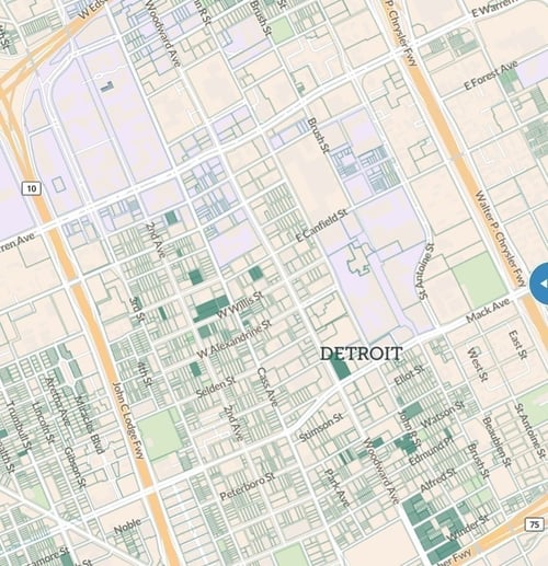
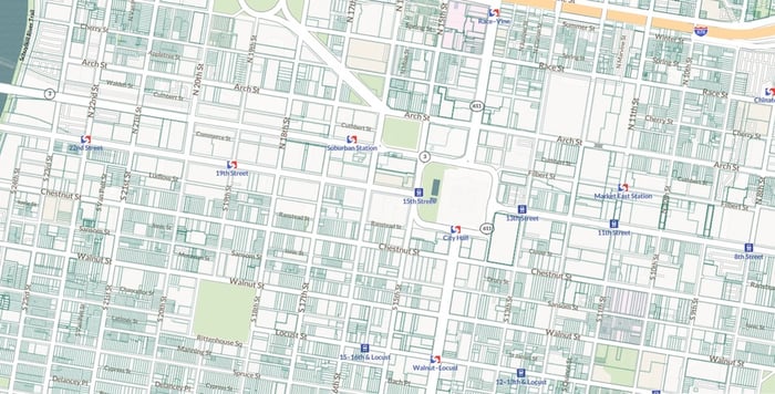
We’ve also updated the base streets layer provided by Mapbox in our map, in order to provide more up to date street names and layouts, in order to keep pace with rapid development in some areas. We’ve also changed the way we visualize highway and expressway icons, and now use the official icons for these types of roads. You can see the difference in these two screenshots from the catch-all boxes we had before.

The Regrid Mapping Platform


Downtown Detroit
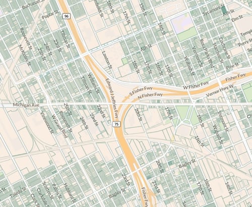
The final big change, and a really exciting one personally, is much better transit wayfinding and icon placement on the map. This includes custom transit icons in certain cities, and better airport icon indicators. Below is an example, using Center City Philadelphia and various SEPTA and trolley stops.

Philadelphia, PA


Parcel maps


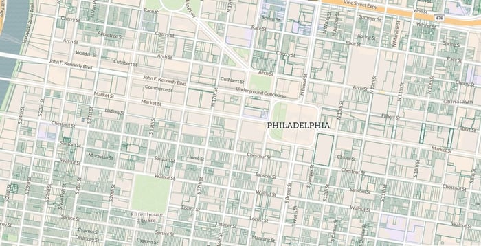
We hope you enjoy the new and improved basemap, happy mapping!

Matthew Klovski

Previous Next
logo

(888) 4RE-GRID

  • Contact Us
  • Customer Support
  • Privacy Policy
  • Terms of Use

Subscribe for email updates

Company

  • About Regrid
  • Careers
  • Press

Resources

  • Coverage Map
  • Support Center
  • Reports
  • Regrid Status Page

Enterprise Solutions

  • U.S. Parcels
  • Canada Parcels
  • Parcel & Tiles API

Self-Serve Solutions

  • Regrid Property App
  • Shop the Data Store
  • API Monthly Plans