×
See Regrid's NEW Roadway ROW Data in Action!
Regrid logo, registered trademark
  • Enterprise

    Regrid premium parcel data menu icon Premium Parcels

    • US Parcel Data U.S. Parcels
    • Canada Parcel Data Canadian Parcels
    • global-icon Global Parcels

    Spatial add-ons menu icon Spatial Add-Ons

    • Matched building footprints menu icon Matched Building Footprints
    • Matched secondary addresses menu icon Matched Secondary Addresses
    • Standardized zoning menu icon Standardized Zoning
    • Enhanced property ownership menu icon Daily Ownership Updates

    road icon Roadway ROW

    • Roadway polygons icon U.S. Roadway Polygons

    Data access icon Data Access

    • data-store-2 Coverage Map
    • blog_resources_icon-1 Parcel Schema
    • Bulk files icon Bulk Files
    • Feature Service Feature Service
    • api-icon_2025 Parcel API & Tiles
    • API Sandbox icon Interactive API Sandbox
  • Data Store
  • Regrid App
  • Esri Users
  • Resources

    Support menu icon Support

    • Support site menu icon Support Site
    • Tutorial videos menu icon Tutorial Videos

    Content menu icon Content

    • Blog menu icon Blog
    • Customer stories menu icon Customer Stories
    • Reports menu icon Reports

    Programs menu icon Programs

    • academia_menu-icon Nonprofit & Academia
    • Regrid giving menu icon Regrid Giving
  • Contact Us
Contact Us
  • Enterprise

    Premium Parcels

    • U.S. Parcels
    • Canadian Parcels
    • Global Parcels

    Roadway ROW

    • U.S. Roadway Polygons

    Spatial Add-Ons

    • Matched Building Footprints
    • Matched Secondary Addresses
    • Standardized Zoning
    • Daily Ownership Updates

    Data Access

    • Coverage Map
    • Parcel Schema
    • Bulk Files
    • Feature Service
    • Parcel API & Tiles
    • Interactive API Sandbox
  • Data Store
  • Regrid App
  • Esri Users
  • Resources

    Support

    • Support Site
    • Tutorial Videos

    Programs

    • Nonprofit & Academia
    • Regrid Giving

    Content

    • Blog
    • Customer Stories
    • Reports
  • Contact Us

The Regrid Blog

Discover the Latest in Land Parcels & Spatial Data with the Regrid Team!

Regrid Blog

Living In The Map

Categories

  • Announcements
  • Parcel Data Updates
  • Democratizing Data
  • Regrid Updates
  • Product How-To
  • Use Cases
  • Customer & Guest Blogs
  • All About Parcel Data
  • Working at Regrid
  • Regrid 100
  • Reports
Regrid Recap - Updates, news, and tools for enhancing your experience.

Regrid Recap | Vol. I - February 2023

Team Regrid February 1, 2023

2023 is off to a solid start! The Regrid Team is busy enhancing our services to empower your business. Here’s a quick look at the progress we’ve made so far this year as well as some new tools and news you can use.

Regrid Named as ‘Global Top 100 Geospatial Companies’


Regrid is thrilled to have been chosen from more than 800 submissions for the second year running! Being acknowledged by the industry for the contribution we make to ensure that our clients benefit fully from our spatial solutions is amazing.

Read the Press Releasemore

Regrid named as Global Top 100 Geospatial company.

The Regrid Property App on all platforms and devices.

NEW & IMPROVED Regrid Property App


Now you can connect with land like never before. Search properties nationwide, follow the places that matter to you and get notified when a change happens.

Try the Regrid Property App


Building A Great Customer Experience in the Data World


Convenience & friendliness are qualities we don’t take for granted - whether you’re downloading counties or a state from our self-serve Data Store or speaking with our helpful sales team about a national license. Regrid is the right choice to help you achieve your business goals with the best land parcel and spatial solutions.


Email the Regrid sales team.


Contact our team at parcels@regrid.com to discuss your data needs.

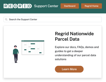
Check Out the New Regrid Support Center

Experience easier navigation, accessibility, and digestible how-to content in the completely refreshed Regrid Support Center.


Take a look

Regrid Product documentation support center.
Data With Purpose webcast with Michigan Geological Survey Data with Purpose Continues to Make a Difference. Watch the Webinar to See How…

Data with Purpose is Regrid’s program for positive change through data access for non profits. 
The Triage Project protects Michigan well water - and we help by delivering the data they need directly into their Esri stack with the Regrid Feature Service.

Click here to watch

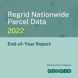
2022 Was A Big Year for Regrid Parcel Data - See Why in our End-of-Year Report


Regrid’s data coverage, currency, and completeness represent the quality we deliver to your organization. 
This report is proof of that.


Take a look

2022 End of Year Parcel Data Report


Regrid is your source for fresh, accurate parcel data and spatial solutions.

If you are interested in learning more about our data and want a sample, 
please email us at parcels@regrid.com. Our land & customer-loving team is here to help you and your business.


Happy Mapping,
Team Regrid

parcels@regrid.com

Regrid logo trademarked


Previous Next
logo

(888) 4RE-GRID

  • Contact Us
  • Customer Support
  • Privacy Policy
  • Terms of Use

Subscribe for email updates

Company

  • About Regrid
  • Careers
  • Press

Resources

  • Coverage Map
  • Support Center
  • Reports
  • Regrid Status Page

Enterprise Solutions

  • U.S. Parcels
  • Canada Parcels
  • Parcel & Tiles API

Self-Serve Solutions

  • Regrid Property App
  • Shop the Data Store
  • API Monthly Plans