×
NEW - Announcing the Esri-compatible Regrid Feature Service
Regrid TM Logo
  • Products

    Data

    • Nationwide Parcel Data Nationwide Parcel Data
    • Parcel API & Tiles Parcel API & Tiles
    • Data Store Data Store
    • Parcels and Matched Building Footprints Parcels + Matched Building Footprints
    • addresses-menu-icon Parcels + Matched Secondary Addresses

    Mapping Tools

    • Self-Serve Plans Self-Serve Plans
    • Mapping Tools Mapping Tools
    • Mobile App Mobile App
  • Use-Cases

    • featureservice-menuicon Feature Service
    • renewables-usecase Renewable Energy
    • datascience-usecase Data Science
    • support-site_nav-1 Land Use Codes
    • blog_nav Vacancy
  • Resources

    Content

    • Regrid Blog Blog
    • Coverage Map Coverage Map
    • Reports Reports
    • Webcasts Webcasts

    Support

    • Support Site Support Site
    • Platform FAQ Platform FAQ
    • Parcel Data FAQ Parcel Data FAQ
    • Tutorial Videos Tutorial Videos

    Customers

    • Customer Stories Customer Stories
    • Case Studies Case Studies
    • Data with purpose logo Data With Purpose
Go to Map
  • Products

    Data

    • Nationwide Parcel Data Nationwide Parcel Data
    • Parcel API & Tiles Parcel API & Tiles
    • Data Store Data Store
    • Parcels and Matched Building Footprints Parcels + Matched Building Footprints
    • addresses-menu-icon Parcels + Matched Secondary Addresses

    Mapping Tools

    • Self-Serve Plans Self-Serve Plans
    • Mapping Tools Mapping Tools
    • Mobile App Mobile App
  • Use-Cases

    • featureservice-menuicon Feature Service
    • renewables-usecase Renewable Energy
    • datascience-usecase Data Science
    • support-site_nav-1 Land Use Codes
    • blog_nav Vacancy
  • Resources

    Content

    • Regrid Blog Blog
    • Coverage Map Coverage Map
    • Reports Reports
    • Webcasts Webcasts

    Support

    • Support Site Support Site
    • Platform FAQ Platform FAQ
    • Parcel Data FAQ Parcel Data FAQ
    • Tutorial Videos Tutorial Videos

    Customers

    • Customer Stories Customer Stories
    • Case Studies Case Studies
    • Data with purpose logo Data With Purpose

Regrid Reports

Check out the official reports on customer property survey and data analyses projects using the Regrid Parcel Data

Check out our videos

Customer Stories

Categories

  • Reports

Partial Deconstruction

Larry Sheradon April 29, 2019

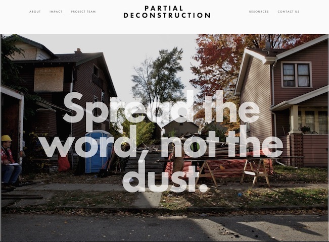
The Partial Deconstruction Pilot Project was staged to measure the economic and environmental impacts of building removal within neighborhoods where people and blight exist side by side. The Partial Deconstruction team purchased ten vacant, blighted houses through the local Wayne County Tax Foreclosure Auction in order to remove nuisances from the neighborhood using demolition and deconstruction tactics. Through an unlikely collaboration, they deployed geologists, demolition contractors, futurists, deconstruction work crews and time / motion studies in our quest to understand and measure the building removal process.


Partial Deconstruction Pilot Project


From the Report

At present in the United States, lead testing and abatement are not required as part of the residential demolition process. This needs to change. Whether building removal is motivated by the demands of a strong real estate market or by efforts to stabilize vacancy, people living nearby are vulnerable to the hazards of demolition. 

The How

The Partial Deconstruction Pilot Project was staged on ten sites located within one neighborhood in Detroit. We pushed against the 'all or nothing' approach to deconstruction, testing a hybrid model of working to understand the outcomes that might emerge. 


Measuring

What, we asked, happens when you remove excess inventory from the system? Can we salvage anything of value from damaged and neglected houses? How will building removal activities affect the safety, health, and comfort of those living nearby? Our team intervened in the physical fabric of a neighborhood to begin to find answers to these questions. We focused our efforts on ten residential structures located in one Southwest Detroit neighborhood. 


The overall aim was to quantify the value of deconstruction on physically compromised buildings and examine how these activities might contribute to the ambient dispersal of lead (Pb) and other heavy metals. 


Each of the ten houses in this study had cycled through the Wayne County Tax Auction. Like many properties emerging from the auction through Detroit's local tax foreclosure process, they had been damaged by fire, water, and an overall lapse of maintenance. 

Previous Next
logo

help@regrid.com

(888) 4RE-GRID

440 Burroughs St, Suite 672 Detroit, MI 48202

Sign up for our email newsletter:

Regrid is a creation of Loveland Technologies and was formerly known as Landgrid

Company

  • About Us
  • Careers
  • Why Regrid?
  • Press

Resources

  • Blog
  • Tutorial Videos
  • Reports
  • Coverage Map

Customers

  • Customer Stories
  • Case Studies
  • Data With Purpose

Support

  • Guidebook
  • Parcel Data FAQ
  • Platform FAQ
  • Contact Us
  • Site Status

Products

  • Nationwide Parcel Data
  • Data Store
  • Parcel API & Tiles
  • Mapping Tools
  • Mobile App
  • Plans & Pricing
  • Matched Building Footprints