Regrid logo, registered trademark
  • Enterprise Solutions

    Regrid parcel data Regrid Parcel Data

    Bulk files delivered in the format your business needs.

    • parcel -data Nationwide Parcel Data
    • matched building footprints menu icon Matched Building Footprints
    • matched secondary addresses menu icon Matched Secondary Addresses
    • enhanced ownership menu icon Enhanced Ownership

    feature service menu icon Regrid Feature Service

    Get data delivery straight into your Esri-stack, no custom integration required.

    regrid api menu icon Regrid API

    Integrate parcel boundaries & records into your app, SaaS, or map.
    • Parcel and Tiles APIcon Parcel & Tiles API
    • typeahead api icon Typeahead API
  • Self Serve Options

    Regrid Property App menu icon Regrid Property App

    Take Regrid property data wherever you go - available for web, iOS, & Android.

    data-store-2 Shop the Data Store

    Instantly download parcel geometries & associated records, by county and state.

    self-serve parcel api menu icon API Monthly Subscriptions

    Sign up and try this nationwide parcel API, free for 7 days.

    api sandbox icon Interactive API Sandbox

    Explore the API Sandbox with complete feature access to 7 counties plus Puerto Rico.
  • Markets

    Regrid for Broadband Market Broadband

    Regrid for data science Data Science

    Parcel data for green initiatives Sustainable Initiatives

    Parcel data for real estate Real Estate

    Parcel data for nonprofit and academia Nonprofit & Academia

    Regrid's Data With Purpose program - propose your own budget to access land parcel data. 

    Plus sign icon Your Business or Organization

    Regrid’s data spans all industries needing land insight.
  • Resources

    support menu icon Support

    Access documentation & support materials to learn about Regrid data.
    • Support site resource icon Support Site
    • tutorial videos resources icon Tutorial Videos
    • parcel data faqs resources icon Parcel Data FAQs
    • property app faqs Property App FAQs
    • coveragemap_resources_icon Coverage Map
    • land use codes menu item Land Use Codes
    • vacancy data menu icon Vacancy Data

    content resources menu icon Content

    Dive into Regrid's world of land parcels & learn about location intelligence.
    • blog resources icon Blog
    • webcasts resources icon Webcasts
    • reports resources icon Reports
    • podcast resources icon Living In The Map

    customers resources icon Customers

    Hear what our customers say have to say & see how they use Regrid data.
    • testimonials resources icon Testimonials
    • Case Studies resources icon Case Studies
  • Contact Us

    Contact a parcel data expert menu icon Contact A Parcel Data Expert

    Contact Regrid parcel data experts to learn more about our offerings.

    Customer Support menu icon Customer Support

    Contact our customer support team & get the help you need.

    megamenu nav image Press & Media Inquires

    Find the information you need & get in touch with our marketing department.
  • Go To Map
Go To Map
  • Enterprise Solutions

    Regrid Parcel Data

    • Nationwide Parcel Data
    • Matched Building Footprints
    • Matched Secondary Addresses
    • Enhanced Ownership

    Regrid Feature Service

    Regrid API

    • Parcel & Tiles API
    • Typeahead API
  • Self Serve Options

    Regrid Property App

    Shop the Data Store

    API Monthly Subscriptions

    Interactive API Sandbox

  • Markets

    Broadband

    Data Science

    Sustainable Initiatives

    Real Estate

    Nonprofit & Academia

    Your Business or Organization

  • Resources

    Support

    • Support Site
    • Tutorial Videos
    • Parcel Data FAQs
    • Property App FAQs
    • Coverage Map
    • Land Use Codes
    • Vacancy Data

    Content

    • Blog
    • Webcasts
    • Reports
    • Living In The Map

    Customers

    • Testimonials
    • Case Studies
  • Contact Us

    Contact A Parcel Data Expert

    Customer Support

    Press & Media Inquires

  • Go To Map

Regrid Reports

Check out the official reports on customer property survey and data analyses projects using the Regrid Parcel Data

Regrid Blog

Living In The Map

Categories

  • Reports
Neighbor to Neighbor illustration of a surveyor talking to a homeowner

Neighbor to Neighbor: Detroit Property Tax Foreclosure Census

Larry Sheradon May 2, 2019

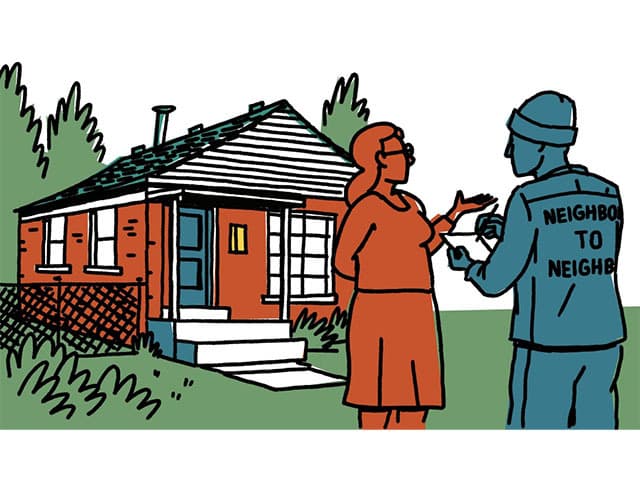
The Quicken Loans Community Fund, in partnership with the United Community Housing Coalition, sent teams of more than 400 Detroiters to visit every home at risk of tax foreclosure in the city of Detroit - 60,000 households. At each house, surveyors distributed foreclosure prevention information and gathered data using the Loveland survey app.


In 2013, the Obama administration convened the Detroit Blight Removal Task Force to chart a course to eliminate blight in Detroit. Co-chaired by Dan Gilbert, founder and Chairman of Quicken Loans, the Task Force first sought to understand the extent of blight in the city. To do so, it commissioned a project called Motor City Mapping. The effort brought together hundreds of Detroit residents, Quicken Loans team members, and other resources from the Quicken Loans Family of Companies and local tech firms, Loveland Technologies and Data-Driven Detroit, to evaluate the condition of all 385,000 properties in Detroit. 


At the conclusion of the project, the Task Force issued a report that contained this warning about tax foreclosure in Detroit. 


"Without intervention, county tax foreclosure will continue to sweep across the city until the inventory of foreclosable properties is exhausted. Speculators will buy cheap property and allow it to deteriorate. Despairing and frustrated residents will continue to walk away from their tax-foreclosed homes and from Detroit. Unscrupulous landlords will evict tenants and scrap their own properties. [...] Even the swiftest and most aggressive fight again today's blight will accomplish very little if we don't address the conditions that led to it."


In recent years, the Quicken Loans Community Fund has taken unprecedented steps to research and address the human cost of the tax foreclosure system. The report [below] is the product of an unprecedented community-led tax foreclosure prevention effort called Neighbor to Neighbor, a project inspired by the legacy and mission of Motor City Mapping.


Read the Report

Previous Next
logo

(888) 4RE-GRID

  • Contact Us
  • Customer Support

Subscribe for email updates

Company

  • About Regrid
  • Careers
  • Press

Resources

  • Coverage Map
  • Support Center
  • Reports

Support

  • Parcel Data FAQs
  • Property App FAQs
  • Contact Support Team

Customers

  • Customer Stories
  • Case Studies
  • Non Profit & Academia

Enterprise Solutions

  • Nationwide Land Parcels
  • Parcel & Tiles API
  • Feature Service

Self-Serve Solutions

  • Regrid Property App
  • Shop the Data Store
  • API Monthly Plans