Introducing - Regrid parcel data in Kalibrate Location Intelligence
April 20, 2022
Discover the Latest in Land Parcels & Spatial Data with the Regrid Team!

This has been reposted from our parcel API & tiles customer Kalibrate.
Based on customer demand, we’re delighted to reveal our partnership with Regrid to provide parcel data for use in Kalibrate Location Intelligence.
The dataset covers over 120 parcel variables and over 152m parcels, representing 99% of the US population. The dataset is regularly updated, so you’re always working with the most current market insight. The Regrid parcel data is licensed as an optional module in KLI and is priced per user. Please contact your account manager for a detailed demonstration and for pricing information.
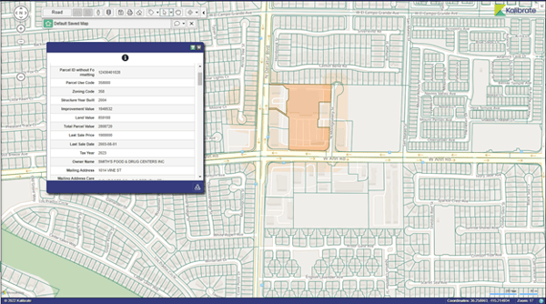
 Sample parcel map and property details from Kalibrate Location Intelligence
Have questions? Want to evaluate our dataset or get a free data sample? Get in touch with our team at parcels@regrid.com.
Learn more about our Nationwide Parcel Data, our schema, pricing and coverage here.
Regrid is an industry-leading property data and location intelligence company. We serve an array of industries that require land parcels and spatial data at scale, including real estate, insurance, energy, infrastructure, agriculture, logistics, and government.