


.png)


.svg)


.png)
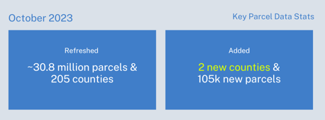
October 2023 Parcel Data Update
A detail of updates in September of 2023 and a preview of the upcoming counties in our pipeline is below.
Parcel Schema Changes in October - We have extensive additional information on the fields below coming out over the next two months on our blog. Please see https://regrid.com/blog/schema-changes-2023 for a detailed discussion of these changes. That post has been updated and will be updated again toward the actual roll out. A summary of the changes is below.
While the final names are still subject to change, these are the columns we will be adding to both our Standard and Premium datasets:
-
state_parcelnumb - The parcel number used by the state
-
account_number - The assessor/tax collector's account number associated with the parcel
-
tax_id - The assessor/tax collector's tax id number
-
census_zcta - The US Census Bureau's Zip Code Tabulation Area zip code
-
previous_owner - The previous parcel owner, seller or grantor where available
-
numrooms - The number of rooms associated with the parcel as tracked by the assessor
-
szip5 - The USPS 5 digit zip code
The following columns are being added to our Premium dataset only:
-
census_elementary_school_district - US Census listed elementary school district
-
census_secondary_school_district - US Census listed secondary school district
-
census_unified_school_district - US Census listed unified school district
-
fema_flood_zone - FEMA Flood Zone Type
-
fema_flood_zone_subtype - FEMA Flood Zone Subtype
-
fema_flood_zone_raw - FEMA Flood Zone full raw data
-
fema_flood_zone_data_date - The FEMA effective date of the flood zone data
We will be removing the following columns from both our Standard and Premium datasets. These columns were identified as redundant with other columns or being of low utility, and all have very low fill rates:
-
sourceagent
-
multistruct
-
subsurfown
-
subowntype
-
sourceref
-
sourcedate
New Export Format - We are now exporting our premium dataset as EWKB csv files. These are primarily used for importing into AWS Redshift.
Past Data Update Emails - The full archive of our monthly data update emails can be found on our main website: https://regrid.com/blog/tag/parcel-data-updates
Coverage Report - Updated for this month and available here.
A machine-readable version of this list is included in the `verse` table available in all the formats above as well as CSV format for use in spreadsheets. To find the latest updates in verse, sort by 'last_refresh' and use the 'filename_stem' column to identify the file.
Data refreshed or added from the county in September and live now: (Asterisk * indicates newly added county)
AK - North Slope Borough
AL - Baldwin, Madison
AR - Pulaski
AZ - Graham, Maricopa, Mohave, Pima, Pinal, Yavapai
CA - Alameda, Fresno, Santa Cruz, Tehama, Tulare
CO - Adams, Arapahoe, Boulder, Broomfield, Crowley*, Denver, Douglas, Elbert, Hinsdale*, Jefferson, Larimer, Mesa, Rio Blanco
CT - Capitol Planning Region
DE - Kent
FL - Broward, Hillsborough, Lee, Orange, Sarasota, Volusia
GA - Clayton, DeKalb, Forsyth, Fulton, Gwinnett, Richmond
HI - Honolulu
IA - Linn
ID - Ada, Bannock
IL - Lake, McHenry
IN - Hamilton, Lake, Marion
KS - Douglas, Saline, Sedgwick, Shawnee
LA - Lafayette, Orleans, St. Helena*, Tangipahoa
MD - Anne Arundel, Baltimore City, Carroll, Cecil, Charles, Dorchester, Garrett, Harford, Howard, St. Mary's, Talbot, Wicomico
MI - Charlevoix, Eaton, Ionia, Montcalm, Oakland
MN - Anoka, Carlton, Dakota, Ramsey, Washington
MO - Franklin, Greene, Jackson, Jefferson, Pettis
MS - DeSoto, Forrest
NC - Brunswick, Buncombe, Carteret, Forsyth, Granville, Guilford, Mecklenburg, Wake
ND - Williams
NE - Hall, Lancaster
NJ - Monmouth
NM - Valencia
NV - Douglas, Nye, Washoe
NY - Erie, Ulster, Washington
OH - Allen, Ashland, Ashtabula, Auglaize, Belmont, Brown, Butler, Clark, Clermont, Clinton, Columbiana, Coshocton, Defiance, Delaware, Fairfield, Franklin, Gallia, Greene, Guernsey, Holmes, Jefferson, Knox, Lake, Licking, Logan, Lorain, Mahoning, Marion, Medina, Miami, Montgomery, Morrow, Muskingum, Ottawa, Perry, Pickaway, Portage, Preble, Putnam, Ross, Scioto, Seneca, Shelby, Stark, Summit, Tuscarawas, Union, Wayne, Williams
OK - Caddo
OR - Deschutes, Lane, Marion, Multnomah
PA - Berks, Bradford, Bucks, Butler, Cambria, Carbon, Chester, Clinton, Dauphin, Erie, Lehigh, Monroe, Montgomery, Northampton, Philadelphia, Westmoreland, York
SC - Anderson, Beaufort, Berkeley, Charleston, Colleton, Georgetown, Greenville, Greenwood, Horry, Laurens, Lexington, Newberry, Oconee, Orangeburg, Pickens, Richland, York
SD - Aurora, Beadle, Bennett, Bon Homme, Brule, Buffalo, Butte, Campbell, Clark, Codington, Davison, Day, Deuel, Edmunds, Faulk, Grant, Hanson, Hutchinson, Lawrence, Lyman, Marshall, McPherson, Mellette
TN - Anderson, Bedford, Benton, Bledsoe, Blount, Bradley, Campbell, Cannon, Carroll, Cheatham, Claiborne, Clay, Cocke, Coffee, Crockett, Cumberland, Davidson, Decatur, DeKalb, Dickson, Dyer, Fayette, Fentress, Franklin, Gibson, Giles, Grainger, Greene, Grundy, Hamblen, Hamilton, Hancock, Hardeman, Hardin, Hawkins, Haywood, Henderson, Henry, Houston, Humphreys, Jackson, Jefferson, Johnson, Knox, Lake, Lauderdale, Lawrence, Lewis, Lincoln, Loudon, Macon, Madison, Marion, Marshall, Maury, McMinn, McNairy, Meigs, Monroe, Moore, Morgan, Obion, Overton, Perry, Pickett, Polk, Putnam, Rhea, Roane, Robertson, Rutherford, Sequatchie, Sevier, Smith, Sullivan, Tipton, Trousdale, Union, Van Buren, Warren, Washington, Wayne, Weakley, White, Wilson
TX - Aransas, Armstrong, Atascosa, Austin, Bailey, Baylor, Bell, Brazoria, Brewster, Brooks, Calhoun, Camp, Castro, Childress, Clay, Collingsworth, Comal, Denton, DeWitt, Edwards, Falls, Fisher, Galveston, Hamilton, Hartley, Henderson, Houston, Howard, Jeff Davis, Johnson, Karnes, Kendall, Lamb, Liberty, Loving, Lubbock, Lynn, Martin, Menard, Morris, Nueces, Potter, Refugio, Smith, Stephens, Sterling, Williamson
UT - Davis, Duchesne, Utah, Weber
VA - Bedford, Chesterfield, Hampton, Henrico, Mecklenburg, Pittsylvania, Shenandoah, Smyth, Suffolk
WA - Clark, Columbia, King, Pacific, San Juan, Snohomish, Thurston, Whatcom
WI - Columbia, Milwaukee
In the current pipeline for updating in October 2023:
Kansas
Oklahoma
In the pipeline for updating in November 2023:
Alabama
Georgia
South Carolina
Virginia
Based on feedback and county challenges, pipeline planning is always subject to change. As always, please contact us if you have any questions about accessing or using the data, if you find issues with any of our data, or you have any comments or questions about our data in specific areas or states. We also love to hear from you about which counties or regions you'd like to see us update next, as it helps inform our planning process.
Thank you for being a part of Regrid!
Best Wishes,
The Regrid Data Team
tech@regrid.com
