Regrid logo, registered trademark
  • Enterprise Solutions

    Regrid parcel data Regrid Parcel Data

    Bulk files delivered in the format your business needs.

    • parcel -data Nationwide Parcel Data
    • matched building footprints menu icon Matched Building Footprints
    • matched secondary addresses menu icon Matched Secondary Addresses
    • enhanced ownership menu icon Enhanced Ownership

    feature service menu icon Regrid Feature Service

    Get data delivery straight into your Esri-stack, no custom integration required.

    regrid api menu icon Regrid API

    Integrate parcel boundaries & records into your app, SaaS, or map.
    • Parcel and Tiles APIcon Parcel & Tiles API
    • typeahead api icon Typeahead API
  • Self Serve Options

    Regrid Property App menu icon Regrid Property App

    Take Regrid property data wherever you go - available for web, iOS, & Android.

    data-store-2 Shop the Data Store

    Instantly download parcel geometries & associated records, by county and state.

    self-serve parcel api menu icon API Monthly Subscriptions

    Sign up and try this nationwide parcel API, free for 7 days.

    api sandbox icon Interactive API Sandbox

    Explore the API Sandbox with complete feature access to 7 counties plus Puerto Rico.
  • Markets

    Regrid for Broadband Market Broadband

    Regrid for data science Data Science

    Parcel data for green initiatives Sustainable Initiatives

    Parcel data for real estate Real Estate

    Parcel data for nonprofit and academia Nonprofit & Academia

    Regrid's Data With Purpose program - propose your own budget to access land parcel data. 

    Plus sign icon Your Business or Organization

    Regrid’s data spans all industries needing land insight.
  • Resources

    support menu icon Support

    Access documentation & support materials to learn about Regrid data.
    • Support site resource icon Support Site
    • tutorial videos resources icon Tutorial Videos
    • parcel data faqs resources icon Parcel Data FAQs
    • property app faqs Property App FAQs
    • coveragemap_resources_icon Coverage Map
    • land use codes menu item Land Use Codes
    • vacancy data menu icon Vacancy Data

    content resources menu icon Content

    Dive into Regrid's world of land parcels & learn about location intelligence.
    • blog resources icon Blog
    • webcasts resources icon Webcasts
    • reports resources icon Reports
    • podcast resources icon Living In The Map

    customers resources icon Customers

    Hear what our customers say have to say & see how they use Regrid data.
    • testimonials resources icon Testimonials
    • Case Studies resources icon Case Studies
  • Contact Us

    Contact a parcel data expert menu icon Contact A Parcel Data Expert

    Contact Regrid parcel data experts to learn more about our offerings.

    Customer Support menu icon Customer Support

    Contact our customer support team & get the help you need.

    megamenu nav image Press & Media Inquires

    Find the information you need & get in touch with our marketing department.
  • Go To Map
Go To Map
  • Enterprise Solutions

    Regrid Parcel Data

    • Nationwide Parcel Data
    • Matched Building Footprints
    • Matched Secondary Addresses
    • Enhanced Ownership

    Regrid Feature Service

    Regrid API

    • Parcel & Tiles API
    • Typeahead API
  • Self Serve Options

    Regrid Property App

    Shop the Data Store

    API Monthly Subscriptions

    Interactive API Sandbox

  • Markets

    Broadband

    Data Science

    Sustainable Initiatives

    Real Estate

    Nonprofit & Academia

    Your Business or Organization

  • Resources

    Support

    • Support Site
    • Tutorial Videos
    • Parcel Data FAQs
    • Property App FAQs
    • Coverage Map
    • Land Use Codes
    • Vacancy Data

    Content

    • Blog
    • Webcasts
    • Reports
    • Living In The Map

    Customers

    • Testimonials
    • Case Studies
  • Contact Us

    Contact A Parcel Data Expert

    Customer Support

    Press & Media Inquires

  • Go To Map

The Regrid Blog

Discover the Latest in Land Parcels & Spatial Data with the Regrid Team!

Regrid Blog

Living In The Map

Categories

  • Announcements
  • Democratizing Data
  • Regrid Updates
  • Parcel Data Updates
  • Product How-To
  • Use Cases
  • Customer & Guest Blogs
  • All About Parcel Data
  • Working at Regrid
Reflections and photos from the Esri User Conference

Reflections and Photos from the Esri User Conference

Jerry Paffendorf July 27, 2022

This post is a photo gallery of sights from the event mixed with memories and observations by Regrid CEO, Jerry Paffendorf.

You can follow Regrid on LinkedIn, Twitter, Facebook, and Instagram. Get in touch to discuss our land parcel products for your maps, apps, and spatial analysis.


A sign in the style of a large postcard that reads 'Greetings from San Diego - Esri User Conference 2022'


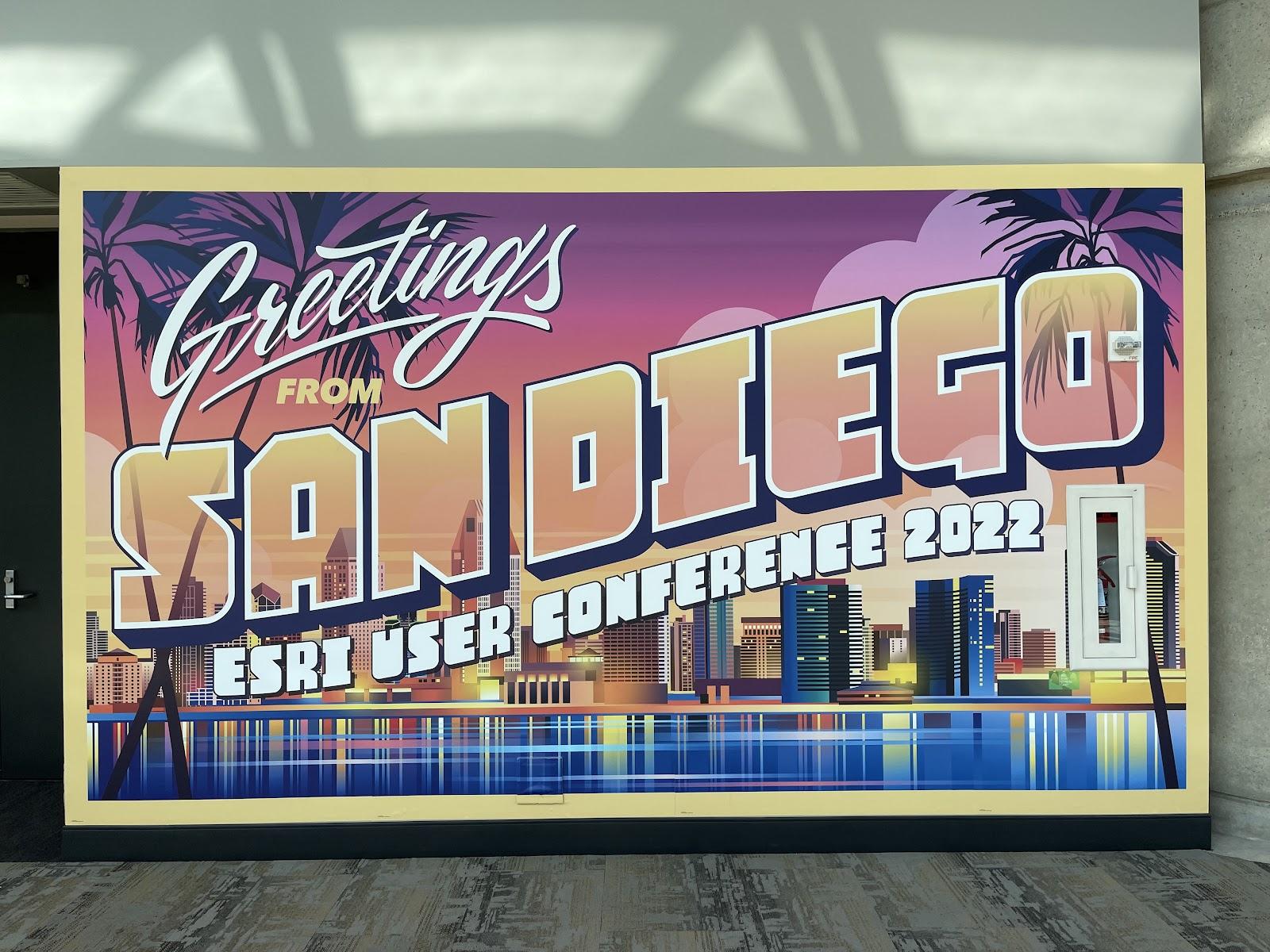
Earlier this month some Regrid teammates and I attended the big Esri User Conference in San Diego.


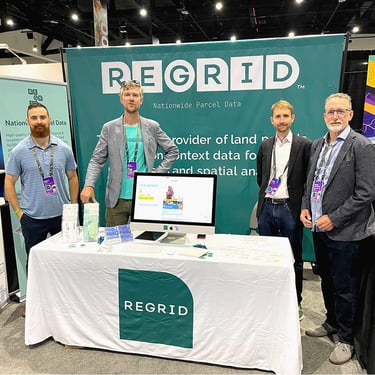
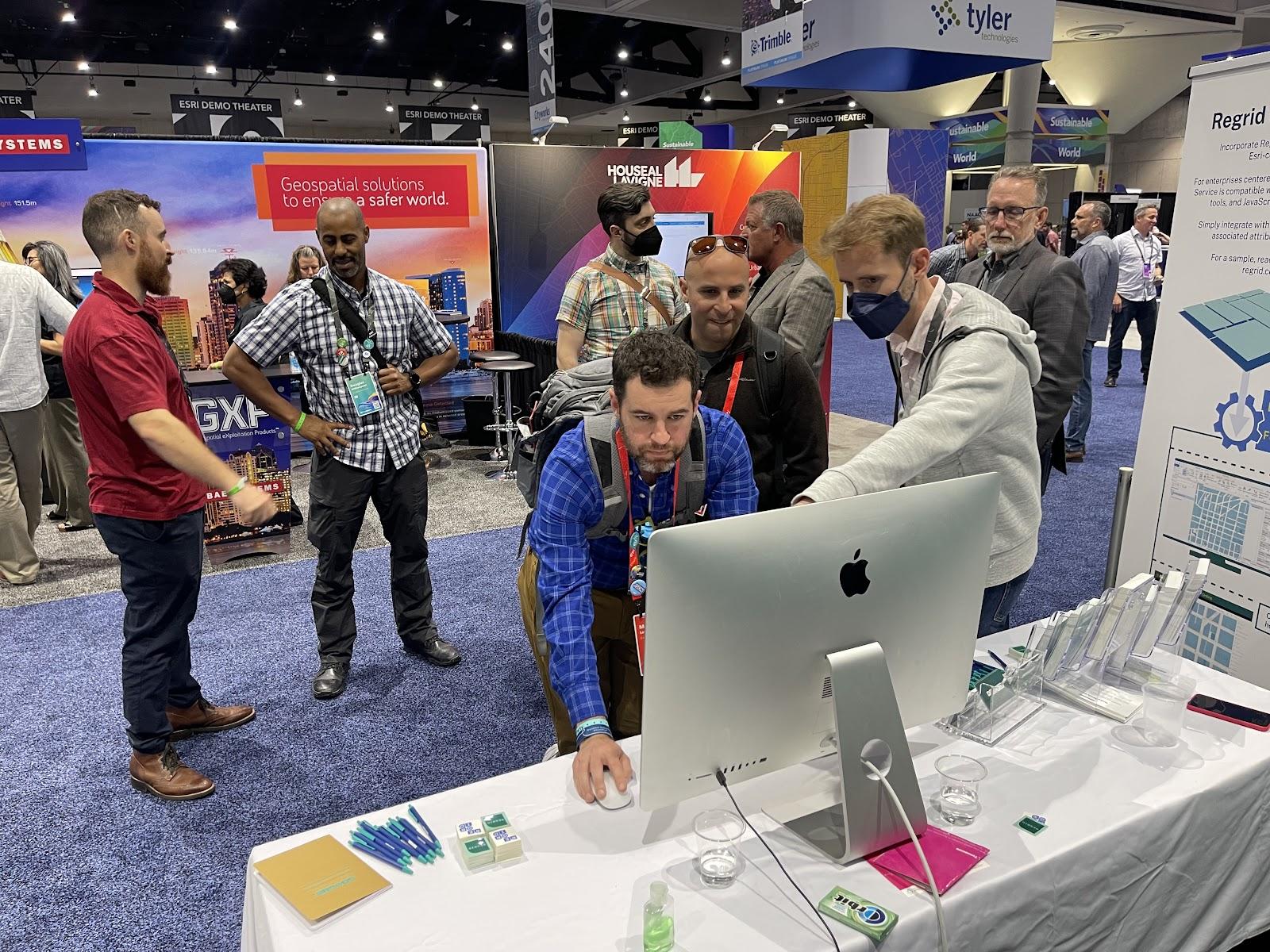
We had a booth to showcase our new Regrid Feature Service, making it simple to stream our land parcel data into Esri software products.


Here we are posing for our other 26 teammates back home on Slack:


The Regrid Team stands around the Regrid booth at the Esri UC 2022


Like a lot of people, this was our first big in-person conference since 2020, and some of us hadn’t met in person yet, so it was a big deal on a few levels: travel, product, team, and networking. 


First views out of an airplane in a long, long time:


The view from Jerry's plan on the way to San Diego - blue skies, a bright sun, and lots of little clouds along the bottom of the screen.


It was also my first time at an Esri User Conference so I was excited to see what it was all about. Founded in 1969 as a land use consultancy, and independently growing into the world’s largest geographic software company, I find Esri fascinating and inspiring.


For a long time I’ve appreciated this quote from Esri founder, Jack Dangermond:

“I don't understand why young entrepreneurs feel this pressure to take venture capital or go public. Don't get me wrong: Public companies are A-OK with me. I just think there is another way.”

As soon as I walked out of my hotel the night before the event, I found myself walking down the same street as none other than Jack Dangermond. This felt like an auspicious way to begin an Esri event, like spotting a bald eagle flying over a rainbow while clutching a four-leaf clover. 


At the risk of being 'that guy,' I jogged up to Jack and quickly introduced myself by saying, “Hi Jack, I know you’re the busiest person in San Diego right now, but wanted to say hi and thank you. Jerry from Regrid; nationwide parcel data. Have a great show.” 


I asked him if he was shaking hands, and he said 'air handshakes,' so we grinned and chopped the air near each other for a moment. A nice start to the event, and a delightful way to 'meet' Jack in my book.


Flash forward to the next morning and I sat in the audience as Jack welcomed the 15,000 attendees with a 2-hour-plus presentation about Esri and 'the geographic perspective,' and this year’s theme of 'mapping common ground,' interspersed with demos and guests.


A photo of Jack Dangermond at the Esri UC Plenary 2022 Slides from a presentation at the Esri UC Plenary


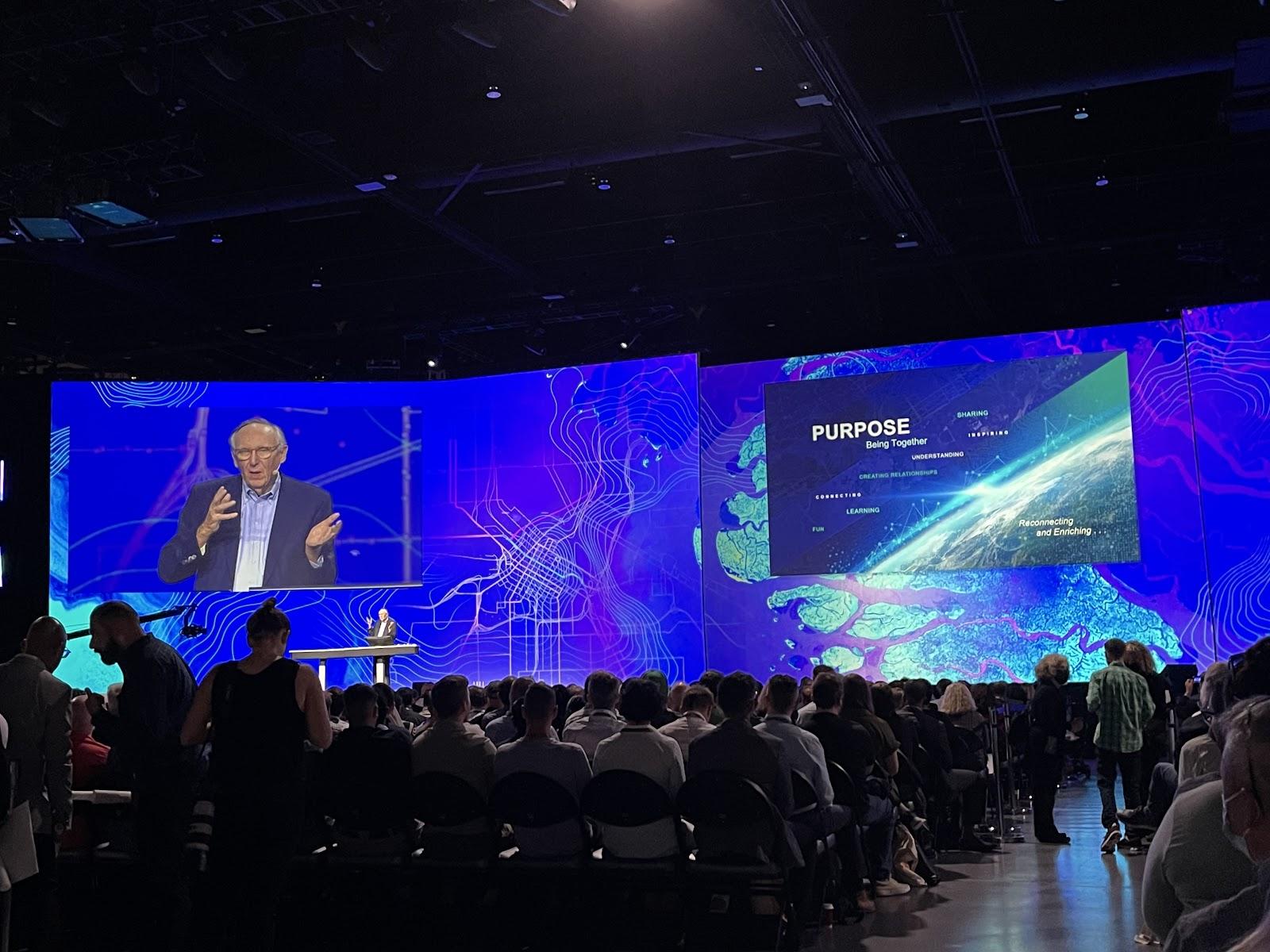
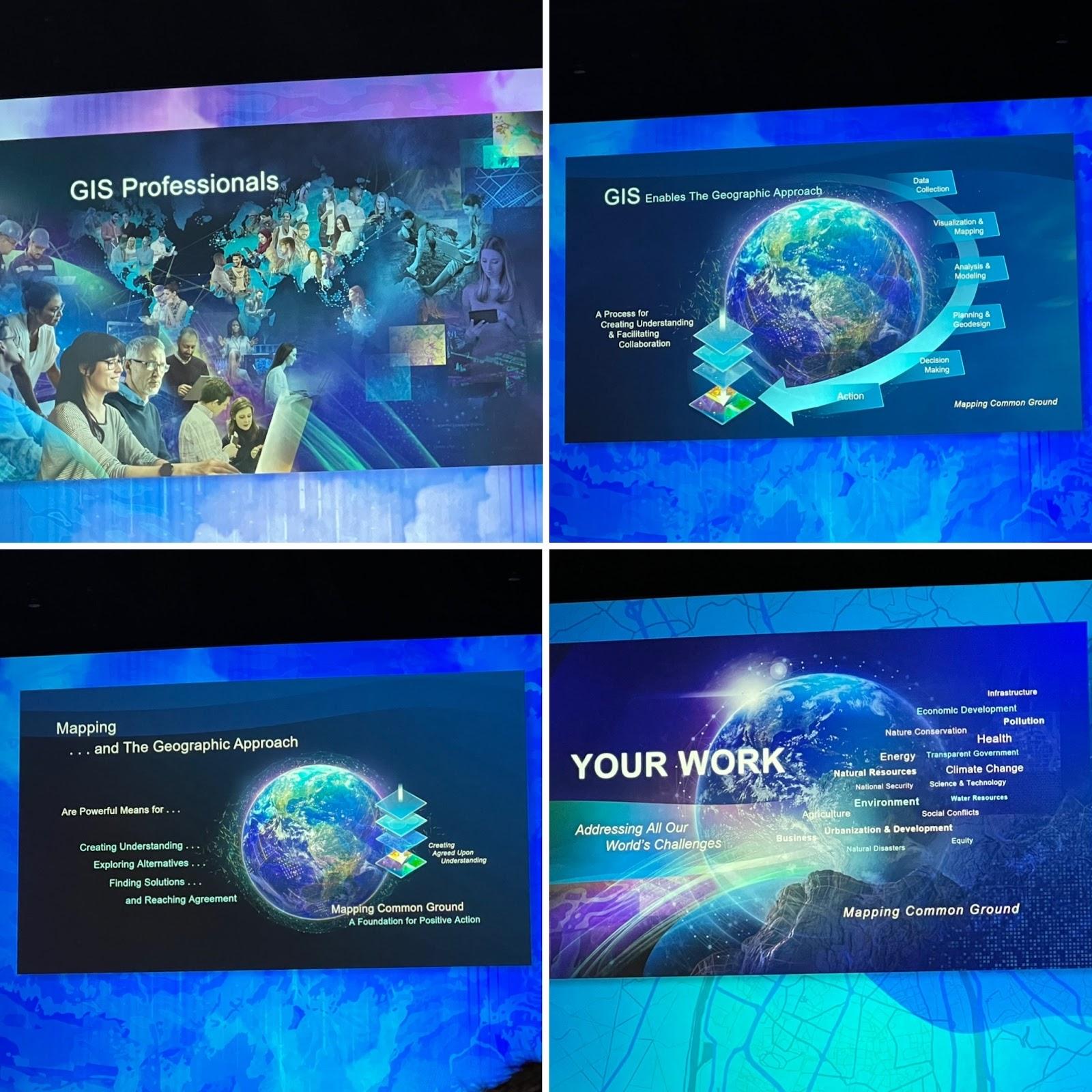
I’m impressed by how Esri maintains such a big tent of products, projects, and perspectives, all held together by the theme of “the geographic perspective.” 


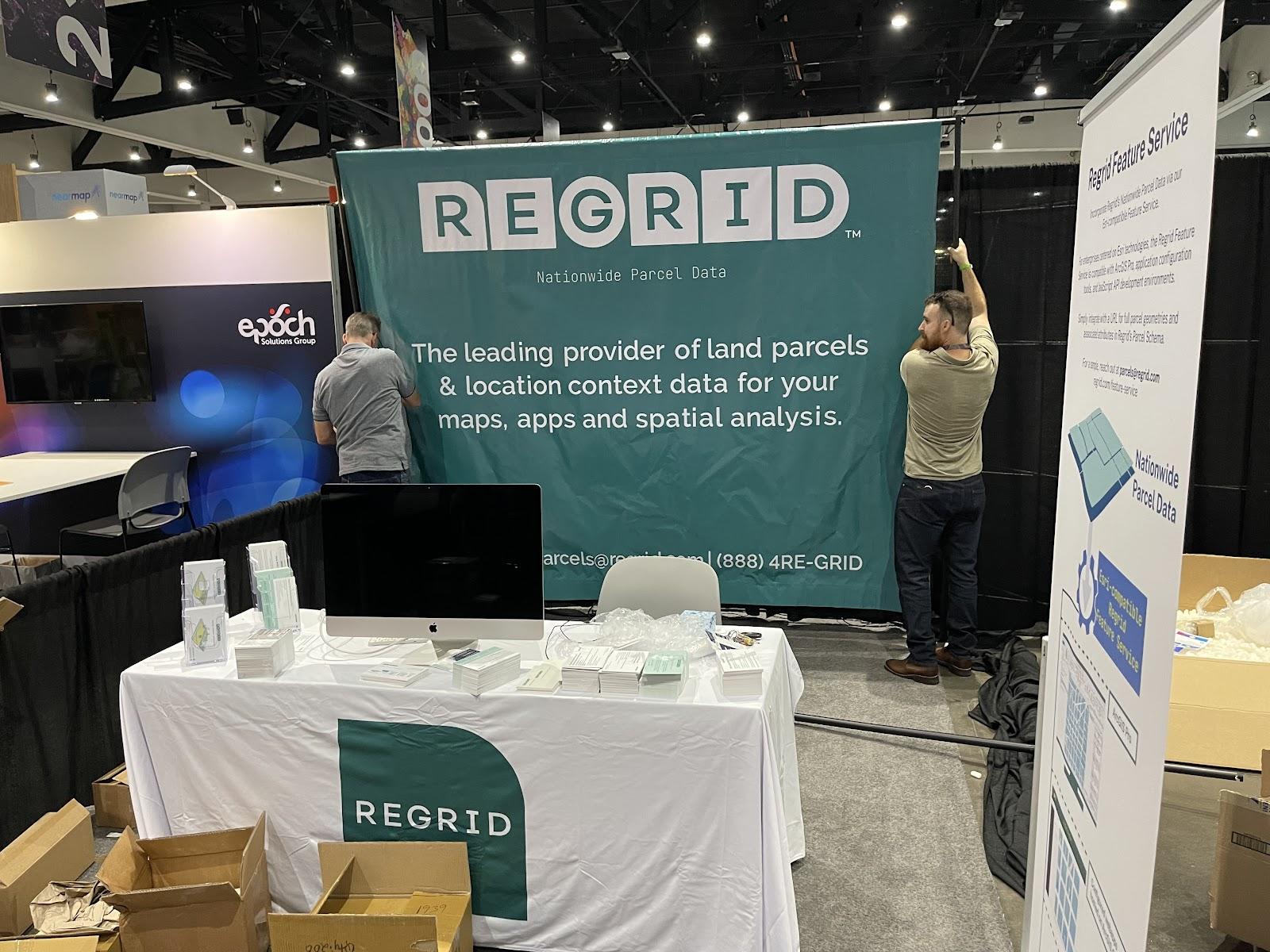
After that, it was booth setup time with my colleagues Roman Kahler (Solutions Engineer) and Steve Stautzenbach (Chief Revenue Officer). 


Ah, the simple joy of assembling a conference booth. At once common, and, these days, somehow novel and exotic.


Regrid's Steve S. and Matt H. set up our booth at the Esri UC 2022


The next morning we were joined by our colleagues Matt Hampel (Chief Data Officer) and Steve Kendall (VP of Partnerships), and the exhibit hall doors were thrown open to unleash a flood of geographic professionals and enthusiasts. 


The Regrid Team gathered around our booth and ready to meet potential customers


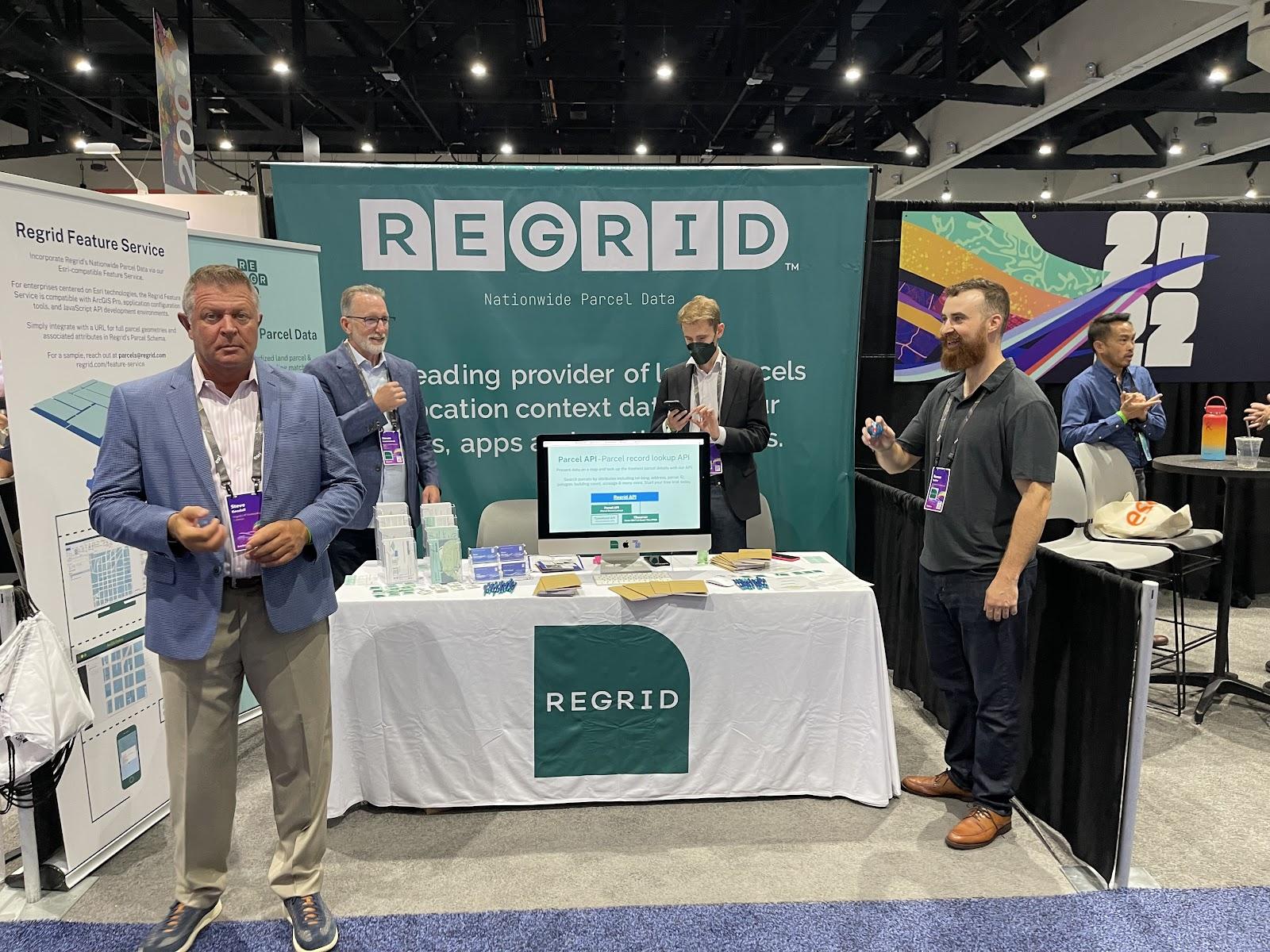
I gotta say it felt great. We pride ourselves on being the most accessible provider of the highest-quality land parcel data, and the vibe of the booth, the team, and the reception we got bore that out. It was nonstop productive conversations about land parcel data, how people use it, and how Regrid helps people use it more effectively.


Matt Hampel shows Regrid's nationwide data to attendees at the Esri event.  A busy Regrid booth at the esri UC


Even birds were coming by to check things out – I couldn’t believe this short video clip I captured coming into the conference:

I watched this bird alight on an Esri User Conference attendee’s backpack, stay there until it got inside, and then fly back out when it realized it needed a wrist band. Thank you for observing protocols, bird! 🙏 🐦 #esri #esriuc #esriuc2022 pic.twitter.com/VFkyke4IY8

— Jerry Paffendorf (@WELLO) July 13, 2022


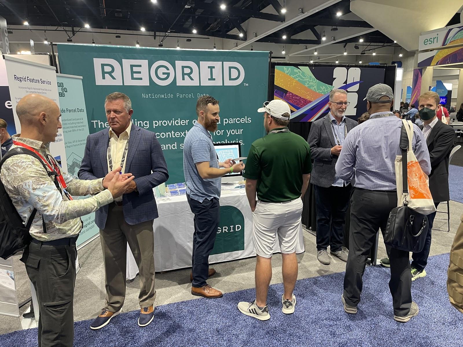
Person after person and group after group came by to say hello, see what we offered, demo the Feature Service, and make connections. Conversation after conversation, it was energizing.


We met with existing customers, soon-to-be customers, partners, Esri staff, county parcel managers, and a host of interested and interesting people. And that dynamic was sustained throughout the three days of the exhibit hall.


A look at the view from behind the Regrid booth Matt Hampel doing a product demonstration


I was only able to sneak away from the exhibit hall to attend two sessions, and I’m very glad I did. I felt very privileged to attend parts 2 and 3 of a multi-session presentation called The History of GIS by Esri teammates Bob Moreland and Erik Hoel.


I’m of the mind that history is where they keep most of the interesting stuff that’s relevant to the present and future and I was not disappointed. Bob and Erik gave a tour de force journey from the 1950s through the present day, year by year, with a slide or few per year, listing notable accomplishments in computing, spatial analysis, and the development of Esri and the GIS industry.


This is a picture of Esri’s first webpage back in 1994!:


The original esri webpage from the 90s


Again I was impressed by Esri’s multi-decade dedication to the geographic software industry, and how this industry grew up as one of many threads braided into the weave of the expanded revolution in computing. It put the work we do at Regrid into greater focus and historic context.


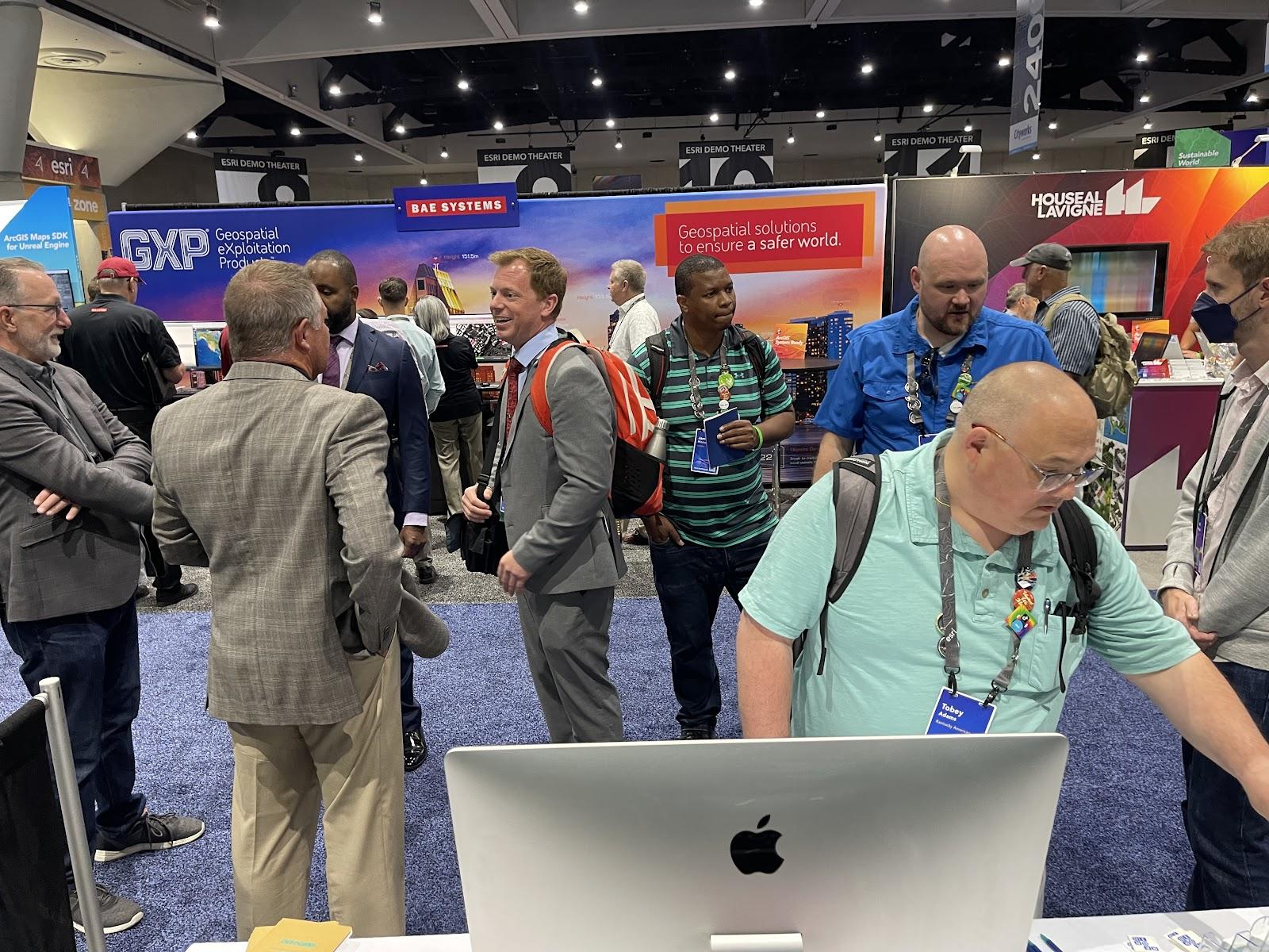
Back in the exhibit hall, I did my best to spend as much time talking to people at our booth while also checking out every other booth that I could. The scale of offerings was immense, with software providers, hardware providers, data providers, aerial imagery providers, professional service providers, and every variety of geographic service you could think of.


Outside of the conference and exhibit hall, it was so great to spend time in person with some teammates over meals and walks. I truly enjoy running a distributed organization with all of the advantages that it has, but it is, of course, so nice to get together with people in person.


Steve S. and Roman enjoy the San Diego Sun

Quiet conversations.

Downtown San Diego

Wandering San Diego's Gaslamp District.

San Diego at sunset

Wandering San Diego's Gaslamp District.

Screen Shot 2022-07-27 at 10.03.30 AM

Hanging with our friends from ATTOM Data.

The Regrid Team stands around an empty booth space.

You don’t have to go home, but you can’t stay here

Leaving the San Diego Convention Center for the last time.

You don’t have to go home, but you can’t stay here

View of the Expo Floor

A view of the Esri Expo floor

Steve S. and Roman enjoy the San Diego Sun
Downtown San Diego
San Diego at sunset
Screen Shot 2022-07-27 at 10.03.30 AM
The Regrid Team stands around an empty booth space.
Leaving the San Diego Convention Center for the last time.
View of the Expo Floor


Before we knew it we were breaking down the booth and heading home to reconvene with the rest of the team from our remote locations.


Thank you to Esri for putting on a great show. 


To those we met or reconnected with at the event, it was great to see you. Please keep the channel wide open. For those who haven’t met us yet, don’t be a stranger. You can connect with Regrid on LinkedIn, Twitter, Facebook, and Instagram, and you can contact us at parcels@regrid.com.


Jerry Paffendorf

CEO & Co-founder


Previous Next
logo

(888) 4RE-GRID

  • Contact Us
  • Customer Support

Subscribe for email updates

Company

  • About Regrid
  • Careers
  • Press

Resources

  • Coverage Map
  • Support Center
  • Reports

Support

  • Parcel Data FAQs
  • Property App FAQs
  • Contact Support Team

Customers

  • Customer Stories
  • Case Studies
  • Non Profit & Academia

Enterprise Solutions

  • Nationwide Land Parcels
  • Parcel & Tiles API
  • Feature Service

Self-Serve Solutions

  • Regrid Property App
  • Shop the Data Store
  • API Monthly Plans