regrid_tm_forest
Sign In
  • Products ⌄

    Regrid premium parcel data menu icon Premium parcels

    • global-icon Global parcels
    • US Parcel Data U.S. parcels
    • Europe-icon-navigation European parcels
    • Canada Parcel Data Canadian parcels
    • map-location-pin-regrid-icon U.S. coverage map

    Spatial add-ons menu icon Spatial add-ons

    • Matched building footprints menu icon Matched building footprints
    • Matched secondary addresses menu icon Matched secondary addresses
    • Standardized zoning menu icon Standardized zoning
    • Enhanced property ownership menu icon Daily ownership updates
    • roadway-row-icon_2025-1 U.S. roadway polygons

    Data access icon Delivery methods

    • Bulk files icon Bulk files
    • Feature Service Feature service
    • api-icon_2025 Parcel API and tiles
    • API Sandbox icon Interactive API sandbox
  • Industries ⌄

    industries-we-serve Industries we serve

    • aec-navigation-icon Architecture, engineering, and construction (AEC)
    • re-navigation-icon Real estate
    • gov-navigation-icon Government
    • ag-navigation-icon Agriculture
    • energy-navigation-icon Renewable energy and utilities
    • telco-navigation-icon Broadband and telecommunications
    • insurance-navigation-icon Insurance and finance
    • ai-ml-navigation-icon AI and machine learning
    • transportation-navigation-icon Transportation and logistics
  • Data store
  • Property App
  • Esri users
  • Resources ⌄

    Support menu icon Support

    • Support site menu icon Support site
    • Tutorial videos menu icon Tutorial videos
    • blog_resources_icon-1 Parcel schema
    • Regrid icon Sign into the Regrid Property App

    Content menu icon Content

    • Blog menu icon Blog
    • Customer stories menu icon Customer Stories
    • Reports menu icon Reports
    • data-store-2 Coverage map

    Programs menu icon Programs

    • academia_menu-icon Nonprofit & Academia
    • Regrid giving menu icon Regrid Giving
    • dwp-navigation-icon copy Data with Purpose

    shop icon Shop

    • merch_icon_2025 Regrid Merch
  • Contact us
Contact us
  • Products ⌄

    Premium parcels

    • Global parcels
    • U.S. parcels
    • European parcels
    • Canadian parcels
    • U.S. coverage map

    Delivery methods

    • Bulk files
    • Feature service
    • Parcel API and tiles
    • Interactive API sandbox

    Spatial add-ons

    • Matched building footprints
    • Matched secondary addresses
    • Standardized zoning
    • Daily ownership updates
    • U.S. roadway polygons
  • Industries ⌄

    Industries we serve

    • Architecture, engineering, and construction (AEC)
    • Real estate
    • Government
    • Agriculture
    • Renewable energy and utilities
    • Broadband and telecommunications
    • Insurance and finance
    • AI and machine learning
    • Transportation and logistics
  • Data store
  • Property App
  • Esri users
  • Resources ⌄

    Support

    • Support site
    • Tutorial videos
    • Parcel schema
    • Sign into the Regrid Property App

    Programs

    • Nonprofit & Academia
    • Regrid Giving
    • Data with Purpose

    Content

    • Blog
    • Customer Stories
    • Reports
    • Coverage map

    Shop

    • Regrid Merch
  • Contact us

REGRID MCP SERVER

Millions of parcels.
One conversation.

The easiest way for API clients to query the data. Connect your private LLMs, AI agents, and developer tools using a single token.
Get your API token
Learn more
Chat conversation between Regrid user and Regrid MCP server
What is Regrid MCP

What is the Regrid MCP Server?

MCP (Model Context Protocol) is an open standard that lets AI tools securely connect to outside data sources.

The Regrid MCP server connects AI tools like ChatGPT, Perplexity, Claude, and Cursor directly to Regrid.

Without writing code or navigating API documentation, you can ask questions about our parcel data, schema, coverage, and capabilities.

Add a Regrid API token, and your AI can also retrieve live parcel data and property information.

Think of it as a conversational layer on top of the Regrid API.

Learn more about how Regrid MCP works

Real world use cases

What you can do with Regrid MCP

See how the Regrid MCP Server translates everyday questions into direct API actions across core workflows

MCP conversation

Screen properties

Ask for parcels that match specific location, zoning, acreage, sale, ownership, or building criteria and receive structured results.

MCP code generation

Generate code

Use AI-powered development tools to generate Regrid API queries, Python scripts, and integration boilerplate with the right syntax and parameters.

Coverage check MCP conversation

Check data coverage

Ask direct questions about coverage, freshness, field availability, and last-refresh dates for the counties or regions you care about.

Chat conversation between Regrid user and Regrid MCP server against a green background

Analyze sites

Explore candidate parcels by combining Regrid property attributes with your own requirements for location, size, use, and development context.

Field and schema exploration

Explore the data

Use natural language to understand available fields, compare attributes, and identify which Regrid data points support your use case.

Workflow prototyping

Prototype workflows

Test parcel data ideas, sample queries, and internal tools before building full API integrations or production pipelines.

Get started with Regrid MCP right now

Connect your AI client and start querying nationwide parcel data in less than 5 minutes.

Add the Regrid MCP URL

Connect the Regrid MCP server to ChatGPT, Perplexity, Claude, or Cursor using a single connection URL.

Copy the link below, then add it to your LLM of choice: https://support.regrid.com/mcp

AI tools logos set against colourful background circles

Verify the connection

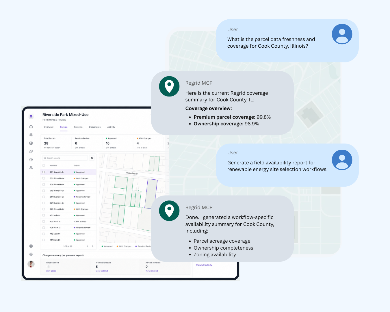
Confirm the MCP server is active with a simple prompt such as: "Use the Regrid MCP to list the available Regrid API endpoints"

three connected dots on a parcel map background

Start asking questions

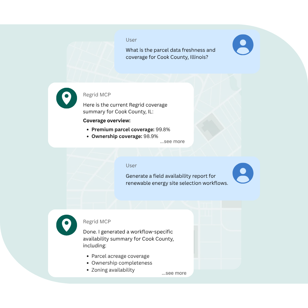
Explore coverage, understand available fields, compare attributes, and learn what Regrid data is available for your use case.

Tablet screen with chat conversation set against parcel map background

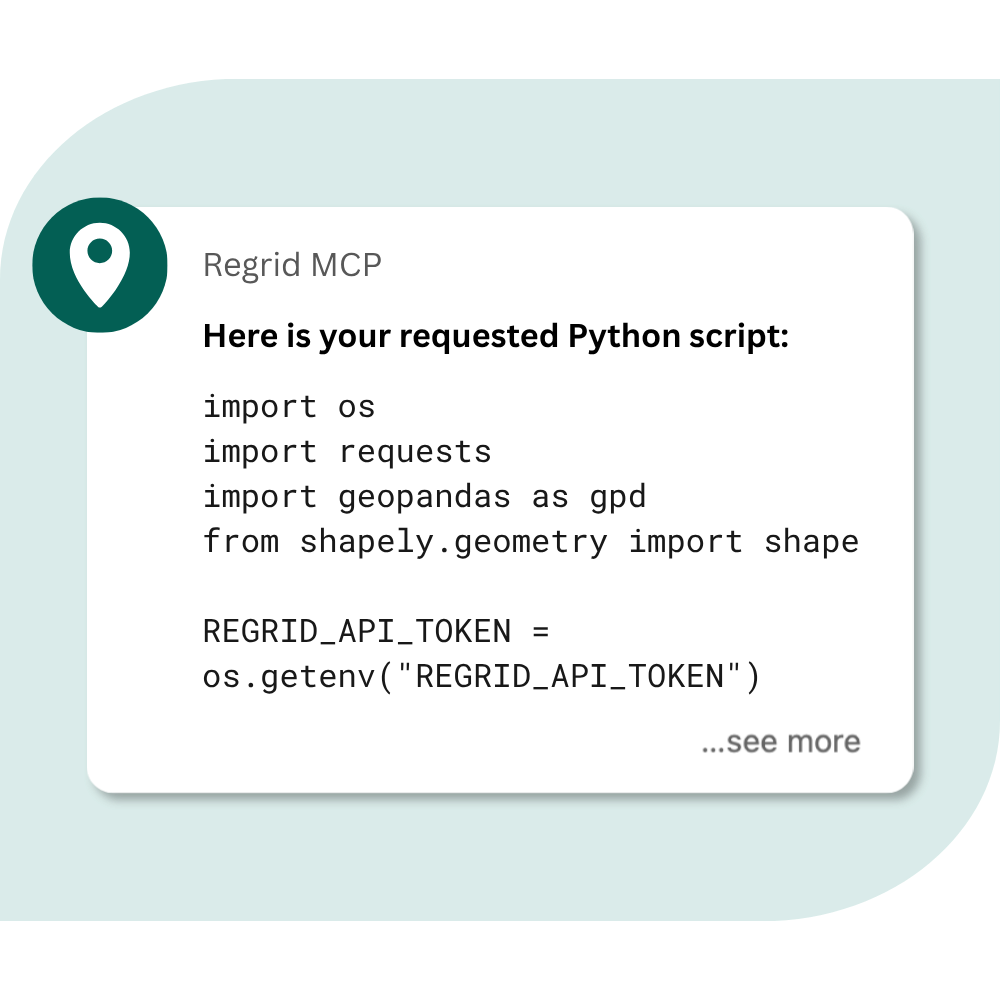
Unlock live parcel data

Add your Regrid API token to retrieve parcel records, ownership details, addresses, zoning information, and building data directly through your AI tool.

Get started
AI icons connected to an unlocked lock which leads to the Regrid logo

Required AI settings: To comply with Regrid’s Terms & Conditions, you must disable "Model Training," "Data Sharing," or equivalent features in your AI account settings before using Regrid Data with any AI or LLM.

Benefits built for AI workflows

The Regrid MCP Server is a native capability added directly to your existing API access. It acts as a secure bridge, translating human intent into precise data actions.
people with a clipboard talking

160M+

U.S. parcels

11M+

Canada parcels

AI cityscape
MCP chat conversation
1-Jun-18-2026-09-22-40-9313-PM

For technical and non-technical teams


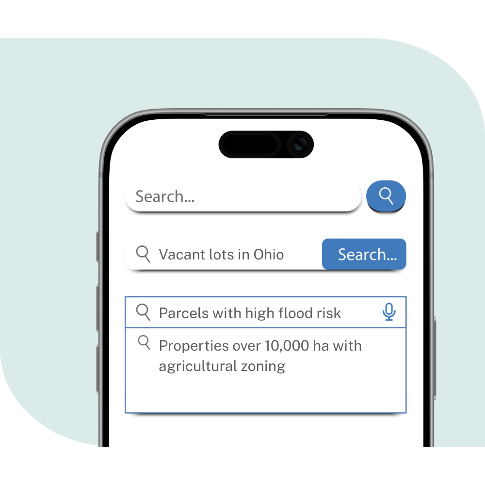
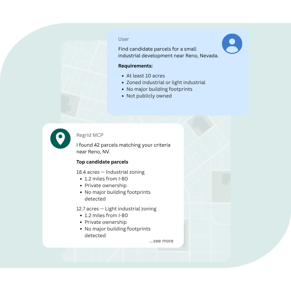
Anyone on your team can run complex, ad-hoc property lookups using plain English instead of writing custom code or manual SQL queries.

2-Jun-18-2026-09-22-40-9376-PM

Interactive sandbox testing


Validate queries and preview live data responses in real time before pointing your AI workflows at production volumes.

3-Jun-18-2026-09-22-40-9313-PM

Engineered for stability


Built from our live OpenAPI spec, so it always matches the production API. No wrapper code to maintain.

4-Jun-18-2026-09-22-40-9405-PM

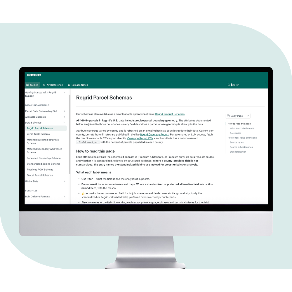
Comprehensive data definitions


Provide your models with explicit field definitions and standardized data schemas to reduce processing errors and hallucinations.

Ready to chat with millions of parcels?

Start querying nationwide property data using your existing API token in minutes.

Start your free
self-evaluation

Use the Regrid MCP Server to ask questions about Regrid's data, coverage, and capabilities before you commit to anything. No account needed — just copy and paste the link below to your LLM of choice then start asking questions.

https://support.regrid.com/mcp
Learn more

Get your API token
for live data access

Add a Regrid API token and your AI can return real parcel records, answer questions about specific properties, and power your own maps and applications.
Get your API token

Frequently asked questions

  • No. The MCP server utilizes the exact same API token as your traditional REST setup, and usage permissions inherit directly from your existing account tier.

    Because your AI client translates natural language into real data queries, you are responsible for managing your prompt engineering. To avoid racking up high volume usage or unexpected costs, ensure your team prompts the LLM to request specific parameters or geographical constraints, rather than letting the model execute broad, open-ended data sweeps.
  • The MCP server works with major AI clients including Claude, ChatGPT, and Cursor. Your Regrid license terms apply to any data your AI retrieves, so we recommend connecting through accounts where your organization controls data-retention and training settings : standard on paid Team and Enterprise AI plans.
  • Yes. The server connects your AI client directly to Regrid using your existing API token, and honors that token's exact permissions. Your prompts and conversation history stay in your AI client – Regrid never receives them.


  • This solution is explicitly designed and optimized for our active API tier clients utilizing AI workflows.
  • No. The MCP server establishes a direct connection between your AI workspace and our data engine. Regrid does not have visibility into your conversation history, internal prompts, or data analysis. The server simply processes and fulfills the data retrieval requests securely within your authenticated session boundaries.
  • Data access and restrictions are managed entirely at the authentication level through your Regrid API token. The MCP server inherently respects the exact boundaries of the credentials you provide. If your organization requires that AI agents do not see sensitive information—such as owner names or other Personally Identifiable Information (PII)—you simply need to provision and use a Regrid API token configured to exclude those specific fields.
  • Retrieving live parcel data does, and it's billed per record returned and counts toward your rate limits, exactly like a traditional integration. Documentation search, schema exploration, and match counts (return_count) are free and don't consume your allocation.
  • Absolutely. This is one of the core benefits of the Model Context Protocol. You can load multiple MCP servers into your AI client (e.g., Claude Desktop or Cursor) simultaneously. Your AI agent can then naturally combine them—using Mapbox for routing, Regrid for parcel boundaries, and ATTOM for sales history—in a single conversation.
  • Because the MCP server is built directly on our native, standard OpenAPI specifications, any schema updates, field additions, or documentation improvements are immediately reflected in the server layer. Your AI will instantly recognize the new data fields without requiring you to manually update any code or wrappers.
logo

(888) 4RE-GRID

  • Contact Us
  • Customer Support
  • Privacy Policy
  • Terms of Use
  • Cookie Preferences

Subscribe for email updates

Company

  • About Regrid
  • Careers
  • Press
  • Shop Regrid Merch

Resources

  • Coverage Map
  • Support Center
  • Reports
  • Regrid Status Page

Enterprise Solutions

  • U.S. Parcels
  • Canada Parcels
  • Parcel & Tiles API
  • Roadway Right-of-Way

Self-Serve Solutions

  • Regrid Property App
  • Shop the Data Store
  • API Monthly Plans