
-
Products ⌄
 Premium parcels
.png) AI and ML tools
AI and ML tools
 Roadway ROW
- Industries ⌄
- Data store
- Property App
- Esri users
- Resources ⌄
- Contact us


.svg)


-
Products ⌄
AI and ML tools
Roadway ROW
-
Industries ⌄
-
Resources ⌄
INDUSTRIES
Nationwide parcel data for Real Estate teams
Regrid delivers standardized parcels plus ownership, valuation, zoning, and building context so real estate teams can scope deals correctly, move faster through diligence, and power client-facing maps with confidence.

One parcel layer.
Cleaner work downstream.
Parcels are the common reference in real estate. When they’re inconsistent, everything downstream slows down. With Regrid's standardized nationwide parcel layer, you can:

100%
U.S. Parcel
data coverage


Kick off faster with a clean
starting point
Start from one parcel layer so deal setup and handoffs stay consistent.

Connect your data once, then reuse it everywhere
Link risk, zoning, valuation, comps, and internal data to parcel IDs.

Hand off and share without constant fixes
Keep maps, exports, and client outputs aligned across teams.
What can your real estate team do with a standardized parcel layer?
See how our parcel data can support your workflows.

Streamline site selection for smarter acquisitions
Compare properties across markets using one parcel schema. Validate footprint, acreage, and context early to build your shortlist.

Assemble multi-parcel and complex properties with confidence
Identify the true project area, including split parcels and adjacent ownership patterns, before diligence starts and scope is locked in.
Speed up diligence and underwriting workflows
Use parcels as the reference key for risk layers, zoning context, valuation inputs and internal records, so analysis stays consistent.
Build client-facing mapping experiences
Serve fast parcel overlays via tiles and API so users can explore boundaries and property context directly in your app or portal.

Package reports and deliverables with fewer revisions
Keep parcel-based maps, exports, and supporting layers consistent, so review cycles are smoother and deliverables hold up.

Standardize portfolio and market analytics across counties
Compare across counties without rebuilding your workflow. Parcel IDs keep joins intact as data refreshes.
You're in great company


Trusted by leading Real Estate teams
“Regrid gives us that confident first step — fast, accurate parcel data that powers everything downstream. Without it, the rest of our risk workflow simply doesn’t work.”
- Chris Harrell, CFO at CREtelligent

“Without good parcel boundaries, you risk ordering the wrong survey, missing part of a site, or re-doing fieldwork"

“What brought me to Regrid is just the ability to analyze all of these things in one place”

“For what I do, I can see everything I need to see in five minutes, and Regrid is four of those five”
Explore the coverage map
See live coverage, refresh dates, and attribute completeness. Click any county to see parcel counts and field-by-field coverage, then continue to purchase or explore data in the Regrid web app.

-
What you get
Critical attributes, standardized
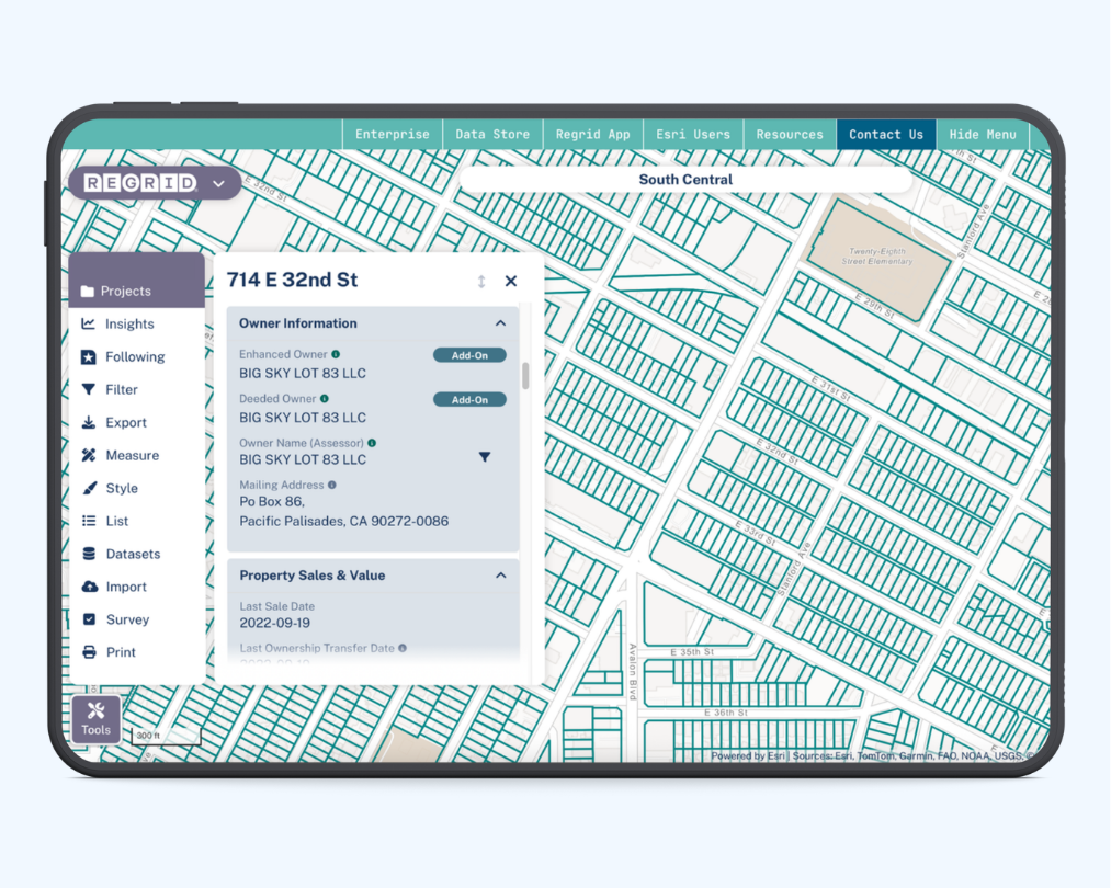
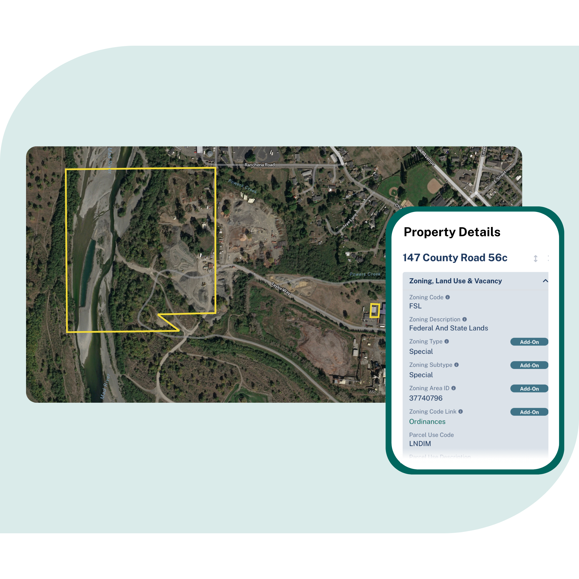
Parcel boundaries and sizes, owner names and mailing addresses, zoning, property valuation, and building and address context, delivered in one consistent structure.
Nationwide coverage, kept current
Coverage across the U.S., with ongoing refresh of key fields like ownership and valuation so your decisions reflect what’s happening on the ground, not last year’s snapshot.
Delivery that fits how real estate teams work
Use APIs and tiles for interactive portals, or bulk delivery for modeling and internal analytics, then connect outputs back to parcels for clean handoffs and repeatable workflows.
Frequently asked questions
-
An address helps you find a place. A parcel defines the actual property boundary and gives you a stable ID you can join everything else to (risk, zoning, valuation, internal records). That’s what keeps analysis, diligence, and reporting consistent across markets.
-
Yes, Regrid’s licensing is designed to support integration into your products and services, including rendering parcel polygons in maps your customers can view. The key constraint is that you generally must prevent end users from extracting a substantial portion of the raw geometries, and you cannot redistribute raw files.
-
Regrid refreshes counties on an ongoing schedule (often dozens to hundreds per month) and maintains a commitment to updating all counties at least annually, subject to source availability. Separately, Premium schema files are updated monthly across all counties (even when the underlying source county file has not changed) for fields that benefit from frequent nationwide updates.
-
Use parcels (not addresses) as the unit of selection: identify the footprint, then select one parcel or multiple parcels as the project area. Regrid supports lookup patterns that go beyond address, including point/lat-long, APN, and owner search workflows, so you can assemble the right set before downstream work begins.

(888) 4RE-GRID
Subscribe for email updates