
-
Products ⌄
 Premium parcels
.png) AI and ML tools
AI and ML tools
 Roadway ROW
- Industries ⌄
- Data store
- Property App
- Esri users
- Resources ⌄
- Contact us


.svg)


-
Products ⌄
AI and ML tools
Roadway ROW
-
Industries ⌄
-
Resources ⌄
INDUSTRIES
Nationwide parcel data for insurance and finance
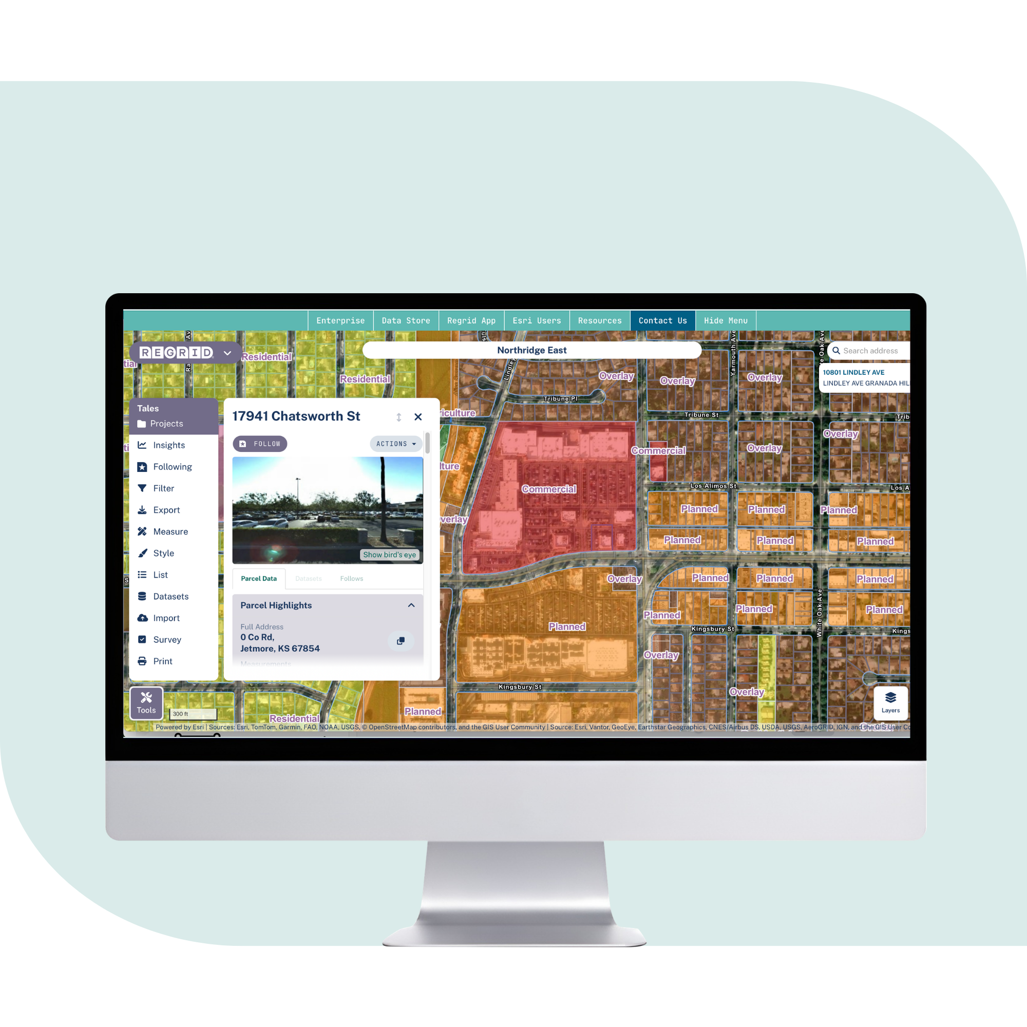
Regrid helps insurance, lending, and financial analytics teams connect property risk, valuation, ownership, buildings, addresses, and internal records to standardized parcels across the United States.

Better parcel context for risk and lending decisions
Use standardized parcel data to connect addresses, buildings, ownership, valuation, and risk layers for clearer insurance, lending, and property intelligence decisions.

100%
U.S. Parcel
data coverage


More accurate property matching
Connect addresses and points to parcel boundaries so underwriting, lending, and risk workflows start from the right property footprint.

Richer context for risk decisions
Bring ownership, buildings, valuation, zoning, and parcel-size data into property-level analysis before decisions move downstream.

Delivery for property intelligence
Use APIs, tiles, bulk files, and GIS-ready layers to bring standardized parcel context into your models, maps, platforms, and internal tools.
What can insurance and finance teams
do with standardized parcel data?
See how a standardized parcel layer supports risk, lending, analytics, and portfolio decisions.
Property and casualty underwriting
Improve quote and risk workflows by connecting addresses to parcel boundaries, matched buildings, and known secondary addresses.
Risk scoring and analytics platforms
Use parcels as a stable location reference for hazard layers, environmental data, valuation inputs, and internal scores, so outputs stay consistent across markets.
Commercial real estate lending
Support loan assessment with parcel boundaries and property context that help analysts review environmental, flood, and location risk early.
Portfolio monitoring and exposure analysis
Connect parcels to ownership, valuation, building, and risk layers to compare properties across counties and track exposure more consistently.
Property data enrichment and matching
Match internal records to parcel IDs, addresses, or spatial joins to reduce duplicate records and keep datasets aligned as Regrid refreshes.

Customer-facing maps and applications
Serve parcel overlays through API and tiles so users can see property boundaries and context in your platform without handling raw files.
You're in great company


Trusted by insurance and finance teams
Regrid supports insurance, lending, and property intelligence teams that need reliable parcel data to assess risk and understand properties at scale.


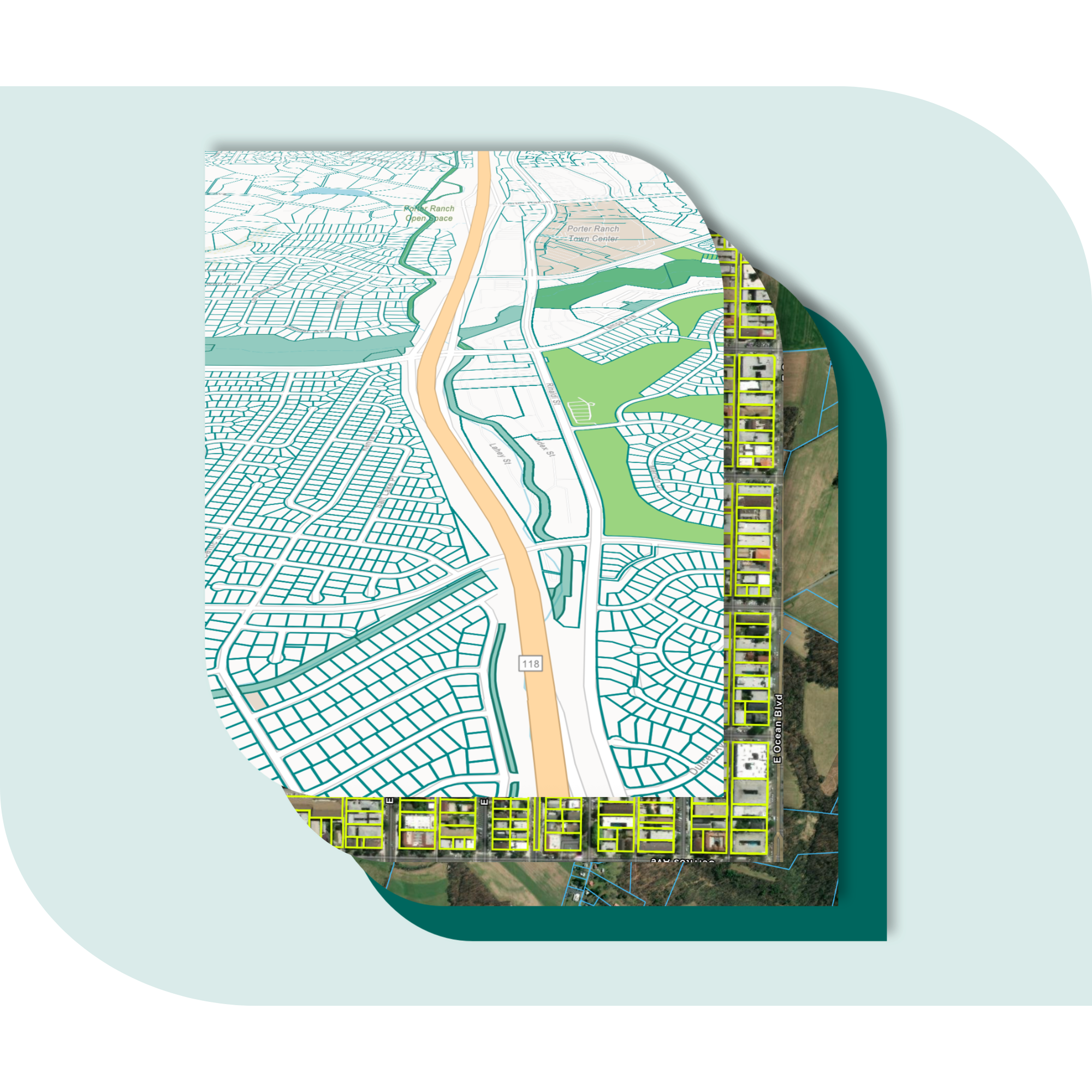
Explore the coverage map
See live coverage, refresh dates, and attribute completeness. Click any county to see parcel counts and field-by-field coverage, then continue to purchase or explore data in the Regrid web app.

What you get

-
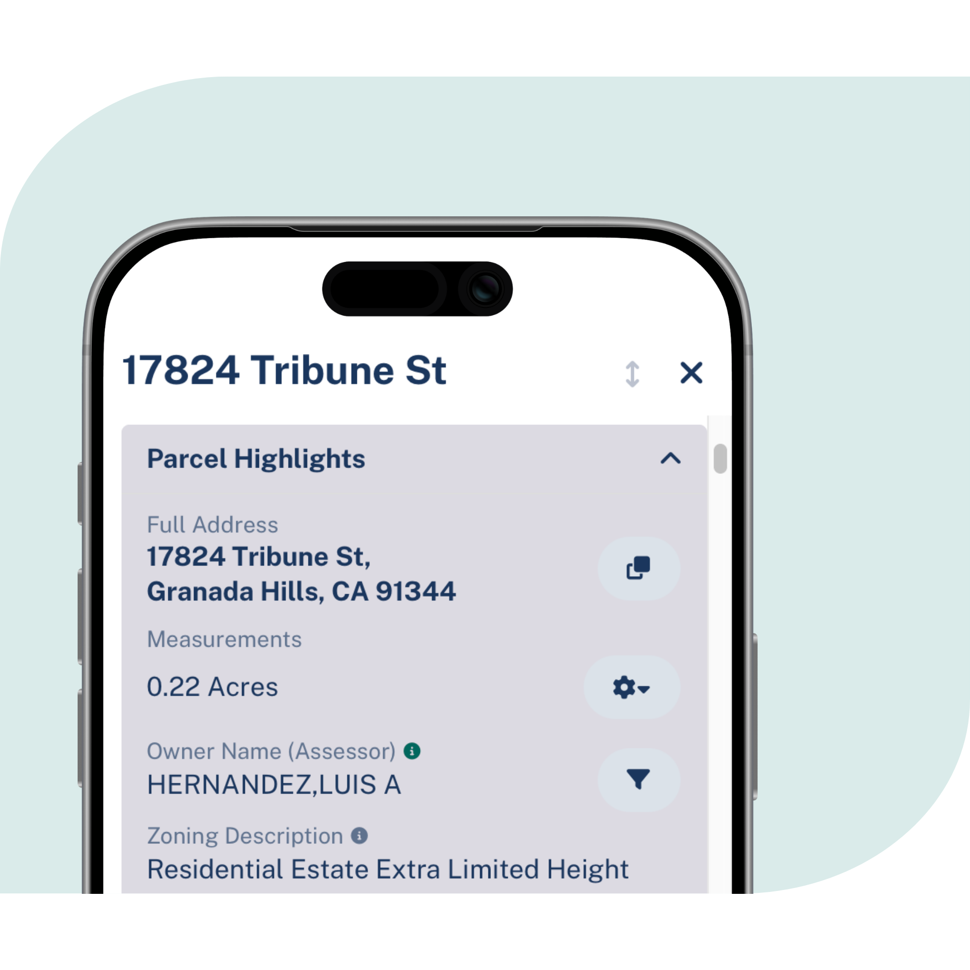
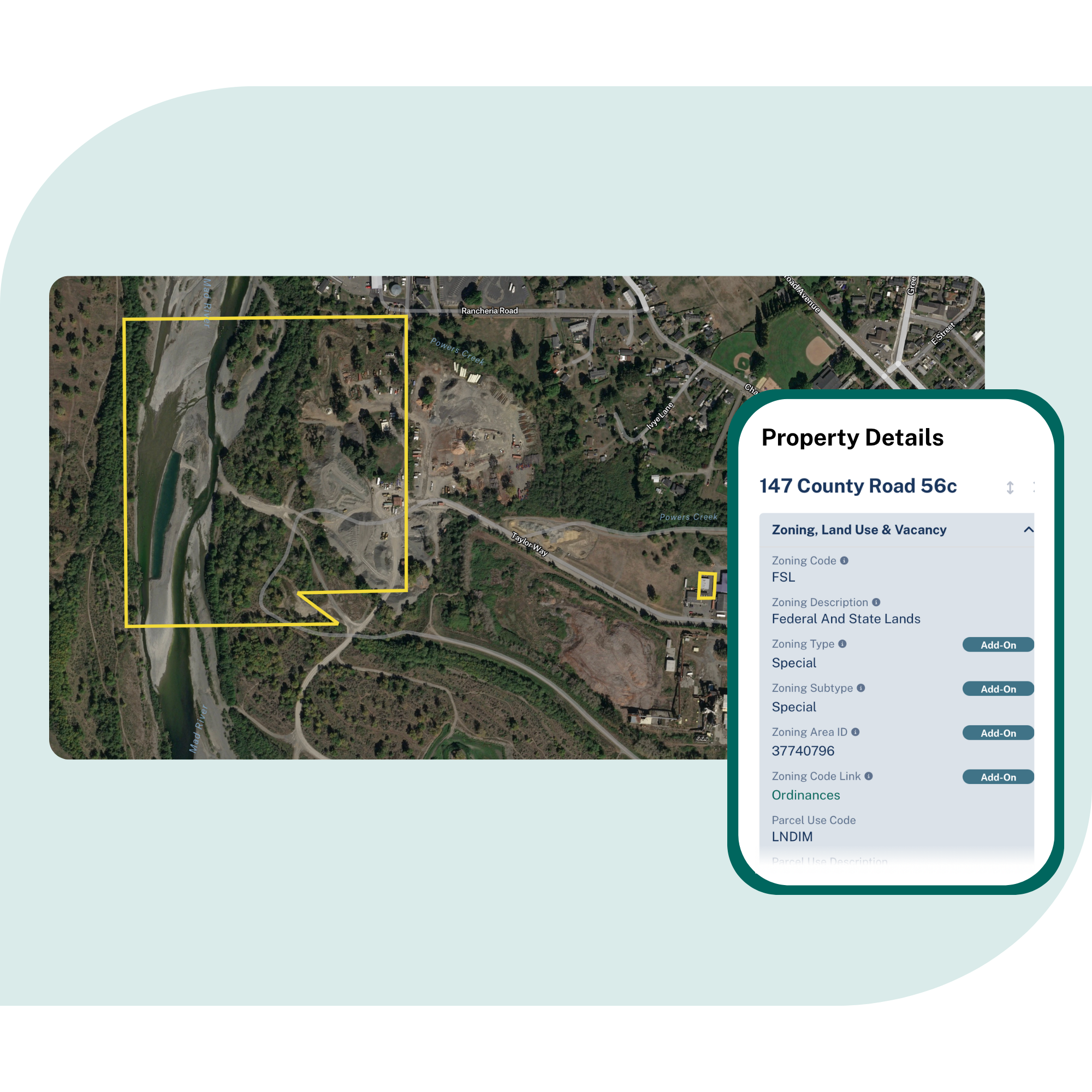
Parcel boundaries and sizes, owner names and mailing addresses, zoning, property valuation, building context, and known address information delivered in one consistent structure.
-
100% U.S. parcel coverage with ongoing refreshes, so insurance and finance teams can work across markets without rebuilding data pipelines county by county.
-
Use APIs and tiles for applications, quote engines, and customer-facing maps, or bulk delivery for modeling, enrichment, portfolio analysis, and internal analytics.
Frequently asked questions
-
Addresses help identify a location. Parcels define the property boundary and provide a stable reference for joining risk data, valuation, ownership, building context, and internal records.
-
Yes. Regrid parcel data can help match addresses to parcel boundaries through API workflows, giving analytics teams a clearer location reference for scoring, underwriting, and downstream decision-making.
-
Regrid provides standardized parcel boundaries and parcel attributes, including ownership, mailing addresses, property size, valuation, zoning, and related building and address context.
-
Yes. Regrid supports delivery through APIs, tiles, Feature Service, and bulk files, so teams can integrate parcel data into models, dashboards, GIS tools, and customer-facing applications.
-
Regrid gives teams one standardized parcel layer across the United States, making it easier to compare properties, join external risk layers, and run analysis across counties without rebuilding the workflow each time.
-
Most teams start with one delivery method, connect it to existing workflows, then expand to additional access methods as needs grow across phases and business units.

(888) 4RE-GRID
Subscribe for email updates