


.png)


.svg)


August Parcel Data Update
Dear Friends of Loveland Parcel Data and landgrid.com,
A lot of important information in this one!
A summary of updates in July of 2020 and the upcoming pipeline is below.
Key Data Stats:
- Total parcel age down by 3.5% from last month
- Average parcel age - 196 days, down from 205 last month
- Average county age - 215 days, down from 239 last month
- ~903K new parcels, 71 new counties added & 146 counties refreshed since last month
Land Based Classification System (LBCS) Use Codes update:
We now have over 70% of our parcels with an LBCS code.
Readable LBCS code descriptions - new columns:
Added the description for each code to every parcel.
Shapefile Important Information:
Starting this month we have made the following changes to help flag the counties whose data exceeds the 2GB soft limit. Please double check how you are handling these files.
Duplicate Parcel Records:
We are in the process of identifying and removing about 218,000 truly duplicated parcel records across our dataset. Many counties 'stack' parcels to record multiple owners or multiple units, natural resource rights, etc. These situations are expected and they are still considered good data. As a result, these stacked parcels are not affected.
However, we have found a number of parcel records that are actual duplicates, with nothing unique or different between them in any way aside from the 'll_uuid' we assigned each duplicate record.
We will be removing those in August and exporting the corrected counties (918) in September. About 40 counties account for most of the duplicates, and 800 had less than 1% affected parcels.
We are not sure what caused the issue, but we will put monitoring in place to determine if these are duplicates in the sources or something else is happening to cause them.
USPS Vacancy, Residential indicators:
Now updated monthly. Updated in July 2020, next update in August.
Coverage Report:
Updated for this month and available here:
https://docs.google.com/spreadsheets/d/1q0PZB72nO8935EMGmsh3864VjEAMUE-pdHcPkoAiS5c/
For all full dataset customers, the updated data is available for download to bulk data clients in these formats: GeoPKG .gpkg (suggested), GeoJSON, Shapefile, and Postgres SQL files. In addition, this data has been updated on the landrid.com website.
If your organization uses a custom export we are updating your data at the moment and if you don’t see the latest updates, please drop us a line.
A Data Dictionary for the Loveland Standard Schema is always available here:
https://docs.google.com/spreadsheets/d/14RcBKyiEGa7q-SR0rFnDHVcovb9uegPJ3sfb3WlNPc0/
A machine-readable version of this list is included in the `verse` table available in all the formats above as well as CSV format for use in spreadsheets. To find the latest updates in verse, sort by 'last_refresh' and use the 'filename_stem' column to identify the file.
Data refreshed or added from the county in July and live now:
( Asterisk * indicates newly added county)
--------------------------------------------------
Alabama - Houston
Arizona- Apache, Cochise, Coconino, Gila, Graham, Greenlee, La Paz, Maricopa, Mohave, Navajo, Pima, Pinal, Santa Cruz, Yavapai, Yuma
California - Glenn, Mendocino, San Benito, San Francisco
District of Columbia - Washington
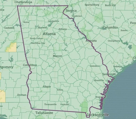
Georgia (55 new counties) - Appling*, Baker*, Banks*, Barrow*, Bleckley*, Butts*, Calhoun*, Candler*, Catoosa*, Chattahoochee*, Chattooga*, Clay*, Clinch*, Colquitt*, Decatur*, Dodge*, Dooly*, Early*, Elbert*, Emanuel*, Franklin*, Glascock*, Hancock*, Harris*, Hart*, Heard*, Jasper*, Jefferson*, Jenkins*, Johnson*, Lamar*, Lanier*, Madison*, Marion*, Meriwether*, Miller*, Montgomery*, Morgan*, Oconee*, Peach*, Pickens*, Pike*, Quitman*, Rabun*, Schley*, Spalding*, Stewart*, Taliaferro*, Tattnall*, Terrell*, Toombs*, Towns*, Treutlen*, Twiggs*, Upson*, Walker*, Walton*, Warren*, Wayne*, Webster*, Wheeler*, Wilkinson*, Worth*, Baldwin, Ben Hill, Brantley, Dade, Evans, Gilmer, Grady, Greene, Laurens, Lee, Lincoln, Long, Lumpkin, Mitchell, Pulaski, Randolph, Rockdale, Seminole, Stephens, Talbot, Taylor, Ware, White, Whitfield
Illinois - Adams, Crawford, DeKalb, Effingham*, Hancock, Lee, Menard, Pike, Sangamon, Tazewell, Whiteside
Indiana - Grant, Porter
Louisiana - Ouachita
Massachusetts - Barnstable, Berkshire, Bristol, Dukes, Essex, Franklin, Hampden, Hampshire, Middlesex, Nantucket, Norfolk, Plymouth, Suffolk, Worcester
Michigan - Allegan, Arenac, Charlevoix, Cheboygan, Eaton, Emmet, Grand Traverse, Ingham, Ionia, Iron, Jackson, Kent, Lapeer, Leelanau, Lenawee, Marquette, Midland, Montcalm, Muskegon, Newaygo, Oceana, Ottawa, Roscommon, Saginaw, St. Clair, Tuscola, Washtenaw
Missouri - Andrew, Atchison, Bates, Benton, Buchanan, Camden, Christian, Cooper, Dallas, Douglas*, Franklin*, Henry, Holt, Laclede*, Lafayette, Lawrence, Lincoln, Linn, Macon*, Miller, Moniteau, Morgan, Phelps, Ralls, Ray, Vernon, Warren
North Dakota - Billings, Bottineau, Bowman*, Burke, Burleigh, Cass, Cavalier, Divide, Dunn, Emmons, Foster*, Golden Valley, Grant, Hettinger, LaMoure, McHenry, McKenzie, McLean, Morton, Mountrail, Nelson*, Pembina, Renville*, Richland, Rolette, Sargent*, Sheridan*, Sioux, Stark, Steele, Traill, Walsh, Ward, Williams
Nebraska - Arthur, Box Butte
New York - Cortland, Genesee, Madison*, Tioga
Oklahoma - Pottawatomie*
Oregon - Columbia, Umatilla
Pennsylvania - Indiana*, Union, Venango*
South Dakota - Aurora, Beadle, Bennett, Bon Homme, Buffalo, Campbell, Clark, Codington, Custer, Davison, Day, Deuel, Douglas, Edmunds, Fall River, Faulk, Grant, Gregory, Hamlin, Hanson, Hutchinson, Jackson, Jerauld, Jones, Kingsbury, Lake, Lawrence, Lincoln, Lyman, Marshall, McPherson, Meade, Mellette, Miner, Minnehaha, Moody, Oglala Lakota, Pennington, Roberts, Sanborn, Tripp, Union, Yankton
Tennessee - Shelby
Texas - Ochiltree
Wisconsin - Adams, Ashland, Barron, Bayfield, Brown, Buffalo, Burnett, Calumet, Chippewa, Clark, Columbia, Crawford, Dane, Dodge, Door, Douglas, Dunn, Eau Claire, Florence, Fond du Lac, Forest, Grant, Green, Green Lake, Iowa, Iron, Jackson, Jefferson, Juneau, Kenosha, Kewaunee, La Crosse, Lafayette, Langlade, Lincoln, Manitowoc, Marathon, Marinette, Marquette, Menominee, Milwaukee, Monroe, Oconto, Oneida, Outagamie, Ozaukee, Pepin, Pierce, Polk, Portage, Price, Racine, Richland, Rock, Rusk, Sauk, Sawyer, Shawano, Sheboygan, St. Croix, Taylor, Trempealeau, Vernon, Vilas, Walworth, Washburn, Washington, Waukesha, Waupaca, Waushara, Winnebago, Wood
In the current pipeline for updating in August 2020
--------------------------------------------------
Michigan - Balance of state
New York - Balance of state
In the pipeline for updating in September
--------------------------------------------------
California
Illinois
Tennessee
Based on feedback and county challenges, pipeline planning is always subject to change. As always, please contact us if you have any questions about accessing or using the data, if you find issues with any of our data, or you have any comments or questions about our data in specific areas or states. We also love to hear from you about which counties or regions you’d like to see us update next, as it helps inform our planning process.
Thank you for being a part of Loveland!
Happy Mapping!
