
-
Products ⌄
 Premium parcels
 AI and ML tools
 Roadway ROW
 Spatial add-ons
 Delivery methods
- Industries ⌄
- Data store
- Property App
- Esri users
- Resources ⌄
- Contact us
































-
Products ⌄
AI and ML tools
Roadway ROW
-
Industries ⌄
-
Resources ⌄

CASE STUDY | RESEARCH & EDUCATION
How Boston University researchers used Regrid to build a high-resolution U.S. land value model
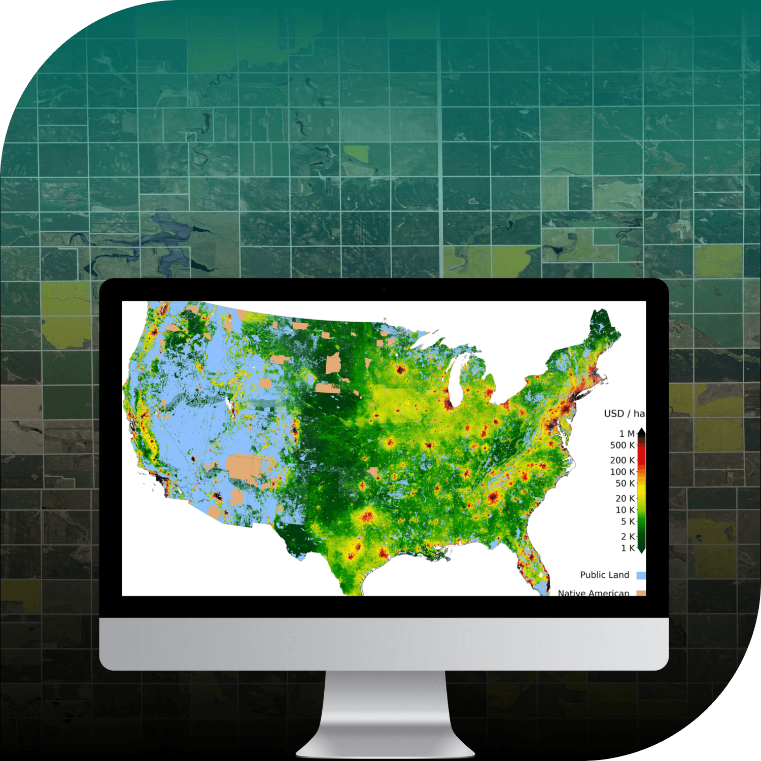
Discover how Boston University's Places Lab combined nationwide parcel data, more than four million land sales, and machine learning to create a more accurate, open-source model of land values across the U.S.
CHALLENGE
The U.S. lacked a consistent, high-resolution land value dataset. Fragmented sales records and inconsistent county assessments made it difficult for Boston University researchers to compare land values and model them accurately nationwide.
SOLUTION
Using Regrid's standardized parcel data, researchers connected more than four million verified land-only sales to a consistent national spatial framework, building an open-source land value model that achieved twice the accuracy of tax assessment-based estimates.
ABOUT
Advancing research into land values, economics, and public policy
Boston University's Places Lab conducts spatial research at the intersection of land, environment, policy, and economics.
In this project, researchers set out to create a consistent, high-resolution model of land values across the contiguous United States. By combining verified land sales, machine learning, and Regrid's nationwide parcel data, the team aimed to provide a more reliable foundation for understanding how land values vary across the country.
The resulting research supports applications ranging from real estate investment and infrastructure planning to taxation, housing policy, and land conservation.
CHALLENGE
Fragmented property records made nationwide land value comparisons difficult
Understanding land value is essential to decisions about real estate, infrastructure, taxation, and conservation. Yet, despite its importance, the United States lacked a reliable, high-resolution dataset for comparing land values across regions.
County tax assessments offered one source of information, but their quality, coverage, and valuation methods varied widely between jurisdictions. Land-only sales provided a more direct indication of market value, but those records were fragmented and difficult to connect to individual properties at scale.
Without a consistent geographic framework, researchers struggled to combine these different sources of information and build a nationwide land value model with sufficient spatial detail.
Boston University's Places Lab needed standardized parcel data that could link millions of verified sales to real-world locations and support comparable land value estimates across the country.
SOLUTION
Standardized parcel data provides the foundation for nationwide land value modelling
Through Regrid's Data With Purpose program, Boston University researchers used Regrid's nationwide parcel dataset as the spatial foundation for their land value model.
The team compiled more than four million verified land-only sales and used machine learning to predict land value per square metre across the contiguous United States.
Regrid's consistent parcel geometry, standardized structure, and nationwide coverage allowed researchers to geolocate sales records, connect them with individual properties, and integrate the information into a unified modelling framework.
This enabled the team to work across jurisdictional boundaries without relying on incompatible local datasets, creating a consistent foundation for detailed land value estimates at a national scale.
RESULTS
An open-source land value model with twice the accuracy of tax assessment-based estimates
The resulting model achieved twice the accuracy of traditional tax assessment-based estimates, providing a more consistent and detailed picture of land values across the contiguous United States.
The research team made the model open source and fully documented, publishing its code, methods, and data through GitHub. The results are also available as GIS-ready raster tiles through Google Cloud and can be explored visually through FMV-USA.
For real estate investors and commercial teams, the model offers a stronger foundation for understanding geographic differences in land value, assessing markets, and supporting location-based investment decisions.
For planners, policymakers, and researchers, it provides a resource for studying taxation, housing affordability, infrastructure investment, and land conservation. The detailed spatial estimates are particularly useful in areas where local valuation records are limited or inconsistent.
By providing a standardized nationwide parcel framework, Regrid helped researchers turn millions of fragmented land sales into a consistent, high-resolution model that can support more informed decisions about land across the United States.
See how Regrid has helped others


















(888) 4RE-GRID
Subscribe for email updates