regrid_tm_forest
Sign In
  • Products ⌄

    Regrid premium parcel data menu icon Premium parcels

    • global-icon Global parcels
    • US Parcel Data U.S. parcels
    • Europe-icon-navigation European parcels
    • Canada Parcel Data Canadian parcels
    • map-location-pin-regrid-icon U.S. coverage map

    ai-ml-navigation-icon (1) AI and ML tools

    • mcp-server-navigation MCP Server

    roadway-row-icon_2025-1 Roadway ROW

    • roadway-row-icon_2025 U.S. roadway polygons

    Spatial add-ons menu icon Spatial add-ons

    • Matched building footprints menu icon Matched building footprints
    • Matched secondary addresses menu icon Matched secondary addresses
    • Standardized zoning menu icon Standardized zoning
    • Enhanced property ownership menu icon Daily ownership updates

    Data access icon Delivery methods

    • Bulk files icon Bulk files
    • Feature Service Feature service
    • api-icon_2025 Parcel API and tiles
    • Green icon of a shopping cart with check mark Data store
  • Industries ⌄

    industries-we-serve Industries we serve

    • aec-navigation-icon Architecture, engineering, and construction (AEC)
    • re-navigation-icon Real estate
    • gov-navigation-icon Government
    • ag-navigation-icon Agriculture
    • energy-navigation-icon Renewable energy and utilities
    • telco-navigation-icon Broadband and telecommunications
    • insurance-navigation-icon Insurance and finance
    • ai-ml-navigation-icon AI and machine learning
    • transportation-navigation-icon Transportation and logistics
  • Data store
  • Property App
  • Esri users
  • Resources ⌄

    Support menu icon Support

    • Support site menu icon Support site
    • Tutorial videos menu icon Tutorial videos
    • blog_resources_icon-1 Parcel schema
    • Regrid icon Sign into the Regrid Property App

    Content menu icon Content

    • Blog menu icon Blog
    • Customer stories menu icon Customer Stories
    • Reports menu icon Reports
    • data-store-2 Coverage map

    Programs menu icon Programs

    • Regrid giving menu icon Regrid Giving
    • dwp-navigation-icon copy Data with Purpose

    shop icon Shop

    • merch_icon_2025 Regrid Merch
  • Contact us
Contact us
  • Products ⌄

    Premium parcels

    • Global parcels
    • U.S. parcels
    • European parcels
    • Canadian parcels
    • U.S. coverage map

    Spatial add-ons

    • Matched building footprints
    • Matched secondary addresses
    • Standardized zoning
    • Daily ownership updates

    AI and ML tools

    • MCP Server

    Delivery methods

    • Bulk files
    • Feature service
    • Parcel API and tiles
    • Data store

    Roadway ROW

    • U.S. roadway polygons
  • Industries ⌄

    Industries we serve

    • Architecture, engineering, and construction (AEC)
    • Real estate
    • Government
    • Agriculture
    • Renewable energy and utilities
    • Broadband and telecommunications
    • Insurance and finance
    • AI and machine learning
    • Transportation and logistics
  • Data store
  • Property App
  • Esri users
  • Resources ⌄

    Support

    • Support site
    • Tutorial videos
    • Parcel schema
    • Sign into the Regrid Property App

    Programs

    • Regrid Giving
    • Data with Purpose

    Content

    • Blog
    • Customer Stories
    • Reports
    • Coverage map

    Shop

    • Regrid Merch
  • Contact us


ABOUT REGRID

One parcel layer for the world's location decisions

Regrid makes parcel data easier to access, understand, and use, so people can make better decisions about land across communities, markets, and borders.

A broader vision for parcel data

We are the parcel people, bringing the actionable unit of geography to everyone.

We began with a community commitment in Detroit and grew that work into a complete, standardized parcel layer for the United States.

Today, that foundation supports enterprise teams across real estate, infrastructure, government, energy, conservation, research, and technology, along with millions of Regrid app users and the wider public.

As Regrid expands globally with international parcel datasets, we are carrying that same care, context, and commitment to usability that shaped our Detroit origins and our U.S. coverage into every new market.

Explore Regrid global parcels

Do you know the Regrid story?

How a grassroots mapping project grew into a nationwide land grid, without ever losing sight of where we began

Founded in 2009

Founded in 2009 in Detroit, Michigan, Regrid spent its early years helping Detroiters use parcel data to overcome the challenges of widespread vacancy, blight, and foreclosure.

1-Aug-20-2026-08-31-52-0304-PM

The journey

That very intense, very human experience showed us that parcel data must be made highly accessible to all audiences, and set us on a journey to bring parcels to every geography.

2-Aug-20-2026-08-31-51-4765-PM

100% US parcel coverage

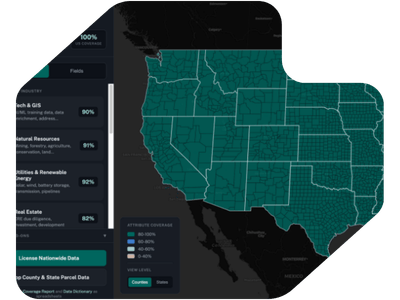
In 2023, Regrid became the first team to ever assemble and deliver a 100% parcel coverage map of the United States - a testament to our unique passion, care, and commitment.
3-Aug-20-2026-08-31-49-5021-PM

Esri's commercial parcel partner

In 2024, Regrid became Esri's commercial partner for parcel data. As the world leader in mapping software and geographic insight, Esri saw what sets Regrid apart and you will too.

4-Aug-20-2026-08-31-50-9164-PM

European Data

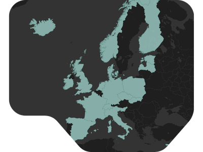
In 2026, we expanded beyond North America—adding over 20 European countries to our grid and bringing enterprise spatial coverage to a global stage.

5-Aug-20-2026-08-31-48-7001-PM


Who we are

We build the parcel foundation for better location decisions

At Regrid, we believe that understanding the world starts at the parcel level, where property and geography meet. We grew from a simple mission to make complex land data accessible to everyone, and that sincerity still drives us. We focus exclusively on one thing: creating the best parcel data on the market.

Because we do one thing exceptionally well, we have the privilege of serving a massive, diverse community. Our data supports millions of app users, global enterprises, nonprofits, educators, and citizens through flexible tools like APIs, bulk cloud delivery, and Esri-compatible services. We operate at a global scale, but our heart remains rooted in true accessibility, helping shape location decisions across the places where we live, build, protect, and govern.

man looking at tablet against a nature background
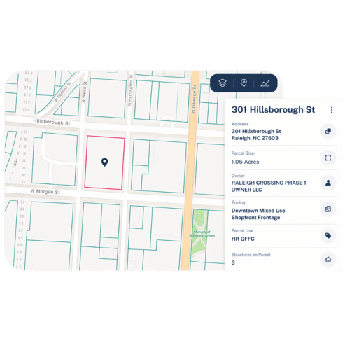
Regrid parcel map with highlighted parcel and attribute window

What we do

Understanding land starts with parcels

Parcels show how land is divided, owned, used, valued, developed, and changed over time.

But parcel data is rarely simple. It is created locally, maintained differently from place to place, and shaped by legal, cultural, historical, and geographic context.

Regrid’s work is to bring parcel information into a clearer, more usable form without losing sight of the local systems behind it.

Explore Regrid products

Regrid international

From nationwide parcel coverage to international expansion

In building 100% parcel coverage of the United States, we brought thousands of unique local parcel systems into a single, standardized foundation.

Today, we are applying that hard-earned experience to international datasets. Our methodology remains unchanged: we start with local context.

By respecting how land data is natively created and used, we ensure that as we scale globally, the data remains accessible, connected, and deeply useful to everyone who relies on it.

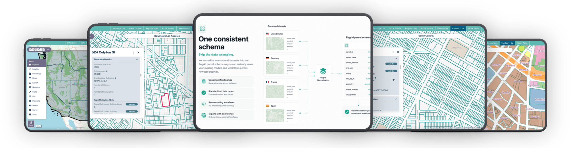
One consistent schema
Explore Regrid global parcels

Our industries

Parcel data for the decisions that shape places

Regrid supports teams that need a reliable parcel layer to understand land, connect records, power workflows, and make better location decisions across markets, projects, and communities.

AEC

Support planning, right-of-way, land acquisition, permitting, engagement, fieldwork, and deliverables with consistent parcel context.
Learn more

Real
Estate

Evaluate sites, assemble properties, compare markets, and connect parcel context to ownership, risk, valuation, and development potential.
Learn more

Government

Use parcel data to support planning, public services, community development, transparency, research, and land-related decision-making.
Learn more

Agriculture

Make better rural land decisions with standardized parcel boundaries, ownership data, and property context for acquisition, operations, forestry, and land analysis.
Learn more

energy and
utilities

Plan, site, connect, and maintain infrastructure with parcel data that links projects to ownership, land use, buildings, addresses, and local property context.
Learn more

broadband & telecommunications

Plan expansion, validate serviceable locations, and connect network decisions to parcels, addresses, buildings, ownership, and coverage areas.
Learn more

insurance &
finance

Connect property, ownership, valuation, building, and risk data to support underwriting, lending, portfolio analysis, and property intelligence workflows.
Learn more

AI & Machine Learning

Build models and analytics workflows on standardized parcel data that connects property boundaries, ownership, land use, buildings, and location context.
Learn more

Transportation & logistics

Use parcel data to understand where destinations, service areas, infrastructure, and stakeholders connect to the land for routing, planning, and mobility decisions.
Learn more

Our initiatives

Data with Purpose

Regrid’s roots are in civic technology, open data, and community problem-solving.

That history continues through programs like Data With Purpose and Regrid Giving, which support nonprofit, academic, conservation, research, and socially minded work with access to parcel data and land-related giving.

Explore Data with Purpose
Data with purpose program

Trusted by leading teams across industries

“Regrid gives us that confident first step — fast, accurate parcel data that powers everything downstream. Without it, the rest of our risk workflow simply doesn’t work.”

-  Chris Harrell, CFO at CREtelligent

CREtelligent customer testimonial quote
Langan customer testimonial quote
Burns & McDonnell customer testimonial quote
Bloom Spatial customer testimonial quote
University of California Berkeley customer testimonial quote
Agccor customer testimonial quote
Autodesk customer testimonial quote
1222 development customer testimonial quote
Upstream tech customer testimonial quote
Immersive homes customer testimonial quote
Dynamic weather solutions customer testimonial
Read more customer stories
logo

(888) 4RE-GRID

  • Contact us
  • Customer support
  • Privacy policy
  • Terms of use
  • Cookie Preferences

Subscribe for email updates

Company

  • About Regrid
  • Careers
  • Press
  • Shop Regrid merch

Resources

  • Coverage map
  • Support center
  • Reports
  • Regrid status page

Enterprise Solutions

  • U.S. parcels
  • Canada parcels
  • Europe parcels
  • Parcel and tiles API
  • Roadway Right-of-Way

Self-serve solutions

  • Regrid Property App
  • Shop the Data Store
  • API monthly plans