
-
Products ⌄
 Premium parcels
.png) AI and ML tools
AI and ML tools
 Roadway ROW
 Spatial add-ons
 Delivery methods
- Industries ⌄
- Data store
- Property App
- Esri users
- Resources ⌄
- Contact us









.svg)

.png)





















.png)



.png)

-
Products ⌄
AI and ML tools
Roadway ROW
-
Industries ⌄
-
Resources ⌄
CASE STUDY: TOPO MAPS+
Bringing land ownership into backcountry navigation
With Regrid’s Parcel API, Topo Maps+ helps hunters and backcountry users understand private land boundaries and identify landowners, while freeing up their team from sourcing and maintaining parcel data.
CHALLENGE
Topo Maps+ needed to add private parcel boundaries, owner names, and owner mailing addresses for hunters and backcountry users without taking on the work of sourcing, standardizing, updating, and monitoring parcel data state by state.
SOLUTION
With Regrid’s Parcel API, Topo Maps+ added private parcel data to its highest subscription tier, giving hunters and backcountry users the land ownership context they need while keeping the data layer simple and reliable behind the scenes.
ABOUT
Built for the backcountry, beyond cell service
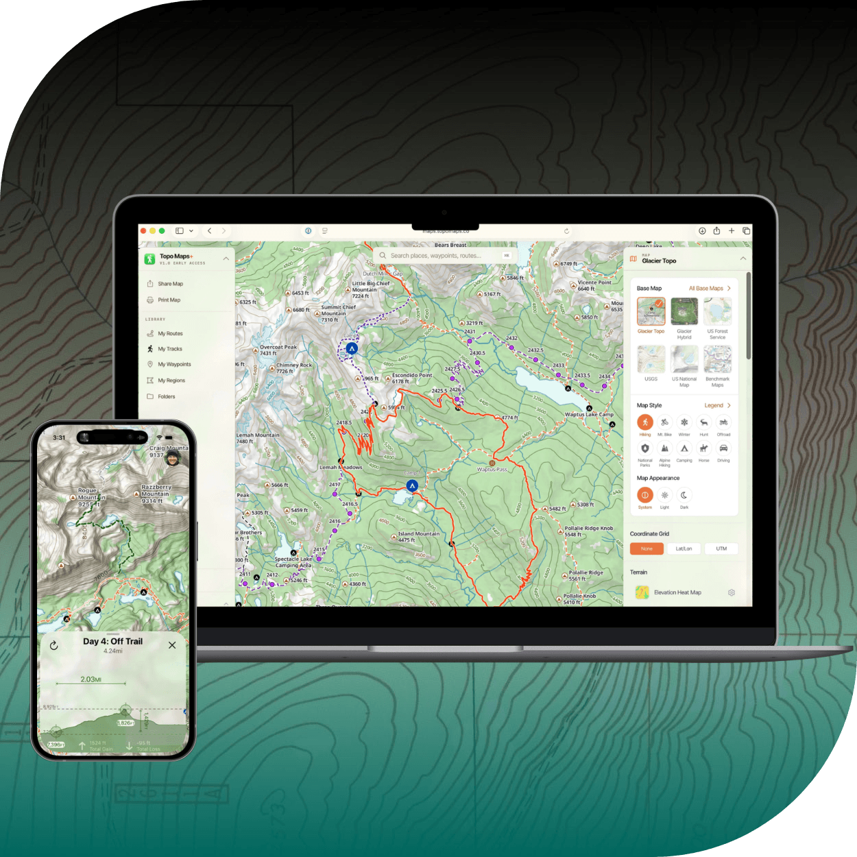
Topo Maps+ is an offline topographic mapping app built for people who need dependable maps beyond cell service.
Originally created for hikers and backpackers in the United States, Topo Maps+ has grown into a map-building tool for anyone who needs to plan, record, customize, and use topographic maps in the field. Users can build routes, add waypoints, record tracks, mark campsites, plan safety routes, and share custom maps with others before heading into the backcountry.
While hiking and backpacking remain important use cases, Topo Maps+ is also used by hunters, outdoor professionals, and people working with large tracts of wilderness land.
CHALLENGE
Knowing the terrain was only half the picture
Topo Maps+ users do not just need a map of terrain. Many of them also need to understand land access.
For hunters, private land context is especially important. Users may need to know whether they are on public or private land, identify parcel boundaries near a hunting area, or contact a landowner to request permission before entering a property. In some cases, that information can matter in the moment, such as when a hunter needs to responsibly track an animal that has crossed onto private land.
Topo Maps+ was hearing this need directly from users. Hunters repeatedly asked for two things: hunting units and private land information. Without private parcel data, Topo Maps+ had a gap in the experience and could not fully pursue the hunting market.
"We couldn’t really market to hunters without the private data,” Stephen Johnson said. “When we were talking to hunters, they were like, I need these two things, over and over and over.
Parcel data was also relevant to another unexpected user group: real estate professionals working with large tracts of wilderness or forest land. These users were not selling typical residential homes. They were evaluating and working with large rural properties where boundaries, ownership, and land context matter.
Topo Maps+ needed a way to add a parcel layer to their app without having to source, clean, standardize, and maintain that data themselves.
Other providers Stephen evaluated were often built around traditional real estate use cases. They offered large property data packages with details Topo Maps+ did not need, such as bedrooms, square footage, and remodeling history. What Topo Maps+ needed was much more specific: parcel boundaries, owner names, and owner mailing addresses.
The team also wanted confidence that the data provider would stay on top of changing rules around public owner information. Stephen did not want to monitor every state-level change himself or manually manage redactions when local laws changed.
SOLUTION
Parcel boundaries and ownership, through one API
Topo Maps+ chose Regrid’s Parcel API to power its private parcel layer in the United States.
Regrid tailored the solution around the specific information Topo Maps+ needed: parcel boundaries, owner names, and owner mailing addresses. Topo Maps+ was not building a traditional real estate app, so it did not need property details like bedrooms, square footage, or remodeling history.
Regrid gave Topo Maps+ the parcel data its users actually needed, without bundling in property attributes built for a different market.
“A lot of the other providers were really focused on the real estate market,” Stephen said. “We didn’t need to know how many bedrooms were in the house. We didn’t need to know the square footage of the house.”
Regrid’s willingness to work with Topo Maps+ on the right data package and pricing model was a major reason the partnership worked.
“What stood out was Regrid’s willingness to work with us on a solution that fit the market we were going after, including the right pricing and packaging,” Stephen said.
The API also reduced the operational burden on the Topo Maps+ team.
Regrid keeps track of the local rules and data changes that affect parcel information, including when certain owner details need to be removed from public display. For Stephen, that means his team can rely on Regrid’s expertise instead of trying to track every state-level rule change themselves.
“Regrid stays on top of all the laws and the changes and all of those things,” Stephen said. “We don’t have to be trying to track as individual states or provinces pass different things. We can just use the API and have confidence that we’re going to be in compliance.”
RESULTS
More value for hunters. Less data work for the team.
With Regrid, Topo Maps+ was able to add private parcel data to its highest subscription tier and better serve one of its most important user groups: hunters and backcountry users.
Parcel data gives these users the private land context they were already asking for. They can understand parcel boundaries and ownership alongside the topographic maps, routes, waypoints, hunting units, and planning tools they already use in Topo Maps+.
For many users in the top subscription tier, hunting units and private property parcels are two of the main reasons they choose that plan. Stephen estimates that roughly 15–20% of the Topo Maps+ user base is on that highest tier.
Regrid also keeps the parcel layer simpler to manage behind the scenes. Topo Maps+ does not have to source and maintain parcel data on its own, monitor state-by-state rule changes, or work with a larger real estate data package filled with property details its users do not need.
Reliability has also been important. The Regrid API has worked smoothly for Topo Maps+, giving Stephen confidence that the parcel layer will be there when users need it.
“We’ve never had an issue with it,” Stephen said. “We can just use the API and have confidence.”
For Topo Maps+, Regrid provides the private parcel data its users need in the field, while allowing the team to stay focused on building a better backcountry navigation experience.
See how Regrid has helped others


















(888) 4RE-GRID
Subscribe for email updates