regrid_tm_forest
Sign In
  • Products ⌄

    Regrid premium parcel data menu icon Premium parcels

    • global-icon Global parcels
    • US Parcel Data U.S. parcels
    • Europe-icon-navigation European parcels
    • Canada Parcel Data Canadian parcels
    • map-location-pin-regrid-icon U.S. coverage map

    ai-ml-navigation-icon (1) AI and ML tools

    • mcp-server-navigation MCP Server

    roadway-row-icon_2025-1 Roadway ROW

    • roadway-row-icon_2025 U.S. roadway polygons

    Spatial add-ons menu icon Spatial add-ons

    • Matched building footprints menu icon Matched building footprints
    • Matched secondary addresses menu icon Matched secondary addresses
    • Standardized zoning menu icon Standardized zoning
    • Enhanced property ownership menu icon Daily ownership updates

    Data access icon Delivery methods

    • Bulk files icon Bulk files
    • Feature Service Feature service
    • api-icon_2025 Parcel API and tiles
    • Green icon of a shopping cart with check mark Data store
  • Industries ⌄

    industries-we-serve Industries we serve

    • aec-navigation-icon Architecture, engineering, and construction (AEC)
    • re-navigation-icon Real estate
    • gov-navigation-icon Government
    • ag-navigation-icon Agriculture
    • energy-navigation-icon Renewable energy and utilities
    • telco-navigation-icon Broadband and telecommunications
    • insurance-navigation-icon Insurance and finance
    • ai-ml-navigation-icon AI and machine learning
    • transportation-navigation-icon Transportation and logistics
  • Data store
  • Property App
  • Esri users
  • Resources ⌄

    Support menu icon Support

    • Support site menu icon Support site
    • Tutorial videos menu icon Tutorial videos
    • blog_resources_icon-1 Parcel schema
    • Regrid icon Sign into the Regrid Property App

    Content menu icon Content

    • Blog menu icon Blog
    • Customer stories menu icon Customer Stories
    • Reports menu icon Reports
    • data-store-2 Coverage map
    • Green file icon representing all resources All resources

    Programs menu icon Programs

    • Regrid giving menu icon Regrid Giving
    • dwp-navigation-icon copy Data with Purpose

    shop icon Shop

    • merch_icon_2025 Regrid Merch
  • Contact us

Contact us
  • Products ⌄

    Premium parcels

    • Global parcels
    • U.S. parcels
    • European parcels
    • Canadian parcels
    • U.S. coverage map

    Spatial add-ons

    • Matched building footprints
    • Matched secondary addresses
    • Standardized zoning
    • Daily ownership updates

    AI and ML tools

    • MCP Server

    Delivery methods

    • Bulk files
    • Feature service
    • Parcel API and tiles
    • Data store

    Roadway ROW

    • U.S. roadway polygons
  • Industries ⌄

    Industries we serve

    • Architecture, engineering, and construction (AEC)
    • Real estate
    • Government
    • Agriculture
    • Renewable energy and utilities
    • Broadband and telecommunications
    • Insurance and finance
    • AI and machine learning
    • Transportation and logistics
  • Data store
  • Property App
  • Esri users
  • Resources ⌄

    Support

    • Support site
    • Tutorial videos
    • Parcel schema
    • Sign into the Regrid Property App

    Programs

    • Regrid Giving
    • Data with Purpose

    Content

    • Blog
    • Customer Stories
    • Reports
    • Coverage map
    • All resources

    Shop

    • Regrid Merch
  • Contact us
TPL logo white

CASE STUDY | NON-PROFIT

How the Trust for Public Land used Regrid to build the first parcel-level climate investment tool

Discover how the Trust for Public Land built a nationwide carbon mapping tool covering 1.3 billion acres, helping conservation organizations, investors, and public agencies identify properties with high carbon storage potential.

Contact enterprise sales
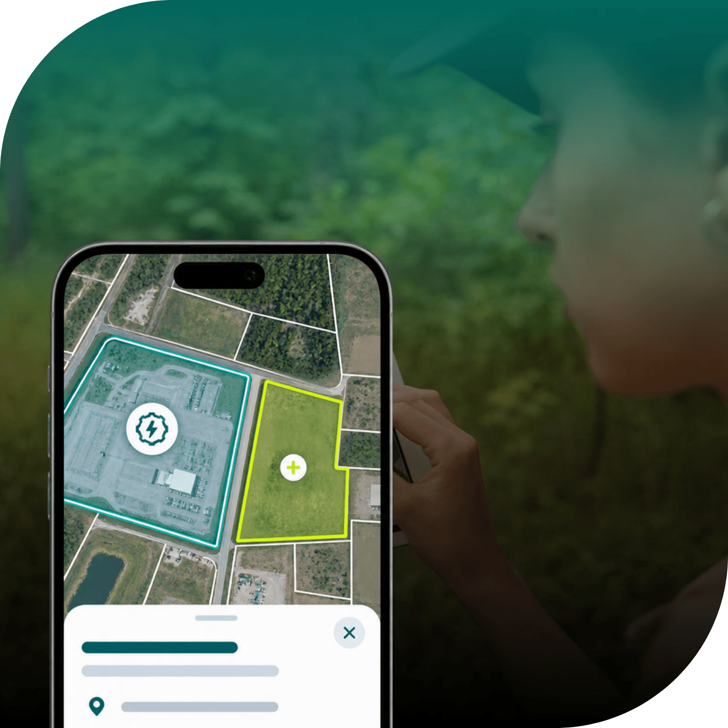
Smart phone screen showing a dashboard of parcel overlays against a background of someone standing in nature looking at a tablet screen

INDUSTRY

Non-Profit

REGION

USA

PRODUCT

Enterprise Data

WEBSITE

https://www.tpl.org/

Jump to:

01 Overview

02 About

03 Challenge

04 Solution

05 Results

06 Contact

CHALLENGE

Fragmented carbon datasets and property records made it difficult to identify individual properties with high carbon storage potential, understand land ownership, and evaluate conservation opportunities.

SOLUTION

Using Regrid's standardized nationwide parcel data, the Trust for Public Land built a first-of-its-kind carbon mapping tool that connects environmental insights with individual properties across 1.3 billion acres.

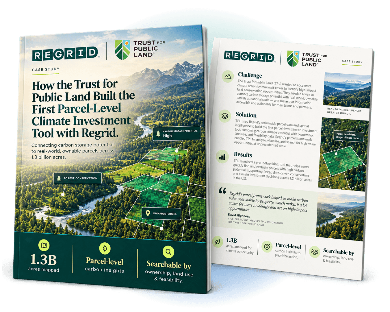
Trust for Public Land case study title page and index page

"Regrid’s parcel framework helped us make carbon value searchable by property, which makes it a lot easier for users to identify and act on high-impact opportunities."

David Highness
Trust for Public Land

ABOUT

Protecting land and creating healthier, more connected communities

The Trust for Public Land (TPL) is a nonprofit conservation organization dedicated to protecting natural landscapes and creating parks and public spaces.

Through its carbon mapping initiative, TPL set out to help conservation organizations, investors, and public agencies incorporate carbon storage potential into land protection and investment decisions.

CHALLENGE

Bridging the gap between carbon storage potential and land ownership

While environmental datasets can reveal the carbon storage potential of landscapes, they rarely provide the property-level context needed to pursue conservation opportunities.

Identifying promising areas is only the first step. Decision-makers also need to understand property boundaries, ownership, land use, and the feasibility of protecting individual properties.

With this information spread across multiple datasets, evaluating conservation opportunities required considerable research.

TPL needed a consistent nationwide parcel framework to connect environmental intelligence with the properties where conservation decisions take place.

SOLUTION

Connecting carbon data with individual properties through a standardized parcel framework

TPL used Regrid's nationwide parcel boundaries, ownership information, and standardized land use classifications as the geographic foundation for its Conservation Carbon Map.

By integrating carbon storage estimates with this parcel data, TPL developed an interactive GIS platform spanning all 50 states.

Users can explore and compare properties based on their carbon value, land characteristics, ownership type, and conservation feasibility.

This combination enables users to move beyond landscape-scale environmental analysis and investigate specific land protection and investment opportunities.

RESULTS

Mapping carbon storage potential across 1.3 billion acres to inform conservation investment

TPL's platform makes carbon storage potential searchable at the property level across 1.3 billion acres.

Conservation teams can identify promising properties, investigate ownership, and evaluate acquisition opportunities more efficiently. The platform also helps surface potentially overlooked opportunities in regions where land costs are lower.

Research that previously took weeks can now be completed in minutes, giving land trusts, investors, and public agencies more time to focus on evaluating and pursuing opportunities.

With Regrid's parcel data as its spatial foundation, TPL's Conservation Carbon Map helps turn environmental research into practical insights for land conservation and climate investment.


See how Regrid has helped others

View all case studies
CREtelligent logo
Esri Logo
Autodesk logo
Langan logo
Burns & McDonnell logo
Agcor logo
Bloom Spatial logo
UC Berkeley logo
Upstream Tech logo
Crexi logo
Dycom logo
CQA logo
TomTom logo
Amazon logo
Polaris logo
United States Census Bureau logo
BCG logo

Let's explore what parcel data can do for you

Tell us a bit about your parcel data needs, and we’ll help you find the right coverage, delivery method, and product fit for your workflow.
*required
logo

(888) 4RE-GRID

  • Contact us
  • Customer support
  • Privacy policy
  • Terms of use
  • Cookie Preferences

Subscribe for email updates

Company

  • About Regrid
  • Careers
  • Press
  • Shop Regrid merch

Resources

  • Coverage map
  • Support center
  • Reports
  • Regrid status page

Enterprise Solutions

  • U.S. parcels
  • Canada parcels
  • Europe parcels
  • Parcel and tiles API
  • Roadway Right-of-Way

Self-serve solutions

  • Regrid Property App
  • Shop the Data Store
  • API monthly plans