regrid_tm_forest
Sign In
  • Products ⌄

    Regrid premium parcel data menu icon Premium parcels

    • global-icon Global parcels
    • US Parcel Data U.S. parcels
    • Europe-icon-navigation European parcels
    • Canada Parcel Data Canadian parcels
    • map-location-pin-regrid-icon U.S. coverage map

    ai-ml-navigation-icon (1) AI and ML tools

    • mcp-server-navigation MCP Server

    roadway-row-icon_2025-1 Roadway ROW

    • roadway-row-icon_2025 U.S. roadway polygons

    Spatial add-ons menu icon Spatial add-ons

    • Matched building footprints menu icon Matched building footprints
    • Matched secondary addresses menu icon Matched secondary addresses
    • Standardized zoning menu icon Standardized zoning
    • Enhanced property ownership menu icon Daily ownership updates

    Data access icon Delivery methods

    • Bulk files icon Bulk files
    • Feature Service Feature service
    • api-icon_2025 Parcel API and tiles
    • Green icon of a shopping cart with check mark Data store
  • Industries ⌄

    industries-we-serve Industries we serve

    • aec-navigation-icon Architecture, engineering, and construction (AEC)
    • re-navigation-icon Real estate
    • gov-navigation-icon Government
    • ag-navigation-icon Agriculture
    • energy-navigation-icon Renewable energy and utilities
    • telco-navigation-icon Broadband and telecommunications
    • insurance-navigation-icon Insurance and finance
    • ai-ml-navigation-icon AI and machine learning
    • transportation-navigation-icon Transportation and logistics
  • Data store
  • Property App
  • Esri users
  • Resources ⌄

    Support menu icon Support

    • Support site menu icon Support site
    • Tutorial videos menu icon Tutorial videos
    • blog_resources_icon-1 Parcel schema
    • Regrid icon Sign into the Regrid Property App

    Content menu icon Content

    • Blog menu icon Blog
    • Customer stories menu icon Customer Stories
    • Reports menu icon Reports
    • data-store-2 Coverage map
    • Green file icon representing all resources All resources

    Programs menu icon Programs

    • Regrid giving menu icon Regrid Giving
    • dwp-navigation-icon copy Data with Purpose

    shop icon Shop

    • merch_icon_2025 Regrid Merch
  • Contact us

Contact us
  • Products ⌄

    Premium parcels

    • Global parcels
    • U.S. parcels
    • European parcels
    • Canadian parcels
    • U.S. coverage map

    Spatial add-ons

    • Matched building footprints
    • Matched secondary addresses
    • Standardized zoning
    • Daily ownership updates

    AI and ML tools

    • MCP Server

    Delivery methods

    • Bulk files
    • Feature service
    • Parcel API and tiles
    • Data store

    Roadway ROW

    • U.S. roadway polygons
  • Industries ⌄

    Industries we serve

    • Architecture, engineering, and construction (AEC)
    • Real estate
    • Government
    • Agriculture
    • Renewable energy and utilities
    • Broadband and telecommunications
    • Insurance and finance
    • AI and machine learning
    • Transportation and logistics
  • Data store
  • Property App
  • Esri users
  • Resources ⌄

    Support

    • Support site
    • Tutorial videos
    • Parcel schema
    • Sign into the Regrid Property App

    Programs

    • Regrid Giving
    • Data with Purpose

    Content

    • Blog
    • Customer Stories
    • Reports
    • Coverage map
    • All resources

    Shop

    • Regrid Merch
  • Contact us
UC Berkeley logo white

CASE STUDY | EDUCATION

How UC Berkeley researchers used Regrid parcel data to uncover groundwater inequality in California

Discover how UC Berkeley researchers connected groundwater well records with land ownership data across California's Central Valley, revealing significant inequalities in the control of agricultural land and groundwater resources.

Download full case study
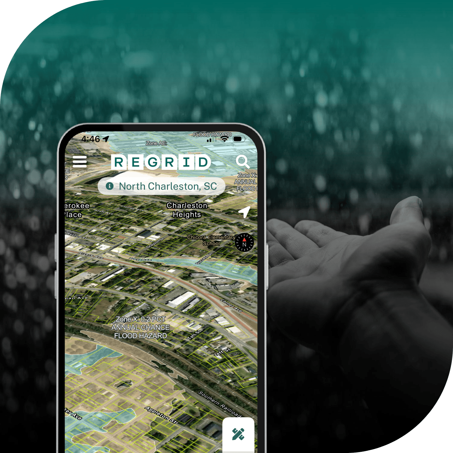
Regrid app showing zoned parcels and information screen overlaid on image of outstretched hand in the rain

INDUSTRY

Education

REGION

US, California

PRODUCT

Enterprise Data

WEBSITE

https://www.berkeley.edu/

Jump to:

01 Overview

02 About

03 Challenge

04 Solution

05 Results

06 Download

07 Contact

CHALLENGE

Incomplete groundwater well records and inconsistent property data across 19 counties made it difficult for UC Berkeley researchers to identify well owners and investigate inequalities in groundwater access.

SOLUTION

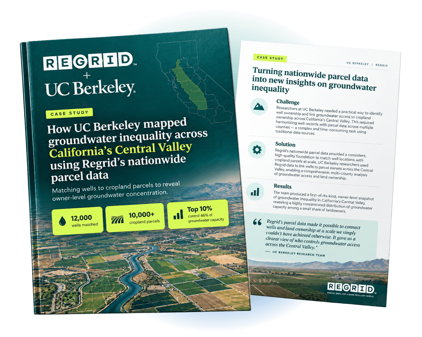
Using Regrid's standardized parcel data, researchers matched 12,000 groundwater wells to more than 10,000 cropland parcels, enabling the first quantitative analysis of land and groundwater inequality at the ownership level across California's Central Valley.

Title and intro page of UC Berkeley x Regrid case study

"We wouldn’t have been able to know who owns which wells or where they were located without the Regrid data."

Benji Reade Malagueño
Researcher, UC Berkeley

ABOUT

Exploring the relationship between natural resources, land ownership, and environmental equity

The University of California, Berkeley's Department of Environmental Science, Policy, and Management (ESPM) brings together research into environmental and social systems to inform sustainable resource management and policy.

In this project, researchers examined the distribution of agricultural land and groundwater resources across California's Central Valley, seeking to better understand inequalities in resource ownership and access.

CHALLENGE

Fragmented property and well records obscured groundwater ownership patterns

Understanding groundwater inequality requires more than knowing where wells are located. Researchers also need to establish who owns them and how that ownership relates to agricultural land.

Publicly available well records frequently omit ownership information or provide only approximate locations. Meanwhile, differences in data structures and maintenance practices across 19 county assessor offices complicated regional property analysis.

The research team needed a consistent property dataset to connect these records and investigate resource ownership across county boundaries.

SOLUTION

Connecting groundwater infrastructure to land ownership with standardized parcel data

Through Regrid's Data With Purpose program, UC Berkeley researchers accessed a standardized multi-county parcel dataset, delivered as bulk files via SFTP and analyzed in RStudio.

Assessor's Parcel Numbers (APNs), ownership details, addresses, and parcel geometry provided the essential information for connecting agricultural properties with groundwater wells.

The researchers combined attribute matching with spatial analysis to account for limitations in the available well location information.

This approach made it possible to investigate the relationship between groundwater and agricultural land ownership within a consistent analytical framework.

"This project really came about because one of our colleagues discovered the Regrid data and encouraged us to look into it. Once we saw what was possible, everything followed from there."

-  Benji Reade Malagueño

RESULTS

Revealing significant inequalities in land and groundwater ownership

The research team matched 12,000 groundwater wells to more than 10,000 cropland parcels, producing a first-of-its-kind quantitative assessment of resource ownership inequality across California's Central Valley.

The analysis revealed that the top 10% of well owners control 46% of groundwater capacity, with agricultural land ownership showing even greater inequality.

These findings raise important questions about the relationship between property ownership and water governance under California's Sustainable Groundwater Management Act (SGMA).

With Regrid parcel data as the foundation, the researchers were able to examine patterns of resource ownership that fragmented public records had previously made difficult to quantify.


Want to learn more? Download the full case study

CREtelligent logo
Esri Logo
Autodesk logo
Langan logo
Burns & McDonnell logo
Agcor logo
Bloom Spatial logo
UC Berkeley logo
Upstream Tech logo
Crexi logo
Dycom logo
CQA logo
TomTom logo
Amazon logo
Polaris logo
United States Census Bureau logo
BCG logo

Let's explore what parcel data can do for you

Tell us a bit about your parcel data needs, and we’ll help you find the right coverage, delivery method, and product fit for your workflow.
*required
logo

(888) 4RE-GRID

  • Contact us
  • Customer support
  • Privacy policy
  • Terms of use
  • Cookie Preferences

Subscribe for email updates

Company

  • About Regrid
  • Careers
  • Press
  • Shop Regrid merch

Resources

  • Coverage map
  • Support center
  • Reports
  • Regrid status page

Enterprise Solutions

  • U.S. parcels
  • Canada parcels
  • Europe parcels
  • Parcel and tiles API
  • Roadway Right-of-Way

Self-serve solutions

  • Regrid Property App
  • Shop the Data Store
  • API monthly plans