






.png)






.svg)


.png)
























.png)

Announcing Parcels: How Property Shapes Geography — A new book from Esri Press by Jerry Paffendorf and Nancy von Meyer
Every community, building, farm, and infrastructure project rests on land property boundaries. Yet, despite being foundational to how we organize modern life, the property lines that divide our world remain invisible to the naked eye. Knowing and mapping these boundaries reveals how society structures land ownership, manages resources, and plans for the future.
Understanding these land parcels has been Regrid’s mission from the start. Today, we are excited to announce that Regrid CEO and co-founder Jerry Paffendorf, alongside parcel systems expert Nancy von Meyer, have co-authored Parcels: How Property Shapes Geography, published by Esri Press as part of The Power of Where Collection.
The book is now available for digital preview and pre-order ahead of its full publication on September 15th.
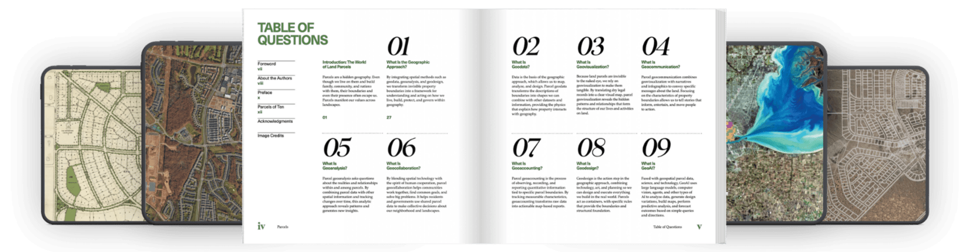
Most books have a table of contents; Parcels has a table of questions. Why? Because understanding land is about asking the right spatial questions; questions we explore in this book.

Where it all began
The story behind Parcels began in 2017 when Jerry and Nancy first crossed paths at a URISA conference (now the Geospatial Professionals Association).
At the time, Jerry and the Regrid team were tackling property challenges block-by-block in Detroit while building the foundation for a nationwide parcel map. Nancy was deep into a storied career establishing land record standards with state and national organizations, having previously authored Esri Press’s GIS and Land Records: The Parcel Data Model.
Though coming from different corners of the geospatial world, they were bound by the same idea: land records are the foundation of spatial intelligence, but they needed to be standardized, accessible, and humanized.
Co-authoring Parcels brought together decades of deep institutional wisdom with the frontline realities of modern parcel mapping.
As Jerry reflected on the collaborative writing process:
“Thoughtfully handcrafting books in the age of self-generating word machines has its charms.”
- Jerry Paffendorf, CEO and Co-founder orf Regrid
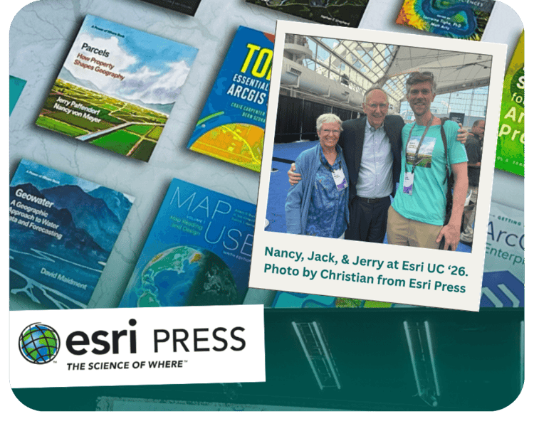
Not every day you get the co-authors of Parcels and the founder of Esri in one frame! We had an incredible time launching the book at Esri UC 2026—big thanks to Jack Dangermond and the entire Esri Press team for making it a week to remember.
Inside the book: A journey through land and time
If you thought parcels were just a boring administrative unit, think again.
Parcels reveals property boundaries as the fundamental "actionable unit of geography"—the place where law, history, ownership, and physical location meet. Instead of treating land records like dry database rows, the book takes you on a tour through how these invisible lines actually shape human life.
You’ll travel back to ancient Egypt, where the goddess Seshat measured pyramid bases and farm plots after the Nile flooded, and to ancient Rome, where people worshipped boundary stones under the god Terminus. From there, the book brings you straight into modern streets, using Detroit as a recurring character to show how parcel data helps city leaders, researchers, and community groups tackle housing and urban planning head-on. By the end, the authors even look upward, asking what parcel frameworks might look like as humanity begins mapping the Moon and deep space.
Parcels also adds GeoAI to Jack Dangermond’s spatial framework
Beyond history and neighborhood stories, the book builds directly on Esri President Jack Dangermond’s vision in The Power of Where, which established seven key spatial methods for solving real-world problems.
Parcels takes that foundation a step further by officially introducing an 8th method to the spatial framework: GeoAI.
Rather than treating artificial intelligence as a distant buzzword, Jerry and Nancy walk through how tools like large language models, computer vision, and spatial AI agents interact with parcel data in practice. They show how spatial analysts and city planners can move from manually hunting through property databases to running natural language queries—asking complex questions about land use patterns, automating tedious workflows, and modeling future growth scenarios in real time.
Part of the Power of Where Collection
Parcels doesn't stand alone. It debuts as one of the inaugural titles in Esri Press’s Power of Where Collection, which launched on the main stage at the Esri User Conference in San Diego.
The broader collection brings together spatial thinkers and industry leaders to show how location intelligence solves complex, real-world problems. By anchoring property boundaries as a core pillar of the series, Esri Press highlights a simple truth: whether you are managing natural resources, planning public transit, or tackling climate resilience, almost every spatial decision eventually comes down to the land beneath our feet and who controls it.
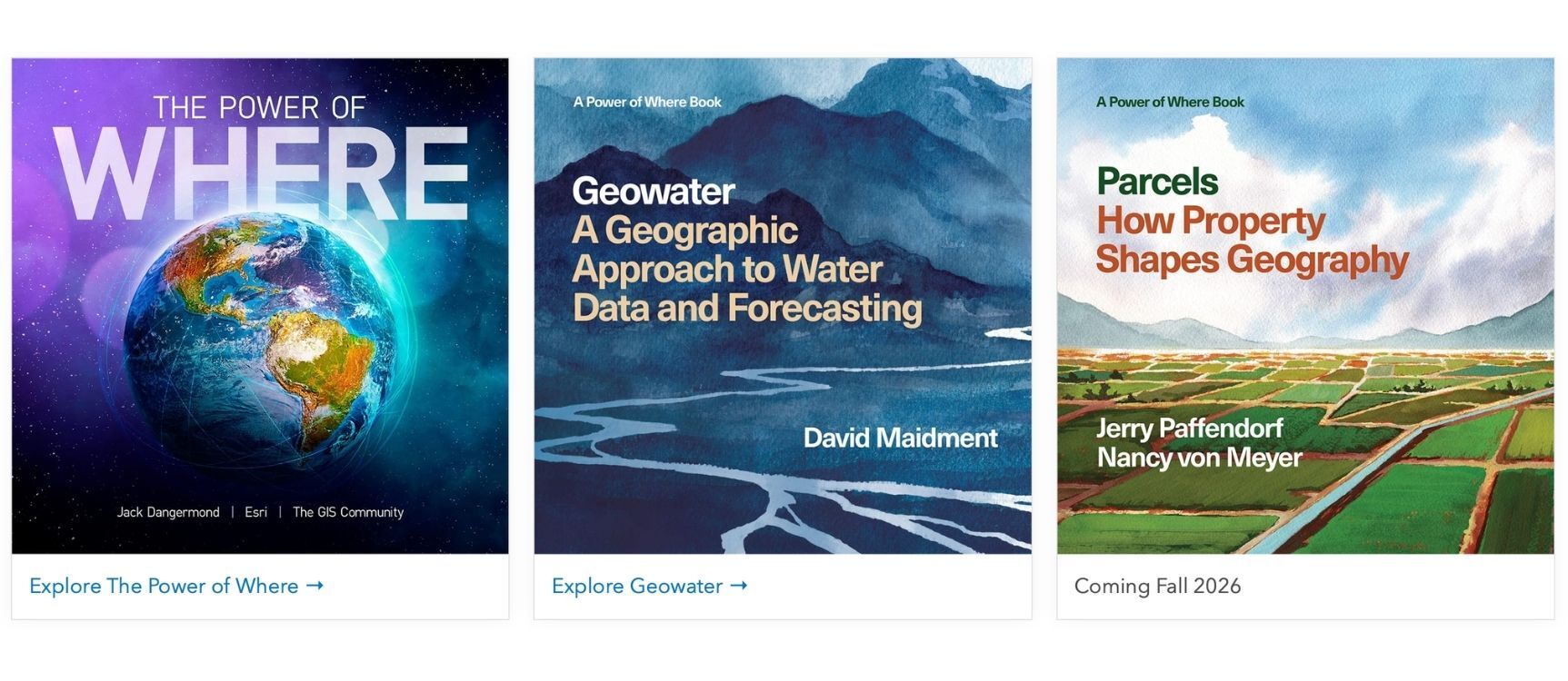
A look at the full "Power of Where" collection lineup from Esri Press! We’re honored to have Parcels featured as a foundational piece of this series, anchoring property boundaries as a core pillar of modern spatial analysis
How to get your copy and start reading today
Whether you spend your days working in local government, commercial real estate, urban planning, or GIS, Parcels gives you a front-row seat to the invisible boundary lines that shape our everyday world.
You can dive in right now with an advance digital preview on Esri Press to get a feel for the chapters.
If you are looking to secure a physical copy, pre-orders are open across online booksellers including IndiePubs, Amazon, and Barnes & Noble. If you order through IndiePubs, you can use the code PARCELS40 at checkout for 40% off your pre-order while supplies last.
Head over to our Parcels Book Page for a short synopsis and read author bios, or visit powerofwhere.com to check out the rest of the series.
