Regrid logo, registered trademark
  • Enterprise

    Regrid premium parcel data menu icon Premium Parcels

    • US Parcel Data U.S. Parcels
    • Canada Parcel Data Canadian Parcels
    • global-icon Global Parcels

    Spatial add-ons menu icon Spatial Add-Ons

    • Matched building footprints menu icon Matched Building Footprints
    • Matched secondary addresses menu icon Matched Secondary Addresses
    • Standardized zoning menu icon Standardized Zoning
    • Enhanced property ownership menu icon Daily Ownership Updates

    road icon Roadway ROW

    • Roadway polygons icon U.S. Roadway Polygons

    Data access icon Data Access

    • data-store-2 Coverage Map
    • blog_resources_icon-1 Parcel Schema
    • Bulk files icon Bulk Files
    • Feature Service Feature Service
    • api-icon_2025 Parcel API & Tiles
    • API Sandbox icon Interactive API Sandbox
  • Data Store
  • Regrid App
  • Esri Users
  • Resources

    Support menu icon Support

    • Support site menu icon Support Site
    • Tutorial videos menu icon Tutorial Videos

    Content menu icon Content

    • Blog menu icon Blog
    • Customer stories menu icon Customer Stories
    • Reports menu icon Reports

    Programs menu icon Programs

    • academia_menu-icon Nonprofit & Academia
    • Regrid giving menu icon Regrid Giving
  • Contact Us
Contact Us
  • Enterprise

    Premium Parcels

    • U.S. Parcels
    • Canadian Parcels
    • Global Parcels

    Roadway ROW

    • U.S. Roadway Polygons

    Spatial Add-Ons

    • Matched Building Footprints
    • Matched Secondary Addresses
    • Standardized Zoning
    • Daily Ownership Updates

    Data Access

    • Coverage Map
    • Parcel Schema
    • Bulk Files
    • Feature Service
    • Parcel API & Tiles
    • Interactive API Sandbox
  • Data Store
  • Regrid App
  • Esri Users
  • Resources

    Support

    • Support Site
    • Tutorial Videos

    Programs

    • Nonprofit & Academia
    • Regrid Giving

    Content

    • Blog
    • Customer Stories
    • Reports
  • Contact Us

The Regrid Blog

Discover the Latest in Land Parcels & Spatial Data with the Regrid Team!

Regrid Blog

Living In The Map

Categories

  • Announcements
  • Parcel Data Updates
  • Democratizing Data
  • Regrid Updates
  • Product How-To
  • Use Cases
  • Customer & Guest Blogs
  • All About Parcel Data
  • Working at Regrid
  • Regrid 100
  • Reports

Report: new data gives insight into trends on Cleveland's east side

Nick April 1, 2019
Cleveland OH east side


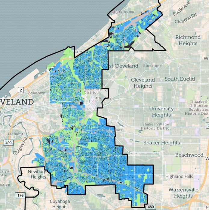
In the summer of 2018 Loveland Technologies partnered once more with longtime allies Western Reserve Land Conservancy to re-survey more than 78,000 parcels on Cleveland’s east side. Using a blended staff from Loveland, WRLC and local Cleveland surveyors, the survey data was gathered in just ten weeks, with a goal of generating data that could be compared to an earlier citywide survey conducted in 2015.

Cleveland's east side was hit hard by the foreclosure crisis, and many neighborhoods continue to struggle with blight and vacancy. Among other things, the report sheds valuable light on the effectiveness of demolition funding to address vacant and dilapidated housing. Thousands of vacant houses have been demolished, leading to an overall decrease in vacant structures (from 16% in 2015 to 12% in 2018) and a corresponding increase in occupancy for those structures that remain. It also provides interesting context when considered alongside data showing that median home sales value in these neighborhoods have increased - but remain far from pre-housing crisis levels.

Interested in more detail? View WRLC's report by clicking here, check out an article about the report in Cleveland's Plain Dealer here or view the data itself right here on landgrid.com


ExcerpT from WRLC's report:


Legacy cities rely on data concerning vacant properties and building conditions to make informed community development decisions. By preparing and conducting property inventories, Western Reserve Land Conservancy's Thriving Communities program provides municipalities with information to most effectively target their limited resources for rehabilitation and demolition, especially in the wake of the foreclosure crisis. In 2015, the Land Conservancy surveyed 158,800+ parcels within the City of Cleveland. 

In order to truly maximize the power of the 2015 inventory, the conditions of these structures and vacant lots need to be reassessed and evaluated. Though a complete resurvey of the City of Cleveland in 2018 was not possible, the Land Conservancy was able to update the data in 13 at-risk neighborhoods on Cleveland's east side which included 78,000+ parcels.

Previous Next
logo

(888) 4RE-GRID

  • Contact Us
  • Customer Support
  • Privacy Policy
  • Terms of Use

Subscribe for email updates

Company

  • About Regrid
  • Careers
  • Press

Resources

  • Coverage Map
  • Support Center
  • Reports
  • Regrid Status Page

Enterprise Solutions

  • U.S. Parcels
  • Canada Parcels
  • Parcel & Tiles API

Self-Serve Solutions

  • Regrid Property App
  • Shop the Data Store
  • API Monthly Plans