






.png)






.svg)


.png)





















.png)



.png)

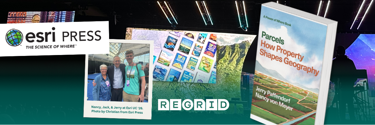
The invisible lines that shape our world: A conversation with the authors of Parcels
What do invisible property lines have to do with Detroit, human settlement, permission, and GeoAI?
In this interview, Parcels authors Jerry Paffendorf and Nancy von Meyer unpack how parcels form the hidden geography beneath the places we live, work, build, and belong.
Most of us cross property boundaries constantly without noticing them.
We walk from one parcel to another on the way to work. We drive across hundreds of them on a road trip. Our homes sit inside them, our neighborhoods are assembled from them, and many of the decisions that determine what can be built, protected, taxed, bought, sold, or changed ultimately resolve to them.
Yet the lines themselves are usually invisible.
That hidden geography is at the heart of Parcels: How Property Shapes Geography, the new Esri Press book by Regrid CEO and co-founder Jerry Paffendorf and parcel systems and land records expert Nancy von Meyer, due out later this year.
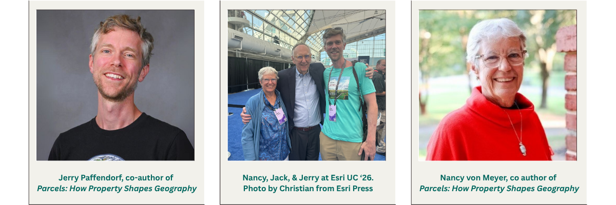
Ahead of the book’s release, we sat down with Jerry and Nancy to talk about what makes parcels so much more than property lines, why Detroit became a recurring character in the book, how their very different careers converged around the same subject, and what happens when AI begins interacting with the parcel fabric.
This is the first of a series of conversations we’ll be sharing with the authors over the months ahead, exploring different ideas, stories, and questions from the book and the much bigger world of parcels behind it.
This conversation has been edited for length and clarity.

If you had to explain to someone why an invisible property line matters, where would you start?
Nancy: The parcel line, the invisible boundary you can’t see, is what ties you to a particular piece of land. It’s a grounding line.
Much like nobody recognizes the third prong on an outlet as the ground outlet, nobody sees the invisible line that you walk over every day as your grounding. But it is the basis for your relationship with your neighbors, for where you walk your dog, for where you put your fences, for where you mow your yard.
It's the thing that defines where you fit. And I think that connects very naturally to the idea of place. Parcels are a way of organizing place—the communities where things happen and where we build relationships.
And when you think of it that way, parcels aren't only about ownership. We also have public parcels.
In my hometown, we have the village green. It's this large public space that's used for children to play, to have picnics, to have concerts, and to meet people. “Meet me on the green” refers to a place. I like that because it expands the concept. It's not all about owning. It's about gathering.
Jerry: I think that's exactly the right thread.
You can think of parcels as this organizational lattice or structure underneath place. We don't normally see it, but it organizes a great deal of what can happen there.
So are parcels fundamentally a real estate system?
Jerry: In the deepest sense, I actually see parcels as more of a permission system than a real estate system.
If you look back through history, these systems haven't always worked the way they do in the United States today, where you have a deed recorded in a database and people can exchange property between themselves.
Historically, systems could be much more top-down—kings, rulers, all sorts of different arrangements. But there was still this idea of space and who was entitled to use that space.
Once humans settle with enough density, you're going to have some system that approximates this. It doesn't have to resemble a modern American parcel system. But there will be some distinction and delineation of space that people understand: this is for this; that's for that; these people are allowed to be here doing this; these people aren't.
That's why I think of the parcel in its deepest sense as a permission system for geography.
Real estate is now an enormously energetic and valuable component of that system, but the deeper phenomenon is the subdividing of space into units with permissions attached to them.
You describe the parcel as the “actionable unit of geography.” What does that actually mean?
Jerry: I use that phrase all the time because I believe it quite literally.
You can know a lot about geography without knowing parcels, but you can never take a lasting action within geography without knowing parcels.
Otherwise, it could be trespassing or property damage.
You can do a geographic analysis and say, “Wow, this would be a great place for me to build a house.” But you can't just go ahead and build it. What you're going to butt up against is the permission system underneath it.
You need to know: Which parcel covers this place? Do I have permission from the owner? Can I become the owner? What are the rules? If I build a giant purple castle here, is the zoning board going to come after me?
That's what I mean by an actionable unit. Can I take an action here, given the rules of this permission system?
A lot of the time, it's like explaining water to a fish. We take the system for granted.
If you roll up to a Dunkin' Donuts, you don't need to know anything about the parcel. All the social cues are there: park here, walk in here. It doesn't matter to you who owns it. But that can give us a false sense that we understand the actionable geography around us.
We don't see most of these boundaries. And because we don't see them, they can invisibly arrest our imagination about what could be in the world—where new housing could go, where development could happen, where something could be protected or changed.
You came to parcels from very different directions. How did those perspectives come together in this book?
Jerry: Nancy and I are sort of the peanut butter and jelly of parcel data.
Nancy has spent her career helping governments with the authoritative work: How do you build this data? How do you standardize it? How do you keep it accessible? How do you get it out to people?
She pursued this vision of a coherent national parcel dataset for many years while helping cities, municipalities and states build the capacity to do parcel data better.
Then I came in and intersected with—and learned from—that world from a very different vantage point.
The Regrid team started in Detroit. We were seeing all of these parcel problems in the city. We were weird enough to observe that a lot of the city's challenges were actually parcel problems, even though nobody really used that language.
Our perspective became: once the authoritative data has been created and made available, what can people actually do with it?
Can we get it to a community group? An urban farmer? Someone trying to solve a problem on their block?
So we approached the same phenomenon from complementary dimensions.
Nancy: And that's part of why the collaboration worked.
There had been a lot of work over many years around building parcel data and making it available. Regrid brought another part of that puzzle: bringing locally created parcel information together while retaining a sensitivity to those local boundaries and records.
Regrid had also been writing about parcels and celebrating its customers and the ways they use the data for years. I had material from my own work. Between us, we almost had a book already.
There's probably another book sitting on the cutting-room floor, to be honest.
At one point, Jerry described writing the book as uncovering a “missing feature of planet Earth.” What did you mean by that?
Jerry: I think it's a privilege in life when you identify something in the world that's very important and has an impact on people, but hasn't really been defined and unpacked in a useful way.
It honestly feels like this book unpacks a missing feature of planet Earth.
Why wasn't this book already written? Why hadn't this phenomenon been unpacked in this way?
There are wonderful books about property, boundaries, land systems and history. But we couldn't find a book that really focuses on the parcel-boundary dimension of the world in this particular way—and especially not one that's so visual.
I love that this book is packed with parcel maps. It's not only words. You can actually see this phenomenon.
Nancy: To me, this isn't really a technical book.
It's a celebration of a discipline, the power of where, and parcels within that power of where.
And a lot of the writing evolved as we went.
We started with our favorite stories and tried organizing them around the different geomethods. That fell apart pretty quickly because those are categories, and sometimes the stories didn't want to live neatly inside them. So we had a lot of false starts.
Then at some point we identified Detroit as an actual character—as a place—and when we made that place a character, the writing came much more easily. It brought the issues to life.
Why Detroit?
Jerry: Detroit is a huge character in the book. It comes back in every chapter, and it has a chapter of its own.
One way to think about why is that Detroit was once a city of around two million people and the fourth-largest city in the United States. Today it has roughly a third of that population.
But even though it lost more than a million people, it didn't lose a single parcel.
What does that mean for living in a place?
It means that when you look at the city and say, “We should fix this neighborhood this way,” or, “We should build this amenity,” or, “Why isn't this a park?”, you're constantly butting up against that invisible fabric.
The parcel fabric hasn't simply disappeared because the population changed.
Instead, you can get fragmented ownership, absentee ownership, accidental city ownership and all sorts of other conditions. So even incredibly well-intentioned people can struggle to build or change things because, to return to that idea of the actionable unit, you can't just work on a parcel you don't have permission to use.
Detroit made that invisible constraint incredibly vivid to us. And that was where the Regrid team first began to see it.
The book also introduces GeoAI as an eighth geomethod. What changes when AI meets parcel data?
Nancy: One of the joyful parts of where this is going is that you can increasingly ask the data questions directly.
You could do a query like: “Show me all the parcels that are owned by the Town of Pendleton in the Town of Pendleton.” And the system can actually begin to mine that data and give you the answer. That changes the interaction.
Historically, parcel information has required people to know how the records are structured, where to find them, how to query them and how to work with the GIS. As these tools improve, that barrier begins to change.
Jerry: GeoAI was also one of the hardest parts of the book to write, because it's moving so quickly.
We didn't want to write a section that just said, essentially, “You can use Chat GPT to ask this particular question.” That's so of-the-moment and so small compared with what's happening.
The tools can change dramatically in six months. So there was a real challenge in trying to write about something that was evolving on so many fronts while the book itself was being written.
But there's another geographic dimension to AI that we look at in the book too: its physical footprint. AI and the data centers that support it ultimately occupy land, which means they sit within the parcel fabric. We look at some of the site-selection questions and controversies surrounding data centers, which are clearly a hot topic, and tried to handle that discussion with balance.
There’s also an interesting historical parallel in Detroit. Long before today’s data centers, enormous automotive manufacturing plants were being built across the city’s parcel fabric to construct what you might think of as robots we call cars. Looking at AI through that longer geographic lens helps connect a rapidly changing technology back to an older question: where does the infrastructure behind technological change actually go?
So AI enters the parcel story in both directions: as a rapidly evolving way to understand and interact with geographic information, and as a technology whose own physical infrastructure has to exist somewhere in the geography we’re trying to understand.
After spending so long writing about parcels, what do you hope people do with the book?
Jerry: One of the most important things is: go hands-on with parcels.
You don't need to just listen to us talk about why they're fascinating.
Go look up your house. Go look up your neighborhood. Explore some of these things yourself.
Part of what we're trying to reveal is this whole system that's sitting there underneath the places you already know.
Once you begin to see that parcel fabric, you start seeing your surroundings differently.
Nancy: There is a love of the work underneath all of this, but also a love of the outcome of the work.
For me, that means helping the people who need parcel data have the best parcel data and be able to do their work as well as they can.
And then you're celebrating the success of the people using it. I think that's really what the book is about.
See the invisible geography for yourself
Parcels: How Property Shapes Geography by Jerry Paffendorf and Nancy von Meyer explores the parcel from the scale of a single property outward—through neighborhoods, cities, governments, economies and the emerging possibilities of GeoAI.
Ready to explore the world of parcels? Read the free digital preview or pre-order on IndiePubs. Use promo code PARCELS40 on IndiePubs for 40% off your pre-order.
