Regrid logo, registered trademark
  • Enterprise Solutions

    Regrid parcel data Regrid Parcel Data

    Bulk files delivered in the format your business needs.

    • parcel -data Nationwide Parcel Data
    • matched building footprints menu icon Matched Building Footprints
    • matched secondary addresses menu icon Matched Secondary Addresses
    • enhanced ownership menu icon Enhanced Ownership

    feature service menu icon Regrid Feature Service

    Get data delivery straight into your Esri-stack, no custom integration required.

    regrid api menu icon Regrid API

    Integrate parcel boundaries & records into your app, SaaS, or map.
    • Parcel and Tiles APIcon Parcel & Tiles API
    • typeahead api icon Typeahead API
  • Self Serve Options

    Regrid Property App menu icon Regrid Property App

    Take Regrid property data wherever you go - available for web, iOS, & Android.

    data-store-2 Shop the Data Store

    Instantly download parcel geometries & associated records, by county and state.

    self-serve parcel api menu icon API Monthly Subscriptions

    Sign up and try this nationwide parcel API, free for 7 days.

    api sandbox icon Interactive API Sandbox

    Explore the API Sandbox with complete feature access to 7 counties plus Puerto Rico.
  • Markets

    Regrid for Broadband Market Broadband

    Regrid for data science Data Science

    Parcel data for green initiatives Sustainable Initiatives

    Parcel data for real estate Real Estate

    Parcel data for nonprofit and academia Nonprofit & Academia

    Regrid's Data With Purpose program - propose your own budget to access land parcel data. 

    Plus sign icon Your Business or Organization

    Regrid’s data spans all industries needing land insight.
  • Resources

    support menu icon Support

    Access documentation & support materials to learn about Regrid data.
    • Support site resource icon Support Site
    • tutorial videos resources icon Tutorial Videos
    • parcel data faqs resources icon Parcel Data FAQs
    • property app faqs Property App FAQs
    • coveragemap_resources_icon Coverage Map
    • land use codes menu item Land Use Codes
    • vacancy data menu icon Vacancy Data

    content resources menu icon Content

    Dive into Regrid's world of land parcels & learn about location intelligence.
    • blog resources icon Blog
    • webcasts resources icon Webcasts
    • reports resources icon Reports
    • podcast resources icon Living In The Map

    customers resources icon Customers

    Hear what our customers say have to say & see how they use Regrid data.
    • testimonials resources icon Testimonials
    • Case Studies resources icon Case Studies
  • Contact Us

    Contact a parcel data expert menu icon Contact A Parcel Data Expert

    Contact Regrid parcel data experts to learn more about our offerings.

    Customer Support menu icon Customer Support

    Contact our customer support team & get the help you need.

    megamenu nav image Press & Media Inquires

    Find the information you need & get in touch with our marketing department.
  • Go To Map
Go To Map
  • Enterprise Solutions

    Regrid Parcel Data

    • Nationwide Parcel Data
    • Matched Building Footprints
    • Matched Secondary Addresses
    • Enhanced Ownership

    Regrid Feature Service

    Regrid API

    • Parcel & Tiles API
    • Typeahead API
  • Self Serve Options

    Regrid Property App

    Shop the Data Store

    API Monthly Subscriptions

    Interactive API Sandbox

  • Markets

    Broadband

    Data Science

    Sustainable Initiatives

    Real Estate

    Nonprofit & Academia

    Your Business or Organization

  • Resources

    Support

    • Support Site
    • Tutorial Videos
    • Parcel Data FAQs
    • Property App FAQs
    • Coverage Map
    • Land Use Codes
    • Vacancy Data

    Content

    • Blog
    • Webcasts
    • Reports
    • Living In The Map

    Customers

    • Testimonials
    • Case Studies
  • Contact Us

    Contact A Parcel Data Expert

    Customer Support

    Press & Media Inquires

  • Go To Map

Regrid Reports

Check out the official reports on customer property survey and data analyses projects using the Regrid Parcel Data

Regrid Blog

Living In The Map

Categories

  • Reports

A School District in Crisis

John Grover January 24, 2016

The goal of this report is to address a simple question: What happened to Detroit Public Schools?


Since the school district's peak in the 1960's, enrollment in DPS has declined as the city's population drops and parents opt out of public schools. Just 47,000 students attend public schools in Detroit today, down from nearly 300,000 in 1966. Nearly 200 schools have closed in the last 15 years. The city’s neighborhoods are dotted with vacant, abandoned schools and empty lots where schools once stood.

A school district in crisis - Detroit's Public Schools 1842-2015Read the Report


Map of Detroit
Survey of the City's Schools


Thumbnail of data from the report
View the Data


abandoned school


Inside Detroit's Schools


About the Report

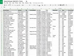
This report is the result of one and a half years of research, examining 200 years’ worth of documents and records and visiting every school in Detroit to establish a comprehensive look at the entire history of the school district, and how the repercussions of decisions made in the past are still being felt today. This report covers three specific topics: 1) A detailed history of every public school in the city, including the school’s location, opening/closing/demolition dates, and other historic details of note 2) A physical survey conducted of all school locations by a Loveland surveyor who took detailed photographs and extensive notes of their current condition/use 3) An analytic look at how the school district has grown and shrunk, examining the underlying factors behind the opening and closing schools.

What happened to Detroit Public Schools?

Since the school district's peak in the 1960s, enrollment in DPS has declined as the city's population has dropped and parents have opted out of public schools. Just 47,000 students attend public schools in Detroit today, down from nearly 300,000 in 1966. Nearly 200 schools have closed in the last 15 years. The city’s neighborhoods are dotted with vacant, abandoned schools and empty lots where schools once stood.


Have questions? Want to evaluate our dataset? Get in touch with our team at parcels@regrid.com. 


Learn more about our Nationwide Parcel Data, our schema, pricing and coverage here.

About Regrid

Regrid is an industry-leading property data and location intelligence company. We serve an array of industries that require land parcels and spatial data at scale, including real estate, insurance, energy, infrastructure, agriculture, logistics, and government.

Previous Next
logo

(888) 4RE-GRID

  • Contact Us
  • Customer Support

Subscribe for email updates

Company

  • About Regrid
  • Careers
  • Press

Resources

  • Coverage Map
  • Support Center
  • Reports

Support

  • Parcel Data FAQs
  • Property App FAQs
  • Contact Support Team

Customers

  • Customer Stories
  • Case Studies
  • Non Profit & Academia

Enterprise Solutions

  • Nationwide Land Parcels
  • Parcel & Tiles API
  • Feature Service

Self-Serve Solutions

  • Regrid Property App
  • Shop the Data Store
  • API Monthly Plans