


.png)


.svg)


Nationwide LBCS - Zoning and Usecode Standardization
(Most Recently Updated on March 17, 2022)
Also read: 'A Deep Dive into Regrid's LBCS_Ownership Field'
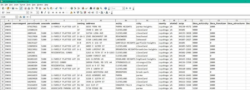
While browsing Regrid's parcel data, you may have encountered fields like "lbcs_activity" and "lbcs_function", but their values are just 4-digit numbers. What exactly do those fields mean? Let's take a quick look!
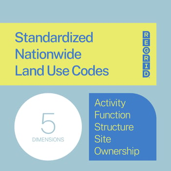
The Land-Based Classification System (LBCS) is a method devised by the American Planning Association to describe how the land of an individual parcel is used. It encodes land use across five dimensions (activity, function, structure, site, and ownership).
These codes are 4-digit numbers, where the first digit denotes the broadest category, and each successive digit describes the parcel in more detail.
We focus primarily on the "lbcs_activity" and "lbcs_function" dimensions because they make the most sense at the parcel level. Activity describes the actual human activities that take place on the parcel, while function describes the broader economic or social use the parcel serves.
For example, a parcel that is used as a parking lot for a school would have an "lbcs_activity" code of "5000" (for "Travel or movement activities"), but an "lbcs_function" code of "6000" (for "Education, public admin., health care, and institutional").
Most parcel data, however, does not use LBCS and its land classification varies widely - if the information is available at all. When there is information pertaining to how a parcel is used, it usually takes the form of local zoning, land use, or tax assessors' codes. Because of this inconsistency, our LBCS classification work is done manually, county by county, matching each place's land use or zoning information to the nearest applicable LBCS code.
The main reason we spend time implementing LBCS in our dataset is its universality. Local zoning, land use, or assessors' codes are still visible on parcels containing that data (usually in the "zoning", "zoning_description", "usecode", or "usedesc" fields, and sometimes in custom fields). But while there is variability from county to county what a zoning value of “101” or “R-1” is, an "lbcs_activity" value of "1000" always means "Residential activities".
This consistency means users of Regrid's nationwide parcel data and The Regrid Property App can perform queries to find trends across the dataset, or to count certain types of parcels.
For instance, a regional business specializing in agricultural equipment could download the data for surrounding counties from the Regrid Data Store. They can then query that data to find the number of parcels in each county with a "lbcs_activity" code in the range 8000-8999, for "natural resources-related activities."
This could give a broad overview of places where agricultural activity is more prevalent and could help with focusing sales and marketing efforts where they are more likely to succeed.
If you have questions about LBCS in general, please contact the Regrid team at parcels@regrid.com, or check out the parcel data FAQ.
Happy Mapping!
Ray Visser
GIS Analyst | Regrid

Regrid is an industry-leading property data and location intelligence company. We serve an array of industries that require land parcels and spatial data at scale, including real estate, insurance, renewables, infrastructure, agriculture, logistics, and government.
