


.svg)


Latest Blog Post
Five years running: Regrid returns to the Geoawesome 100
on July 28, 2026
 Premium parcels
.png) AI and ML tools
AI and ML tools
 Delivery methods

-1.png)
As we wrap up 2025, we want to thank you for being part of our journey. Your support and engagement mean the world to us, and we’re excited to... Read More
.jpg)
When the National Zoning Atlas set out on an ambitious project to democratize national zoning data, they came to Regrid's Data With Purpose program.... Read More
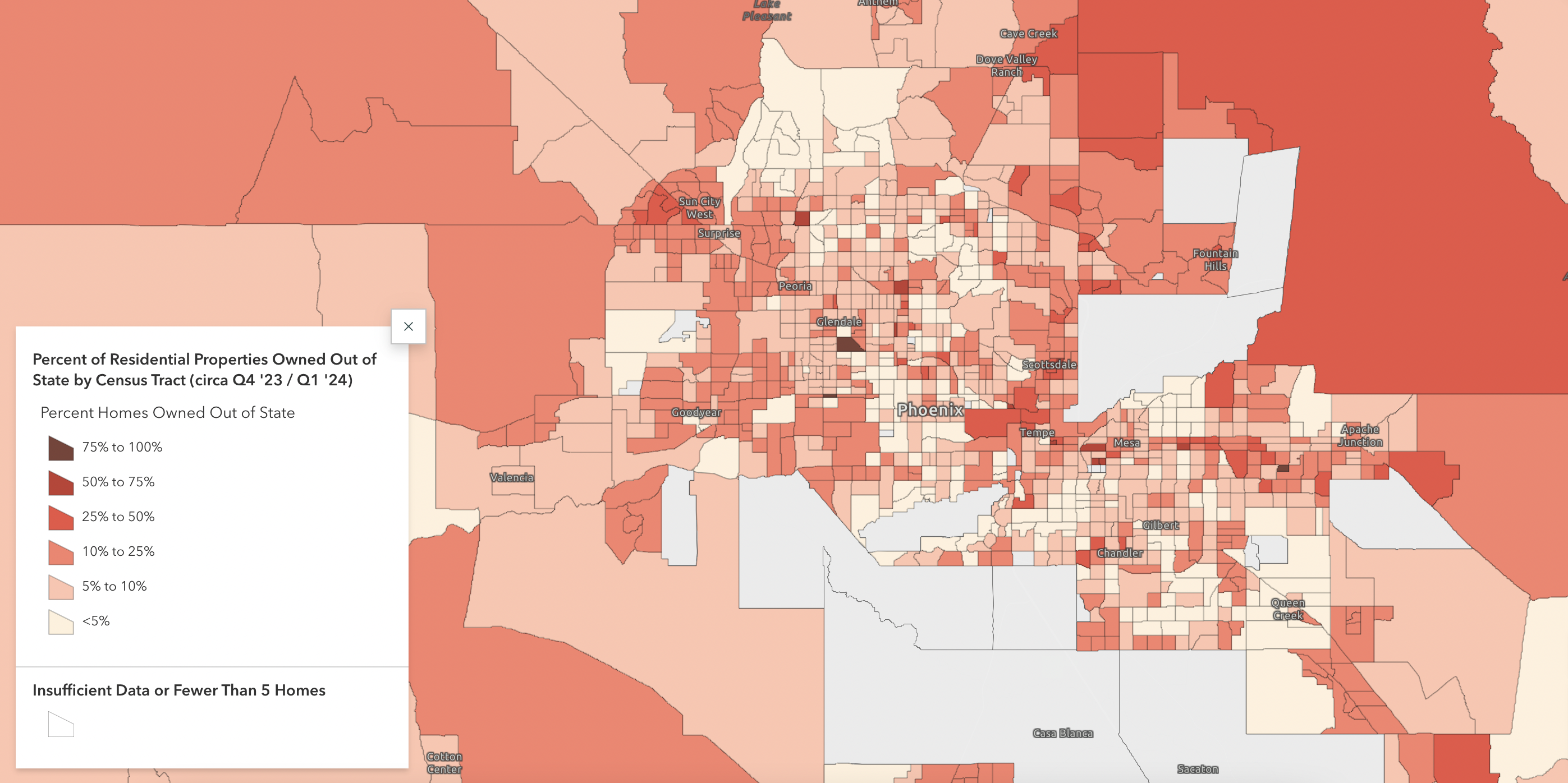
A new report from Regrid gives a unique, nationwide, look at the scale of U.S. homes owned outside their local areas. "Owned Away From Home,"... Read More
